





CORPUS CHRISTI, Texas — A neighbor's question on Facebook sparked this week's Science Snippet. Cindy, a member of the Coastal Bend Weather Watchers group, asked what the El Niño weather pattern will look like for South Texas during the fall and winter months — and it's a question many of you have asked. Here's what you need to know. What does El Niño actually mean for South Texas this fall and winter? Chief Meteorologist Stefanie Lauber breaks it all down — including what the numbers say about our rain deficit.
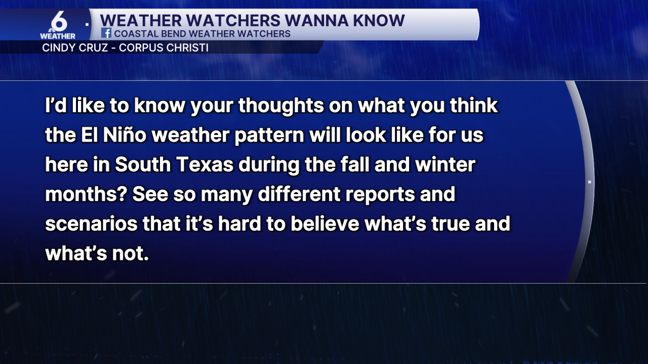
El Niño is a global weather pattern shift, which means its effects vary depending on where you are in the world — and that's why you may be seeing conflicting reports about what to expect.
At its core, El Niño is a shift in water temperature along the equator in the Pacific Ocean. That shift in water temperature then shifts the atmospheric pattern, which changes the kind of weather different regions experience. Those weather patterns move along what meteorologists call jet streams — the polar jet stream and the subtropical jet stream.
When El Niño kicks in during fall and winter, it tends to bring warmer than normal conditions to the northwestern United States, drier than normal conditions along the Ohio River Valley and around the Great Lakes, and wetter conditions across the southern United States.
For South Texas, that means wetter and cooler conditions — welcome news after a brutal summer and years of below-average rainfall.
What the numbers show for the Coastal Bend
Corpus Christi's annual rainfall expectation is 31.74 inches. September is typically the wettest month of the year by a wide margin, with an expected 5.42 inches. August, which normally brings about 2.75 inches, saw zero rainfall this year. That's a significant setback for our yearly rainfall.
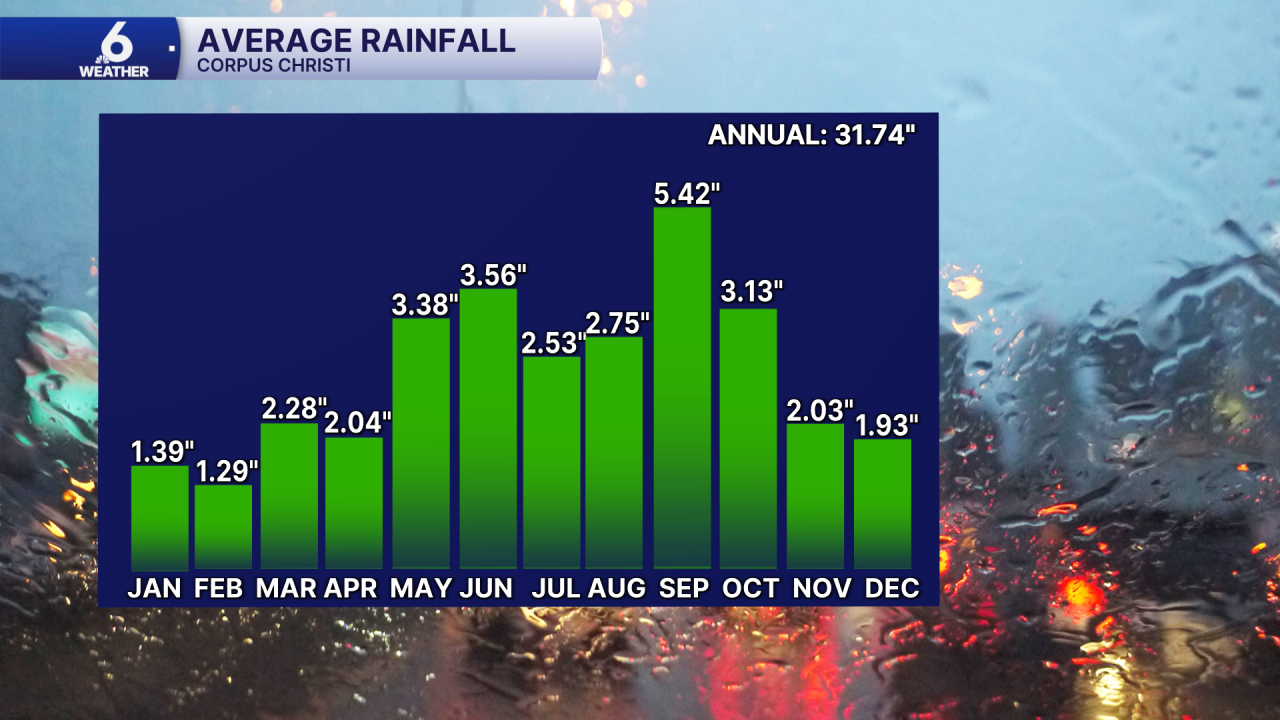
El Niño has its biggest influence during the winter months of December, January, and February. However, those are also some of the driest months on the calendar for Corpus Christi — the city typically picks up 4.56 inches of rain across all three of those months combined— less than September alone.
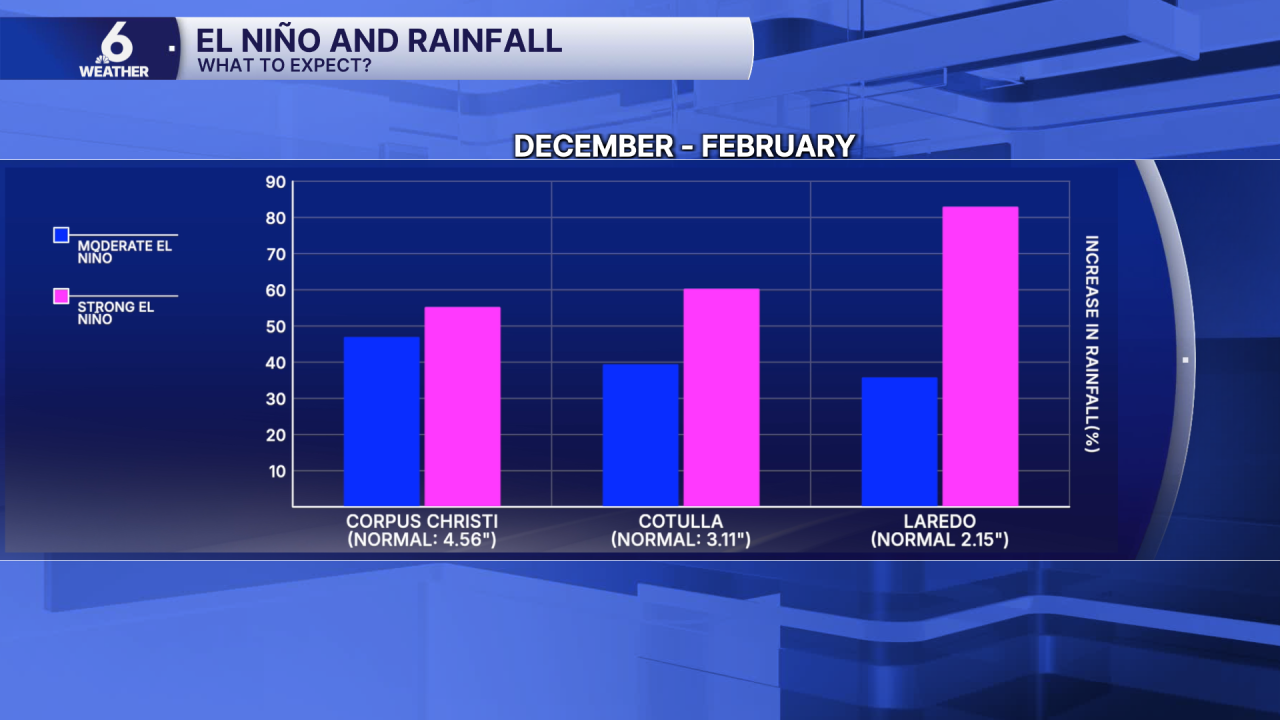
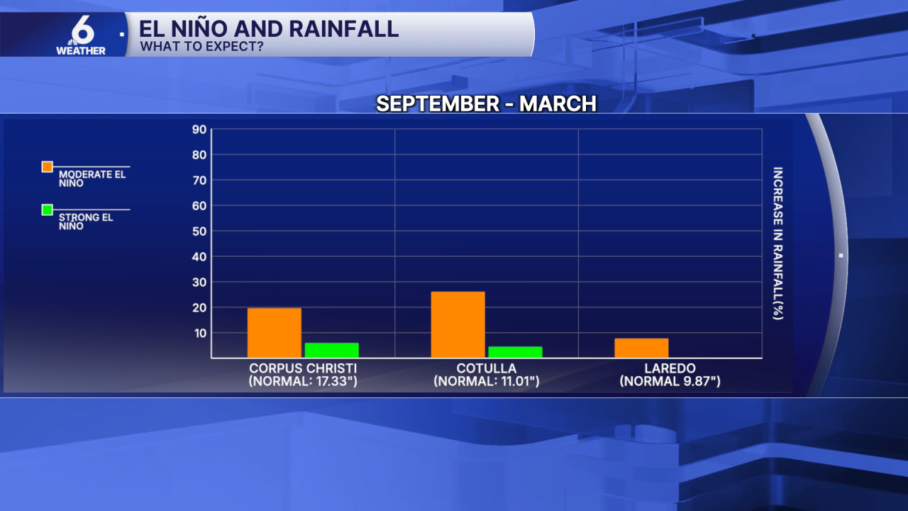
Moderate vs. strong El Niño: Which is better for South Texas?
Looking at the broader picture — September through March, which spans the wet season through the dry season and into early spring — a moderate El Niño may actually be the better long-term scenario for the region.
While a stronger El Niño can provide a bigger boost in rainfall during the winter months, particularly in the watershed areas around Cotulla and Laredo, a moderate El Niño tends to produce slightly more overall rainfall across the full September-to-March window for both Corpus Christi and Cotulla.
From September through March, the region normally sees about 17.33 inches of rainfall. A strong El Niño could provide a modest boost above that baseline, but a not-as-strong or moderate signal would likely produce more rainfall. That said, one El Niño pattern will not erase years of drought and underperforming rainfall totals. Weather patterns serve as a guide — what actually happens on the ground is what matters most.
Thanks to Cindy for not only asking this great question, but for being this week's Coastal Bend Weather Watcher of the Week photographer.
This story was reported on-air by a journalist and has been converted to this platform with the assistance of AI. Our editorial team verifies all reporting on all platforms for fairness and accuracy.
