

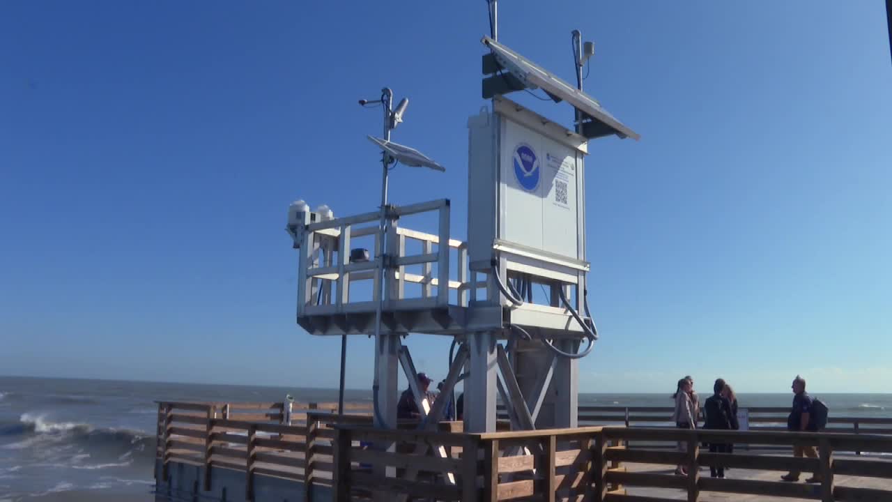


Bob Hall Pier has a new neighbor keeping an eye on the Gulf.
On Tuesday, the National Oceanic and Atmospheric Administration celebrated the installation of a new water level station at the pier. The station is part of NOAA’s National Water Level Observation Network, and it tracks water level, wind speed and direction, barometric pressure, and air and water temperature around the clock.
For people who live on Padre Island, the station is about more than data.
“If there’s anything more important than weather for people who live on a barrier island, I don’t know what it is,” said Padre Island resident Marilyn Litt, who came out Tuesday morning to see the station for herself.
Litt said she wanted to check how sturdy it looked and to learn how to read its data before the next storm, not during one.
“It’s going to be my close friend if we have any tropical storms coming,” she said.
Built to last
The pier’s previous station rode out Hurricane Hanna in 2020. Grace Gray, NOAA’s Gulf Coast team lead, said that station lost its power line when the pier was damaged but switched to solar power and kept working for about another year.
The new station sits on aluminum platforms, with its electronics raised above waves and storm surge. It uses a microwave radar sensor to measure the water, with an underwater pressure sensor as a backup.
“Well, we are very excited to have it back in,” Gray said.
Filling a gap on the coast
Dr. Marian Westley directs NOAA’s Center for Operational Oceanographic Products and Services. She said the Bob Hall Pier station is one of more than 200 tide gauges NOAA runs nationwide, and that it fills a hole in coverage along the Texas coast.
“This is very special because the tides change along the coast and so this fills a data gap in terms of actual reliable tide prediction,” Westley said.
She added that unlike many gauges in sheltered harbors and bays, this one measures the open Gulf.
“It’s really nice to have a gauge that’s right at the end of a pier that’s experiencing true ocean conditions,” she said.
The station is also part of a pilot project testing wave height and wave period measurements. It feeds into the Texas Coastal Ocean Observation Network, a partnership with the state, alongside Texas A&M University-Corpus Christi’s Conrad Blucher Institute.
“They care about us”
For Litt, the station’s return means something more personal.
“First it shows they care about us, that we’re being noticed, but also anyone who lives here knows that half a mile away they got rain and you didn’t,” she said.
Visitors are paying attention too. Adrian Madrigal, who comes down from El Paso every November, said the station “gives us constant up to-date information that we need.”
Check it yourself
The station is already collecting data. Visitors can scan a QR code at the pier to go straight to the station’s home page, or check the water level online at tidesandcurrents.noaa.gov.
Gray said NOAA staff monitor the data around the clock and can fix many problems remotely or send field teams when needed.
For the latest local news updates, click here, or download the KRIS 6 News App.
Catch all the KRIS 6 News stories and more on our YouTube page. Subscribe today!
