



CORPUS CHRISTI, Tx — Happy Weekend, Coastal Bend!
WHAT YOU NEED TO KNOW
- On and off isolated showers Saturday morning/afternoon
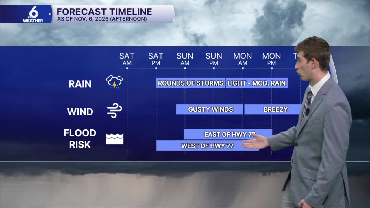
- Heavy showers develop in Coastal Plains late Saturday evening overnight into Sunday
- Slight Risk (Level 2 of 4) for Excessive Rainfall/Flooding Sunday
- Numerous showers and thunderstorms across the region most of Sunday lingering into Monday
Grab those umbrellas
Showers have cleared out of the area Friday afternoon, setting up great conditions for those evening plans. If you are headed out to Art Walk, or friday night lights, you won't have to worry about any showers disrupting the fun! There are several fun events happening around the Coastal Bend, including Greek Fest, Harbor Half, and the Holiday Tree Lighting to name a few. While Saturday's forecast will somewhat be cooperative with outdoor plans, unfortunately, Sunday won't be. Mostly cloudy conditions will overtake our skies on Saturday, with a few isolated showers possible in the afternoon. That changes headed into late Saturday through Sunday morning, with frequent downpours expected. Our neighborhoods can pick up between 2"-3" of rain, with localized higher totals possible.

The main event doesn't get going until Saturday evening well after sunset, with storms firing off in our furthest inland neighborhoods. These storms will become more widespread after midnight on Sunday, and if we see heavy rainfall over the same neighborhoods repeatedly, this could pose the risk for flooding in the Coastal Bend. Wind gusts may be "disrespectful" at times and approach 40mph. To plan ahead for this weekend, be sure to secure any loose outdoor items on Saturday, and avoid any flooded roadways. Turn around, don't drown! Minor Coastal Flooding is also possible this weekend during high tide periods. Saturday is the better beach day for the weekend, with low rip currents in the forecast, but I strongly discourage going out on the waters for Sunday. Most of the rain will fizzle out late Monday, but we won't stay completely rain free for the week ahead.

Comfy weather next week, with another rain chance mid week
The mid-level support from our atmosphere should start to exit the region by Tuesday of next week, leaving behind the cooler temperatures for the second week of November. This puts South Texas "Fall-feeling" weather in the forecast with daytime highs in the mid to upper 70s, and overnight lows in the upper 50s to lower 60s through next Thursday. Keep in mind we're also tracking our upper-level weather pattern for some additional support kick up some more scattered showers Wednesday and Thursday, but that forecast is still several days out, and could change. Either way, we'll take every drop we can get with the moderate to extreme drought encompassing South Texas!
Enjoy the rest of your weekend!
