

CORPUS CHRISTI, Tx — Good morning and Happy Friday Coastal Bend!
WHAT YOU NEED TO KNOW
- Cool start to the day once again in the 50s (and 60s along the coast)
- Sunny afternoons with 80s for daytime highs (a few 90s inland towards Duval and Jim Wells Counties)
- High Pressure overhead keeps rain out of the seven day forecast
- Increased Fire Danger with the ongoing drought
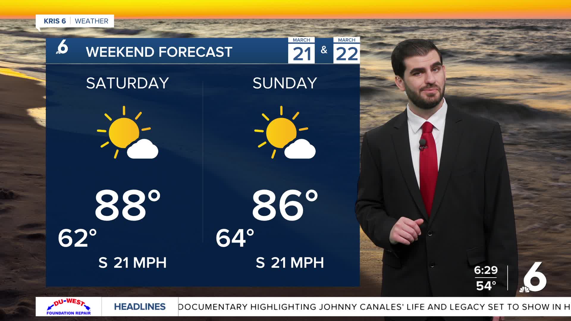
As we officially kick off the first day of Spring we're expecting some warm weather heading into the weekend. Today we'll see highs pushing up towards the mid 80s under wall to wall sunshine. For Saturday and Sunday we look a little warmer chasing the upper 80s for daytime highs, but still under plenty of sunshine each day. Winds will be slightly breezier for the weekend around 15-20mph in the afternoons, but still shy of the 30-40mph range we started the week with Monday morning.
As we head into next week we're looking to stay pretty similar with the high pressure remaining in control of the forecast. Daytime highs look to settle in the mid 80s with overnight lows around the mid 60s. As far as rain goes it still looks like we'll be dry for the remainder of the seven day forecast if not the rest of the month of March.
CORPUS CHRISTI FORECAST
Today: Mostly Sunny
Temperature: 86F
Winds: SE 5-15 mph
Tonight: Mostly Clear and Mild
Temperature: 61F
Winds: S 10-20 mph
Saturday: Mostly Sunny
Temperature: 88F
Winds: S 10-20 mph

I hope you have a great Friday and first day of Spring!
