



CORPUS CHRISTI, Texas — Happy Weekend!
WHAT YOU NEED TO KNOW
- Improving heat risk
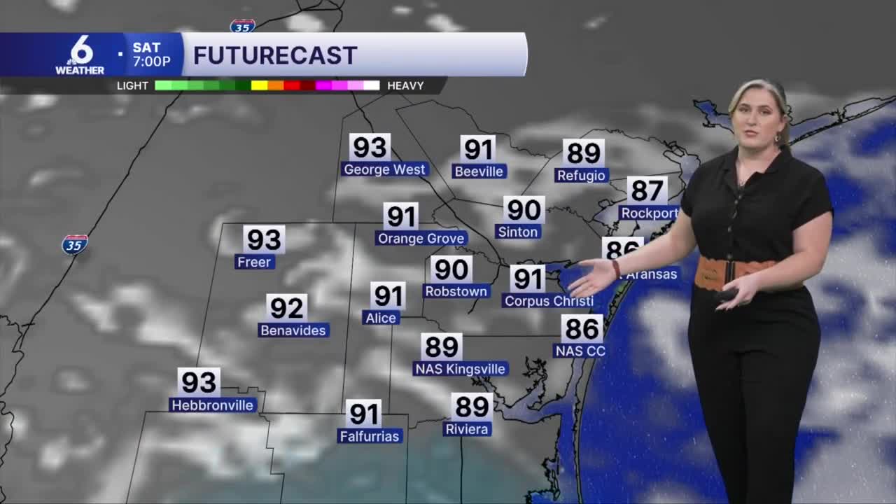
- 'Feels like' temps near 110ºF
- A few stray showers possible
A LITTLE LESS HEAT
The "heat dome" of high pressure is no longer locking in our hot and dry forecast. This will help bring those very hot temps down a few degrees. It makes rainfall a possibility. Saturday's morning low temperatures begin in the upper 70s, warming up quickly after sunrise. Expect highs in the upper 90s and lower 100s. 'Feels like' temperatures will reach the middle 100s by afternoon. While heat alerts are unlikely, please continue to practice heat safety by taking breaks in the air conditioning and staying hydrated. Look before you lock: don't leave anyone or anything inside a hot vehicle! Check in on kids, pets, and the elderly as they are more prone to heat-related illness.
RAIN CHANCES
While the sea breeze could cook up a few showers and possibly even short-lived storms, no significant rainfall is expected across the Coastal Bend. Rain chances remain limited through the rest of August. We'll continue to watch the middle of next week for an uptick in rain chances as the Big Weather Picture continues to evolve.
IN THE TROPICS
With Dolly weakening to a remnant area of low pressure, the Leeward Islands and Puerto Rico can expect beneficial rainfall. Though the Atlantic Basin is now "storm-free", what's left of Dolly has a low chance of redeveloping as it nears the Greater Antilles. Another area to watch is in the Gulf, as a group of disorganized thunderstorms sits stationary off the northern Gulf Coast.
Another area to watch is in the Gulf, as a group of disorganized thunderstorms sits stationary off the northern Gulf Coast.
Have a safe and fun weekend!
