

CORPUS CHRISTI, Texas — Happy Fri-YAY!
WHAT YOU NEED TO KNOW
- Fire Weather Watch - Sunday, 9 a.m. to 9 p.m.
- Extreme fire danger on Sunday
- Very windy on Sunday
- Big cool-down this weekend
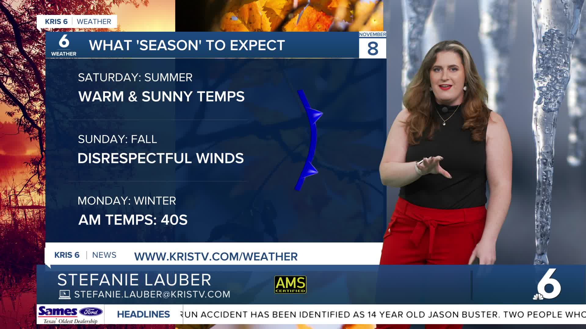
Saturday
Patchy dense fog will creep in shortly after midnight and linger into Saturday morning. While we'll be waking up to the 60s, we'll once again experience unseasonably hot temps. Expect highs in the 90s Friday afternoon with breezy conditions that won't calm after sunset. Our cold front will keep a breeze in the forecast that gets very strong on Sunday.
Sunday
Our cold front will pass through the Coastal Bend from 10 p.m. Saturday to 3 a.m. Sunday. The front will bring cool, very dry air. Expect winds to gust around 40 mph. All of this will lead to extreme fire danger! Please practice fire safety!! A Fire Weather Watch will be in effect from Sunday, 9 a.m. to 9 p.m. Very windy conditions behind the front may also cause coastal flooding.

The big cool down
Still windy by Monday, we will be participating in winter on Monday morning. Temps take a big dip, with lows in the 40s and highs in the mid 60s on Monday. By Tuesday morning, some inland neighborhoods will be waking up in the upper 30s! A freeze is unlikely right now, but it will be colder than the last big cool-down!
CORPUS CHRISTI FORECAST
Friday night: Clear skies, inland fog
Temperature: Low 61ºF
Winds: S 5-10 mph
Saturday: AM fog, sunny & hot
Temperature: High 90ºF
Winds: S 5-15 mph
Saturday night: A few clouds, windy
Temperature: Low 66ºF
Winds: S/NE15-25 mph
Have a safe and wonderful weekend!
