

CORPUS CHRISTI, Texas — Happy Fri-YAY!
WHAT YOU NEED TO KNOW
- Weekend Heat Risk: Moderate (2 out of 4)
- Heaviest rainfall Monday & Tuesday
- Rough conditions on the coast
Heat begins to improve
The heat continues to dial back this week, as rain chances increase. Expect afternoon high temperatures to stay in the upper 80s and lower 90s this weekend. As the clouds begin to grow and showers become more scattered across our neighborhoods, 'feels like' temps will become more tame. While Saturday will be a better day for outdoor plans, it is still going to be hot and muggy! Sunday will also feature hit-or-miss showers, but gloomy skies will offer little sunshine.
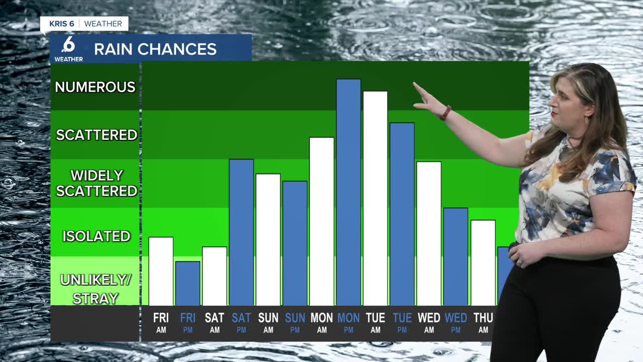
Rainfall expectations
All eyes remain on the tropics. But we are no tracking tropical trouble here across the Coastal Bend! This area of low pressure will simply 'boost' our rainfall expectations by providing abundant tropical moisture. This is why we're expecting 2-4 inches of rainfall over the next seven days, with most of it accumulating late Monday and into Tuesday. With the extra moisture, heavy downpours are expected— meaning flooding is possible. I'll be keeping an eye on that threat as the weekend wraps. Beach conditions have been less than ideal since last weekend and they will surely be unfriendly this weekend. A high risk of rip currents and coastal flooding are expected. You can always get the latest beach conditions right here.
