

CORPUS CHRISTI, Texas — Happy Friday!
WHAT YOU NEED TO KNOW
- High to Very High Fire Danger (3-4 out of 5)
- Freezing temps likely Sunday morning
- Watching rain chances next week
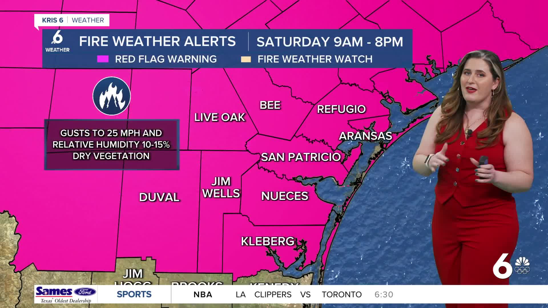
FIRE DANGER
Friday was warm and beautiful! One cold front later and we're cold and windy again. The gusty conditions and dry air behind the front are the reasons why there is a Red Flag (Fire Weather) Warning is effect on Saturday. Please be careful with any outdoor activities since any fires that spark will be difficult to control under these conditions.
LIGHT FREEZE POSSIBLE
The Coastal Bend will wake up to 30s on Sunday morning! It's best to once again prepare for a light freeze across inland neighborhoods— just in case. It's possible for morning low temps on Sunday to fall below freezing for neighborhoods west of HWY 77. Tender plants and exposed pipes should be prepped ahead of time!
Rainfall
The forecast for Martin Luther King, Jr. Day look great! Another second cold front arrives Monday night into Tuesday. Confidence is growing in favor of a soggy Tuesday and Wednesday next week (yay)! Expect widely scattered showers on Tuesday and Wednesday. Rainfall estimates still look ambitious: between 0.5-1.0 inches by Thursday! If this pans out, we should be caught up for our expected January rainfall in many neighborhoods!
CORPUS CHRISTI FORECAST
Friday night: Windy and cool
Temperature: Low 51ºF
Winds: NE 10-20 mph, gusts to 25 mph
Saturday: Partly cloudy, elevated fire danger
Temperature: High 61ºF
Winds: NE 15-25 mph, gusts to 35 mph
Saturday night: Partly cloudy and COLD!
Temperature: Low 35ºF
Winds: NE 5-15 mph
Have a wonderful weekend!
