



CORPUS CHRISTI, Tx — Happy Weekend Coastal Bend!
WHAT YOU NEED TO KNOW
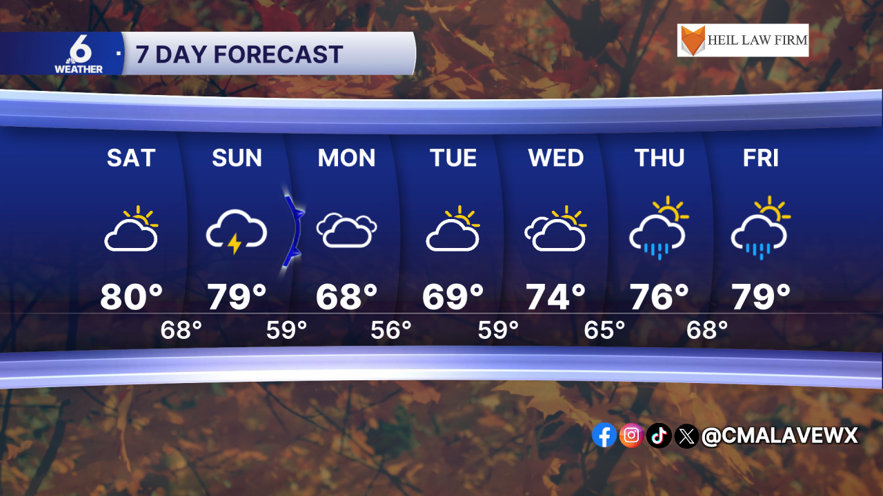
- Partly cloudy skies Saturday with a few showers possible
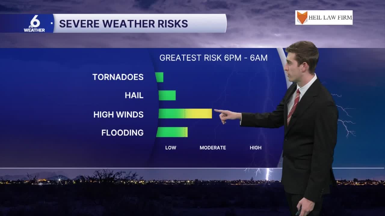
- Widely scattered thunderstorms starting Sunday afternoon, a few storms may be severe
- Strongest storms on Sunday may contain damaging winds and heavy downpours that could lead to flooding
- Cooldown on Monday with highs in the upper 60s
Increasing rain chances throughout the weekend
In this weekend's forecast, winds will start to blow out of the east bringing in more muggy air to the Coastal Bend. On Saturday, we're not expecting much for rain, just a few isolated showers from time to time. Most of the area can expect partly cloudy skies with highs in the low 80s. By Sunday, a developing surface low pressure system will bring in another cold front, and with it a line of more scattered showers and thunderstorms. As this line approaches our northern neighborhoods, these storms could be on the stronger to severe side of things.
Stormy Sunday
The Coastal Bend is under a level 1 out of 5 marginal risk for severe weather on Sunday afternoon. Primary weather hazards will be damaging winds possibly up to 60mph and localized flooding from heavy rainfall. The threat of large hail or even a quick spin up tornado can't be completely ruled out, but the odds of that happening are quite low. Aransas and Refugio counties are also under a marginal risk for excessive rainfall that could lead to flooding. By around noon on Sunday, a line of thunderstorms will approach our Northeastern coastal neighborhoods and continue to push towards the southeast. This rain won't be completely widespread, as some of our furthest inland neighborhoods could miss out on seeing any rain for Sunday. Up towards the Victoria Crossroads, neighborhoods can expect about an inch of rain, but the further south you go, less than one inch can be anticipated over the next 7 days. The main window for severe weather could take place between noon and 10pm Sunday.
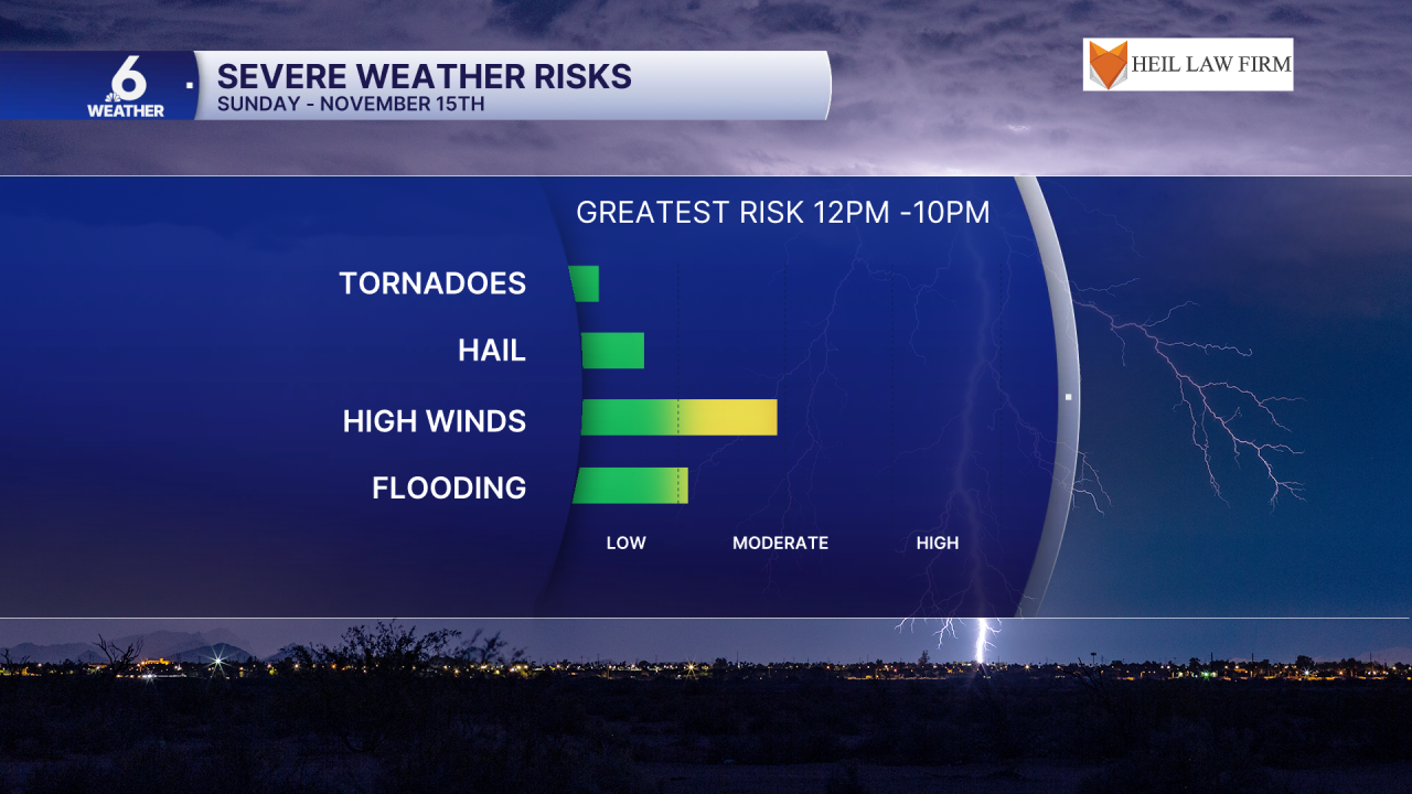
Make sure you are staying weather aware on Sunday as these storms roll through the area, and keep checking back in on the forecast for any new information regarding timing and intensity of storms.
The week ahead
On Monday, most of us will catch a break from the rain and feel the cooldown after our cold front passes by. Right now, most of the weather models are depicting highs in the upper 60s in the Coastal Bend for Monday and possibly Tuesday. I will continue to monitor lower rain chances through later next week, with some more moisture coming back into the picture.
Have a great rest of your Thursday!
