

CORPUS CHRISTI, Texas — Happy Sunday!
WHAT YOU NEED TO KNOW
- More showers expected overnight
- Sunshine returns Tuesday
- More rain later this week
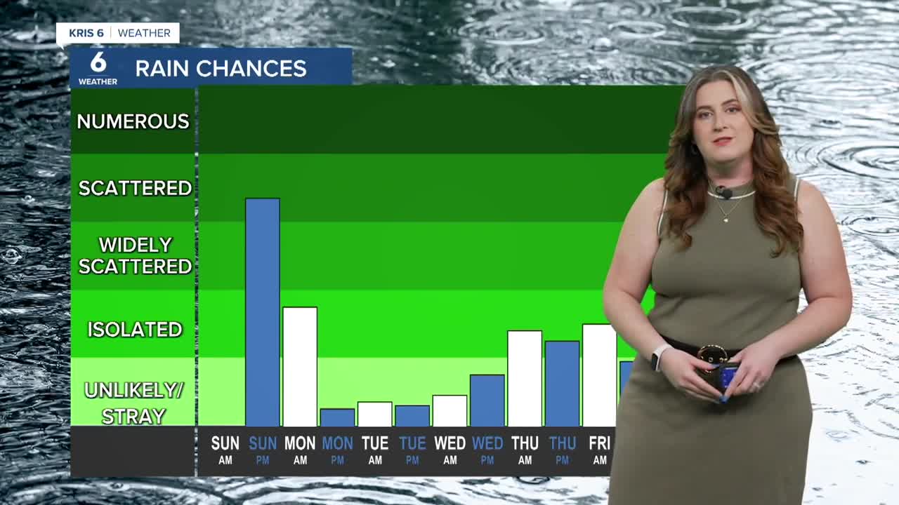
Did you get any rain? Most neighborhoods did! A weak cold front lingers over the Coastal Bend. This front is acting as the 'spark' to initiate showers and storms, and we're not done yet! More shower activity will brew overnight areawide, helping to chip away at our drought. Another half-inch or so of rain is possible overnight and into Monday. The movement of this front is a big part of the forecast. The boundary is currently stalled over the Coastal Bend, but is expected to move to just to our south. This will keep drier air over our neihgborhoods, while rain continues to our south. On a positive note, Temperatures should remain near-average for the start of the week.

As the front makes a 'come back' later this week, another round of isolated showers will be possible on Friday. This will again help to keep temperatures tame, but as of now doesn't seem as generous in terms of rainfall accumulations. I'll continue to watch the forecast— stay tuned!
CORPUS CHRISTI FORECAST
Monday: Mostly cloudy, isolated showers
Temperature: High 90ºF
Winds: E 10-20 mph
Monday night: Decreasing showers, cooler
Temperature: Low 73ºF
Winds: E 5-15 mph
Tuesday: Partly cloudy and warmer
Temperature: High 92ºF
Winds: ENE 10-20 mph
Have a great week!
