



CORPUS CHRISTI, Texas — Happy Tuesday!
WHAT YOU NEED TO KNOW
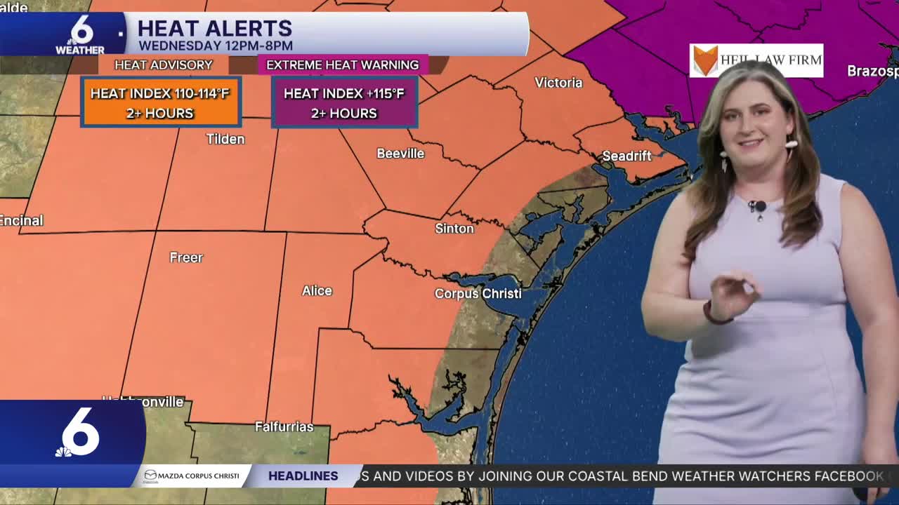
- Heat Advisory: Wed. 12-8p.m.
- Bertha continues along N. Gulf Coast
- Watching the watershed
Dangerous heat
High pressure remains over Texas, taking aftenoon high temperatures to about 5-10 degrees hotter than normal across the Coastal Bend. Wednesday will be the hottest days of the week with many neighborhoods. including Corpus Christi in the triple digits. With ample humidity, 'feels like' temps will reach the 110's. In anticipation of this dangerous heat, a Heat Advisory is on deck for most of the Coastal Bend on Wednesday from 12-8 p.m. Remember to practice heat safety!
Tracking Bertha
Tropical Storm Bertha is at its strongest per the latest forecast. As the storm approaches the 'toe ofthe boot' of Louisiana. Thankfully, most of the thunderstorm activity associated with Bertha is sheared off to the south, over the open Gulf. High pressure over Texas will diminish much of this activity as it approaches the Texas Coast, but some showers are possible on Thursday. The exact track Bertha takes will determind is our gulf-facing beaches see any impacts. Currently there is a low risk of rip current.
Watching the watershed
Both the Frio River at Tilden and the Nueces River at Cotulla have reached flood stage. This means we can start to make some assumptions about how that water will change our lake levels. Choke Canyon looks to rise by a few percentages points (single digits). The flood wave along the Nueces has a long trip to Lake Corpus Christi. Unfortunately, this stretch of the river is know to be quite "loss-y", where 25 to 50 percent of the water moving along the river may be lost to brush and aquifer recharge. We'll have to keep watching.
Have a great night!
