

CORPUS CHRISTI, Texas — Happy Tuesday!
WHAT YOU NEED TO KNOW
- Moderate heat risk Wednesday
- Next cold front/rainfall: Thursday
- Storms likely through Saturday AM
HEAT RISK
If you thought Tuesday was hot, prepare for Wednesday. The windy, humid 90s will return by afternoon across the Coastal Bend. South-southeast winds continue to draw moisture from the gulf, pushing 'feels like' temps to the upper 90s and lower 100s again. This means moderate will be a concern on Wednesday across the Coastal Bend. Please be sure to stay hydrated! Take breaks inside to cool off and stay hydrated.
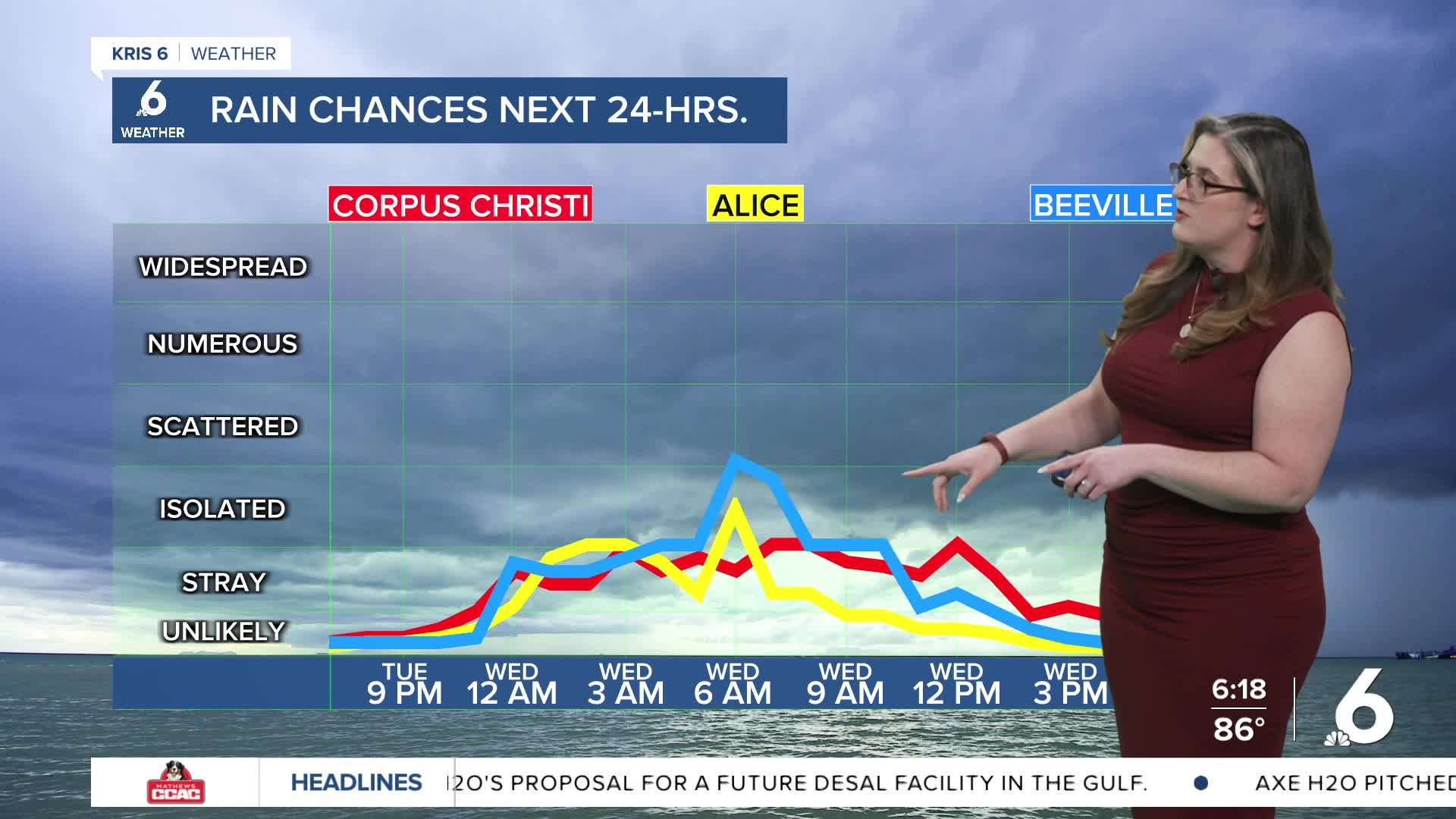
RAIN CHANCES
I expect a few early morning showers (4 a.m. to 7 a.m.) around the Coastal Bend. A few isolated showers are also possible around the midday hours. Still, the bulk of our rainfall won't come until Thursday with our next cold front. While the front arrives on Thursday morning, this boundary will again linger around the Coastal Bend awaiting 'help' from the 'upstairs' in the atmosphere. This gives us a 48-hour of rainfall from Thursday morning, through Saturday morning. It won't be a washout, but widely scattered showers and storms could impact your outdoor plans. Coastal Bend neighborhoods need more rainfall and this event looks to offer as much as a half inch of rain. Thankfully, Mother's Day looks dry and I'd schedule any plans with Mom on Sunday. I'll keep a close eye on this front and the rain expected along with it.
