

CORPUS CHRISTI, Texas — Happy Tuesday!
WHAT YOU NEED TO KNOW
- Showers ending early
- Heat alerts possible
- Heat Risk: Moderate (2 out of 4)
- A few showers return this weekend
Sweltering heat
Out with the rain, in with the heat! Expect morning lows in the middle 70s on Wednesday. By the afternoon, the sunshine returns and high temperatures will return to the low to mid 90s. 'Feels like' temps will stay locked in the triple digits for most of the afternoon. Please be sure to stay hydrated. Check in on kids, pets, and the elderly; these folks are more prone to heat-related illness. Heat Risk will be moderate (2 out of 4). A Heat Advisory might be needed for some neighborhoods!
Tracking the Tropics
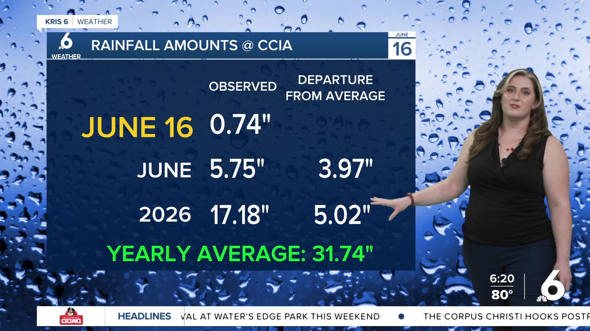
Thanks to tropical moisture, these storms have produced torrential downpours at times, with many Coastal Bend neighborhoods already recording a few inches of rainfall on Monday and Tuesday. Showers have become more scattered in nature, and conditions will continue to improve looking towards Wednesday as most of the heavy rainfall moves offshore and to the Northeast. The area of low pressure that caused the heavy rainfall across South Texas is being dubbed Potential Tropical Cyclone One (PTC #1) by the National Hurricane Center (NHC).
The NHC is tracking PTC #1 for tropical development as it moves along the Texas coast on Wednesday. PTC #1 could gain strength before moving back inland near the Texas/Louisiana border. This system is currently forecast to become Tropical Storm Arthur on Wednesday. Tropical Storm Warnings are now in effect from Sabine Pass, TX to Morgan City, LA, and Tropical Storm Watches have been issued from Sargent, TX to Sabine Pass, TX.
