

CORPUS CHRISTI, Texas — Happy Thursday!
Please stay weather aware throughout the day on Friday: storms can develop quickly and with little notice in this type of weather situation.
WHAT YOU NEED TO KNOW
- Stay weather aware on Friday!
- Strong storms possible throughout Friday
- Rainfall through Sat. AM: 0.25"- 1.50"
STORMS OVERNIGHT
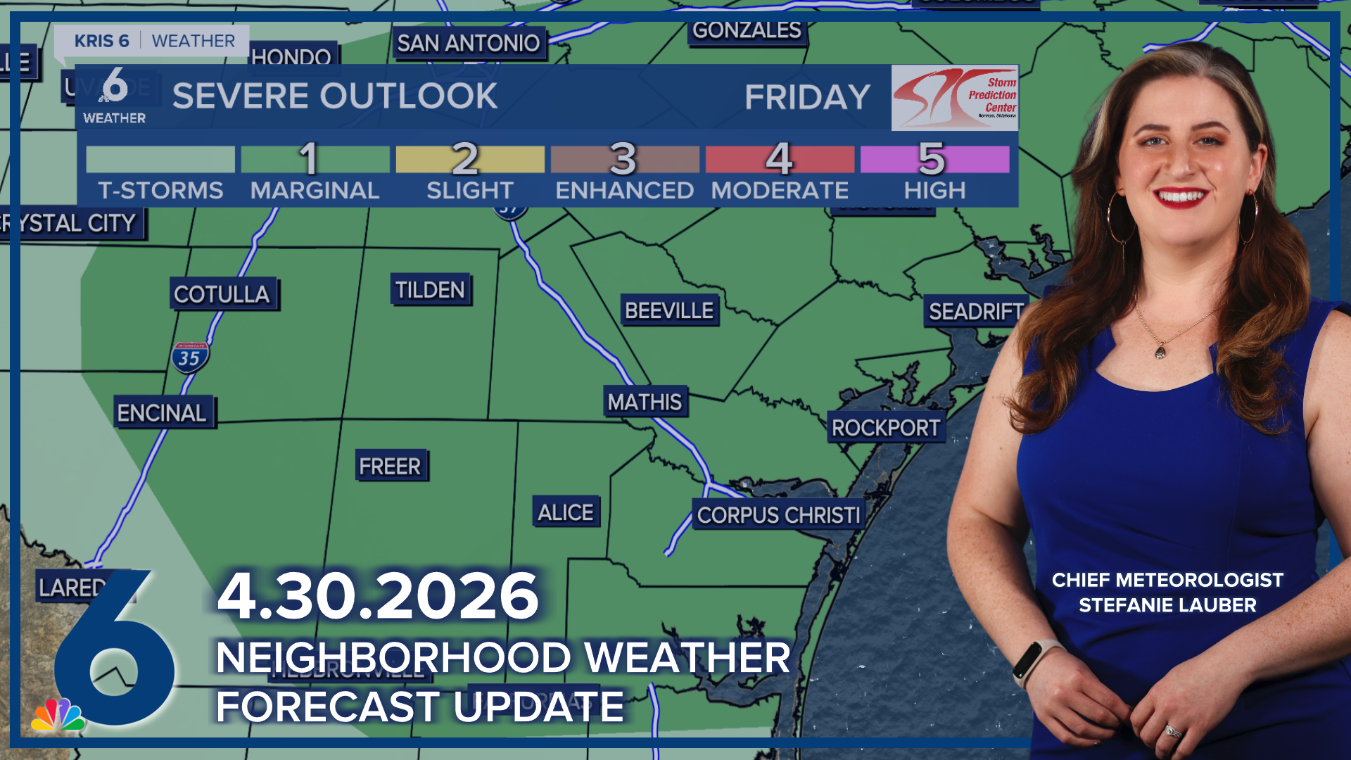
Well, the cold front was here earlier today; as expected, it fizzled out and has since pushed closer to the I-10 corridor. The atmosphere is quite unsettled as a result. Storms are expected to brew during the early Friday morning timeframe. The Storm Prediction Center has placed all neighborhoods of the Coastal Bend under a marginal risk of severe weather (dark green — level 1 out of 5) for Friday. Most neighborhoods won't see much rain until daybreak, when the front wiggles a bit closer.
STORMS ON FRIDAY
While the front is hanging around overhead, it'll give us a one-day window for storms (some severe) and much-needed rainfall. Some showers will still be possible on Saturday morning when the front 'picks up steam' again and moves south. The timing for storms will be tricky.

COOLER TEMPS THIS WEEKEND
With mostly cloudy skies and and scattered storms throughout the day on Friday, afternoon highs will top out in the upper 70s to lower 80s. Once the cold front moves past the Coastal Bend on Saturday, sunshine will return and cool temps will stick around through Monday. Rip current risk will still be a concern at area beaches this weekend.
