



CORPUS CHRISTI, Tx — CORPUS CHRISTI, Texas - Happy Sunday!
WHAT YOU NEED TO KNOW
- Temperatures climb into upper 90s mid week
- Saharan Dust lingers giving us some hazy skies
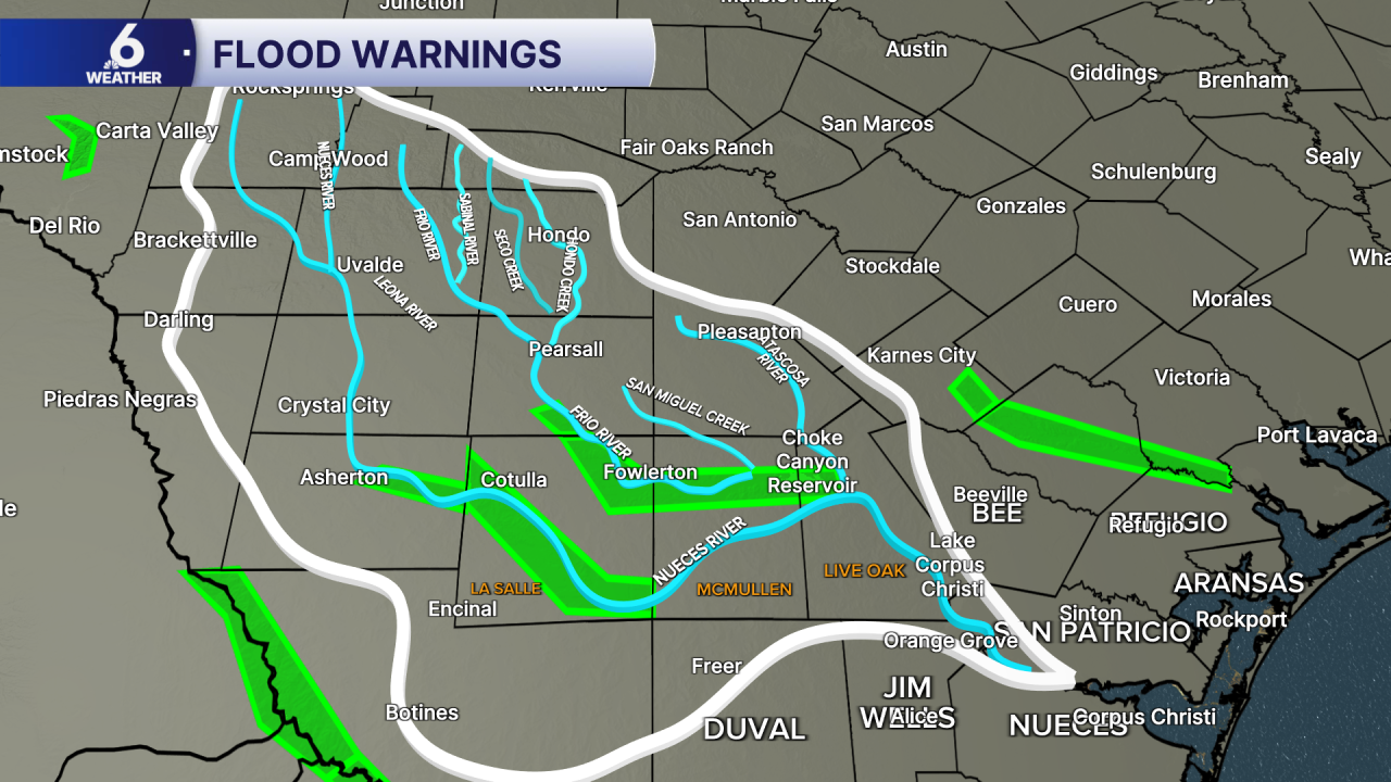
- River Flooding expected Monday along Frio River at Tilden and Nueces River at Cotulla
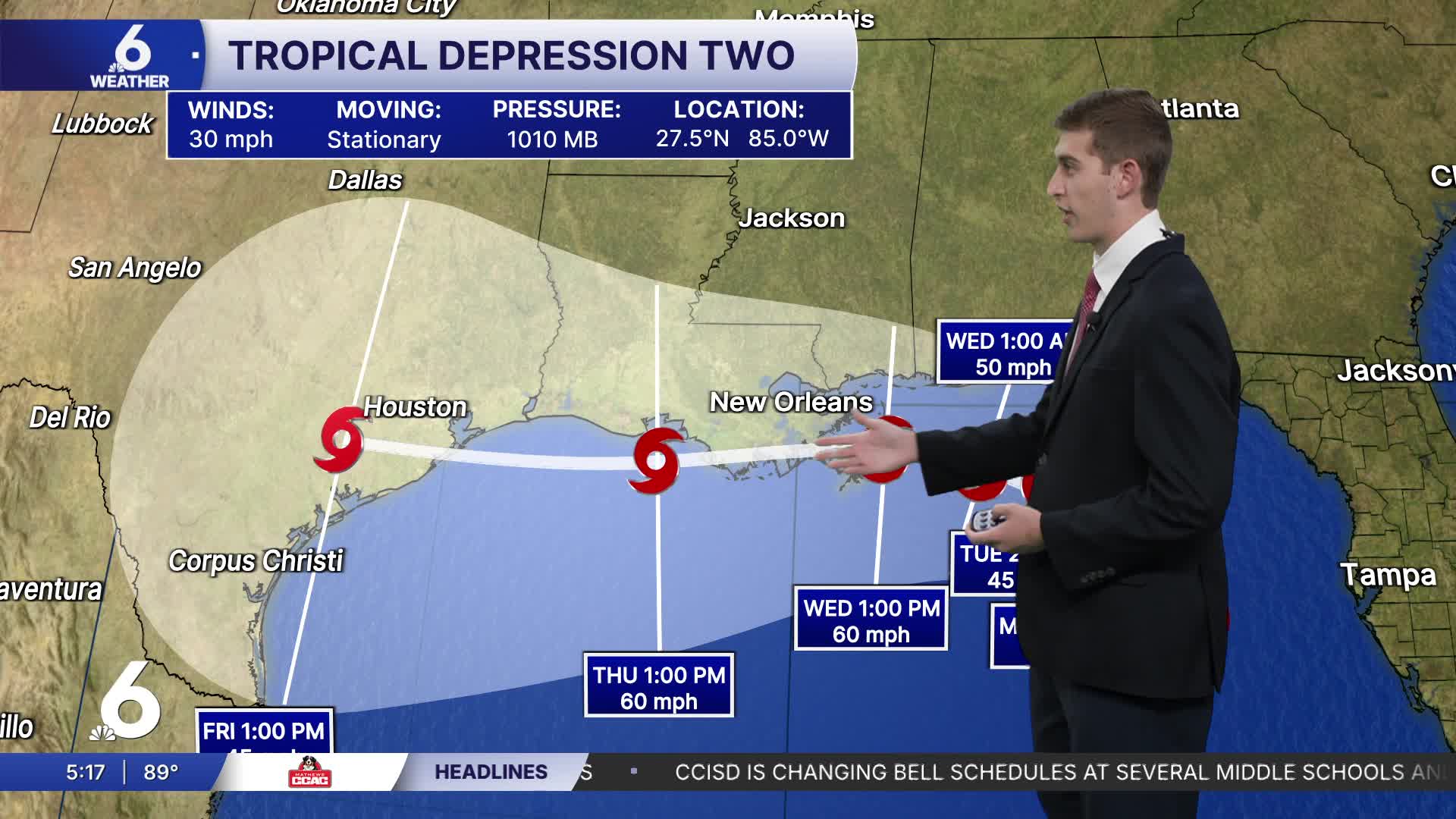
- Tracking Tropical Depression Two in the Gulf
Very hot start to the week
High temperatures this week will soar into the upper 90s in Corpus Christi, but surrounding inland neighborhoods will likely get a taste of triple-digit air temperatures. Rain chances remain low as high pressure still lies thousands of feet overhead. With that in place, daily temperature ranges will be more widespread, with morning lows in the middle 70s, then quickly warming up in the afternoon to near 100 degrees. Make sure to stay hydrated and put on sunscreen if you are outdoors for long periods of time. The humidity that we're used to here in the Coastal Bend will only make it feel hotter, so make sure that you are taking care of you are your loved ones.

River Flooding
Both the Frio and Nueces Rivers are expected to reach major flood stages by Monday into the middle of the week. The Frio River at Tilden reaches major flood stage at 22ft, and is currently forecast to crest around 27.8 feet. At 27 feet, homes and businesses near the Frio River flood, roadways become overtaken by floodwater, and crops are damaged. Along the Nueces River, many roadways flood when the river reaches or exceeds 20 feet. Vulnerable neighbors should plan on evacuating to higher ground.
Tracking the Tropics
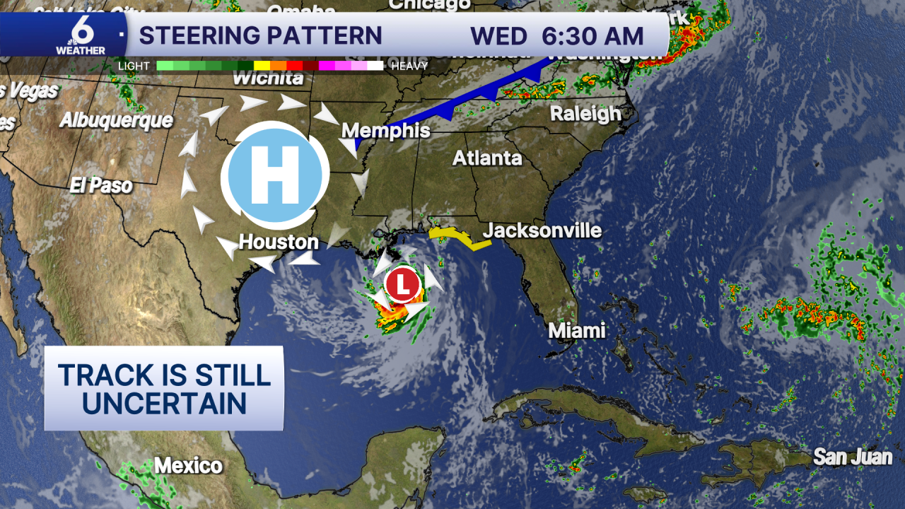
Earlier today, the NHC upgraded Invest 91L to Tropical Depression Two. Right now its movement is stationary but is forecast to strengthen into Tropical Storm Bertha tomorrow as it sits over the very warm Gulf waters. High pressure over the plains may steer Bertha towards the Northwestern Gulf around Coastal Texas. Some models are still not in agreement with this track, but it's something that we will be watching throughout the week. Tropical Storm Watches and Warnings are in effect for portions of the Florida Panhandle and additional watches will likely be issued along the Gulf Coast.

At this point in time, the best thing to do is to make sure that your hurricane kit is ready and that you have a plan in place if a tropical system does come our way. There's still room for things to change in the forecast, but we will continue to update you with what you need to know throughout hurricane season!
Have a great Monday Coastal Bend!
