

CORPUS CHRISTI, Texas — Happy Monday! Our next cold front is going to bring some big changes to the Coastal Bend!!
WHAT YOU NEED TO KNOW
- Disrespectful winds return
- A few t-showers along the front
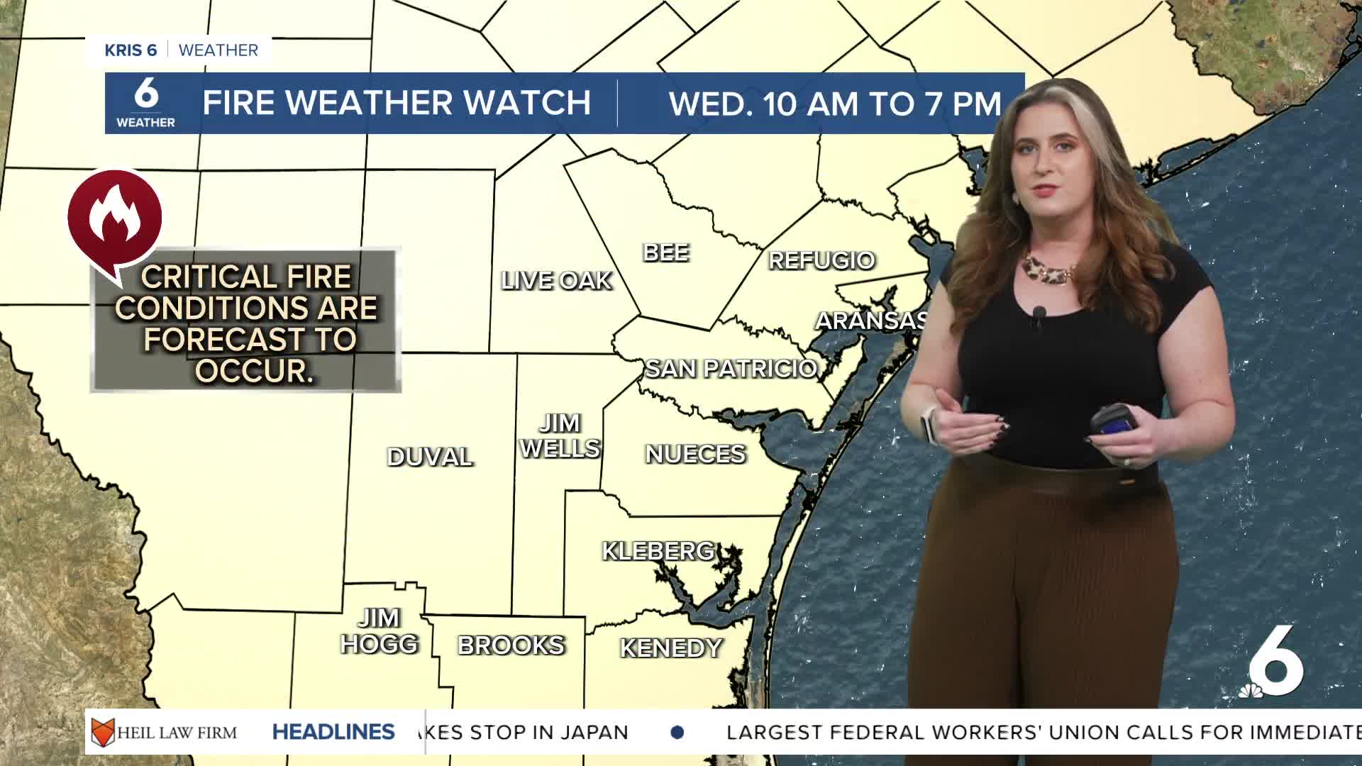
- A Fire Weather Watch will be in effect on Wednesday
Before the cold front
Finally, a strong cold front will grace the Coastal Bend on Tuesday night! This front will actually bring 'fall feels' to the forecast. Before it arrives, we're going to really heat up. Corpus Christi broke another temperature record high temperature today (record high: 93ºF (2004); actual high: 94ºF). Tuesday's high temperature is forecast to break the record, too! Expect highs to reach the middle 90s. Hopefully, a few showers can tame the heat ahead of the cooler air behind the front. Some rain will develop along the front, but don't expect much rainfall.
After the cold front
It takes about 24-48 hours after a cold front's passage for the coldest air to arrive. That process is going to bring 'disrespectful winds' and very dry conditions to the Coastal Bend on Wednesday. A Fire Weather Watch will be in effect on Wednesday 10 a.m. to 7 p.m., as winds gust around 40 mph and relative humidity fall to 20-30 percent! Please practice fire safety! Wednesday morning lows drop to the middle 50s, and the afternoon highs in the upper 70s. This is a little cooler than expected for this time of the year, but the coldest temps arrive early Thursday morning! Lows will likely be in the upper 40s and lower 50s across our neighborhoods!
Major Hurricane Melissa
This is our third Category 5 hurricane of the season. It is unusual to have such a strong storm in late October. This will be Jamaica's strongest hurricane landfall on record.
CORPUS CHRISTI FORECAST
Monday night: Clear skies, breezy
Temperature: Low 73ºF
Winds: SSE 10-20 mph
Tuesday: Sunny, hot, and breezy
Temperature: High 94ºF
Winds: S 10-20 mph, gusts to 25 mph
Tuesday night: T-showers along the front, windy!
Temperature: Low 58ºF
Winds: SE 15-25 mph, gusts to 30 mph
Have a great week!
