


CORPUS CHRISTI, Texas — Happy Thursday!
WHAT YOU NEED TO KNOW
- Heat risk still moderate through the weekend (2 out of 4)
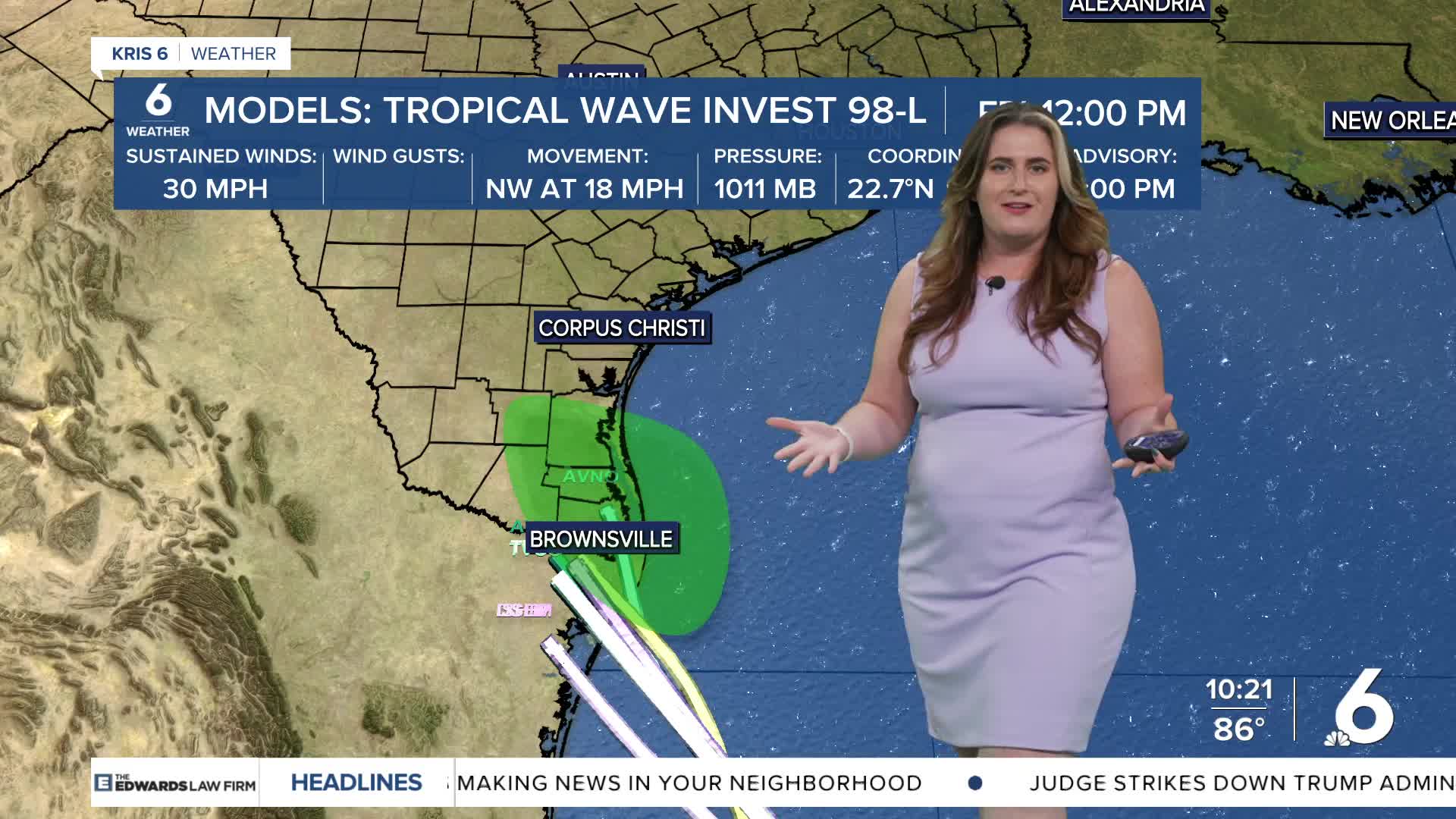
- Tracking the Tropics: Invest 98L
Temperatures will improve on Friday as tropical moisture— and tropical downpours— move across South Texas. Expect highs in the upper 80s to low 90s! It won't last long as most of the rain from our 'Tropical Friend' Invest 98L will occur during the mid-afternoon and wrap up on Saturday morning. Heat risk will remain at least moderate (2 out of 4) through the weekend.
More significant rainfall is expected late Friday night. This timeframe is sooner as upper level sterring pulls Invest 98L toward South Texas. The NHC says this system could become a Tropical Depression before if moves over land. Regardless of tropical development, that water has to go somewhere and it looks like we could benefit. There are still many factors ahead to monitor: small changes in the overall weather pattern could make this rainfall skirt right by us (a slim chance of a let down). I'll continue to monitor. Rip currents will be more likely, so please be mindful of dangerous surf on Friday, Saturday, and potentially Sunday, too!
CORPUS CHRISTI FORECAST
Tonight: Increasing clouds
Temperature: Low 79ºF
Winds: SSE 5-10 mph
Friday: Scattered tropical downpours
Temperature: High 91ºF
Winds: SE 15-25 mph
Friday night: Isolated tropical downpours
Temperature: Low 79ºF
Winds: SE 15-25 mph
Have a great evening!
