



CORPUS CHRISTI, Tx — Good morning and Happy Tuesday Coastal Bend!
WHAT YOU NEED TO KNOW
- Heat Advisory in effect for most of the area from 12-7PM
- Mostly Sunny skies and highs in the mid 90s today
- Summer time heat sticks around on the seven day forecast
- Flood Warning along the Nueces River

Toasty Tuesday and the Week Ahead
Today we're seeing temperatures likely pushing the mid to upper 90s for daytime highs once again with feels like temperatures upwards of 110-114F this afternoon! With that in mind we have a heat advisory in effect from Noon through 7PM for all of us except Jim Hogg, Brooks, and Kenedy counties. This heat will be pretty similar to the next few days going forward and truly the entire seven day forecast it looks like right now. By the weekend we're looking even warmer so make sure to remember those heat safety practices and stay cool and hydrated!

River Flooding and Lake levels
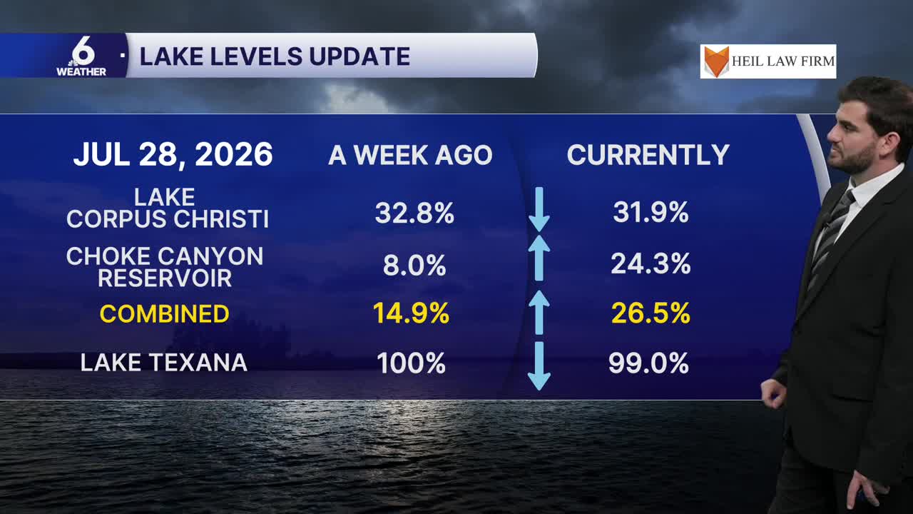
Up towards Live Oak County we have a flood warning in effect along the Nueces River until further notice. Near Cotulla it's expected to continue falling over the next 24-48 hours, near Tilden however it's cresting around ~23ft which is in the major flood stage category. Near Three Rivers it's up to around ~9ft and is expected to climb from Tuesday to Thursday cresting around ~40.3ft with 35ft being the level for major flood stage. We'll be watching to see what this means for Lake Corpus Christi going forward with the water on the way, Choke Canyon has already gotten a significant boost to 24.4% bringing the combined reservoir capacity to 26.5% as of Tuesday morning!

I hope you have a great Tuesday Coastal Bend!
