

CORPUS CHRISTI, Tx — Good morning and happy Thursday Coastal Bend!
WHAT YOU NEED TO KNOW
- Cooler air has moved in keeping daytime highs in the 70s
- Drier air has also worked in keeping relative humidity very dry
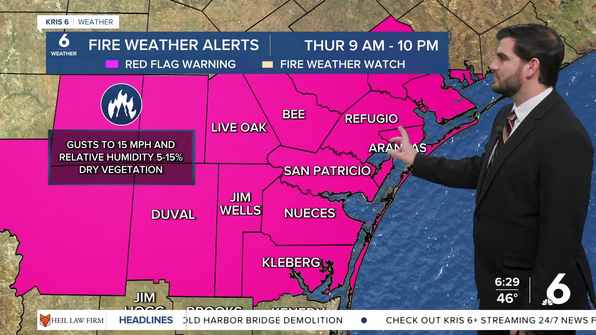
- Fire danger is High to Extreme today due to the already dry vegetation and soil

In the wake of Tuesday evening's cold front we have seen cooler and drier air move into the area. Unfortunately this was perfect fuel for wildfires. Combine this with the winds we saw yesterday in excess of 30mph and they had the perfect mechanism to spread as well. Luckily today the winds are decreasing, but the dry air and vegetation remains in place with some light winds out of the north at 5-15mph.
Tomorrow morning we'll once again wake up to 40s across most of the Coastal Bend before the 50s make their return the rest of the seven day forecast. Rain wise the best chance lies with a weak cold front that pushes in Saturday night into Sunday morning, but overall it's isolated to scattered activity at best and won't be a drought buster by any means. Other than that the rest of the seven day forecast is looking more fall like as we head into November!

CORPUS CHRISTI FORECAST
Today: Sunny, mild, High to Extreme Fire Danger
Temperature: 77F
Winds: N 5-15 mph
Tonight: Clear skies, cool, and dry
Temperature: 49F
Winds: N 5-10 mph
Friday(Halloween): Sunny skies, Mild, Moderate Fire Danger
Temperature: 81F
Winds: N-NE 5-15 mph

Have a great Thursday Coastal Bend it's almost the weekend!
