



CORPUS CHRISTI, Texas — Happy Wednesday!
WHAT YOU NEED TO KNOW
- 'Feels like' temps: near 110ºF
- A few showers: northern neighborhoods
- Better chance of showers: Friday PM
RAIN RETURNS
The ridge of high pressure (a.k.a. the Heat Dome) overhead looks to be leaving the Coastal Bend. This means there are very slight rain chances in the forecast. On Thursday, a weak front in Central Texas could make things unsettled, offering a few showers for the northern neighborhoods of the Coastal Bend. More widespread (but still sparse) rain chances are expected on Friday evening. This rain shouldn't impact your plans, but let's hope it's measureable! Corpus Christi hasn't recorded any this month— something that has only happened two other times: August 1899 and August 1911.
YES, IT'S STILL HOT
Above-average temperatures will continue over the next week. On Thursday, 'feels like' temps rise near 110ºF, and a Heat Advisory could be issued for parts of the Coastal Bend. Either way, please practice heat safety! Take breaks, stay hydrated, and look before you lock. Once again, southeast winds will become breezy during the afternoon as the sea breeze moves inland.
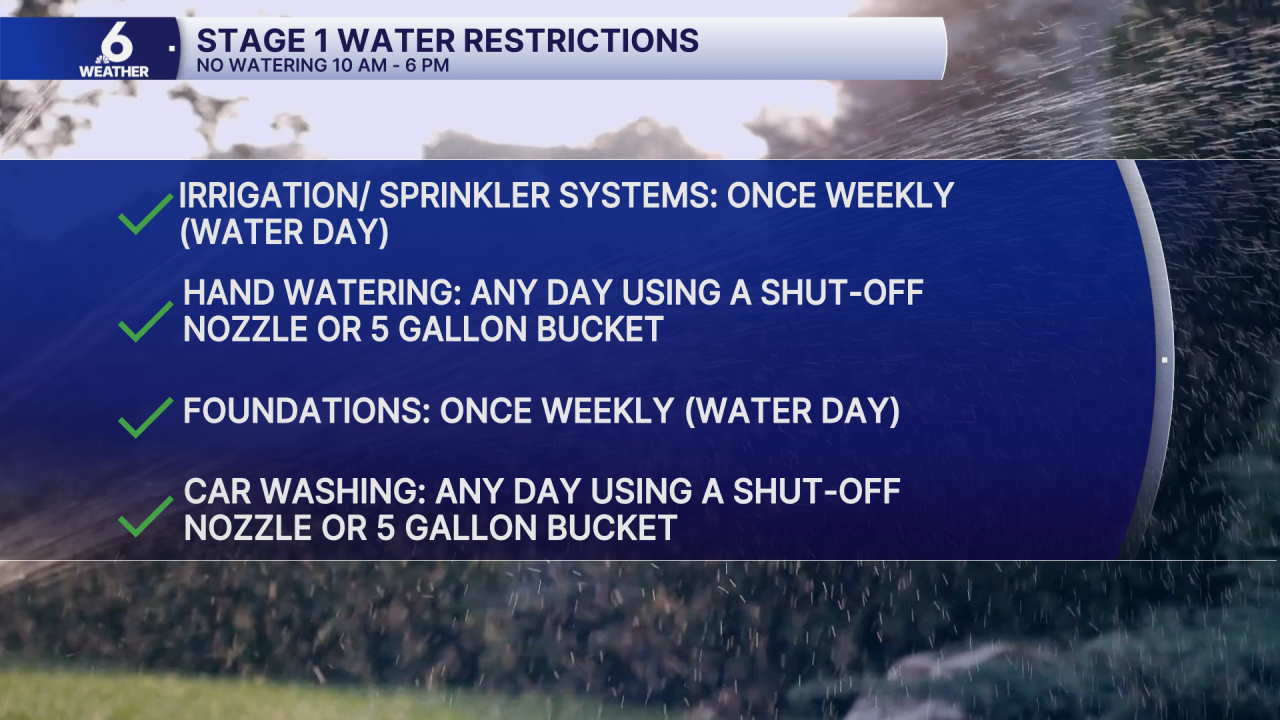
STAGE 1 WATER RESTRICTIONS
On Thursday, the City of Corpus Christi will move to Stage 1 Water Restrictions. Here's what is allowed. Please continue to conserve water as hot weather and dry conditions do not help our water supply challenges!
IN THE TROPICS
In the Atlantic Basin, Invest 96L is still brewing. This tropical wave likely won't have much more time to develop. Conditions look unfriendly for this tropical wave as it continues moving westward, toward the Lesser Antilles.
