



CORPUS CHRISTI, Texas — Happy Wednesday!
WHAT YOU NEED TO KNOW
- Major to extreme heat risk continues
- A few 'chispas' or isolated showers along the sea breeze
- Temps remain unusually hot all week
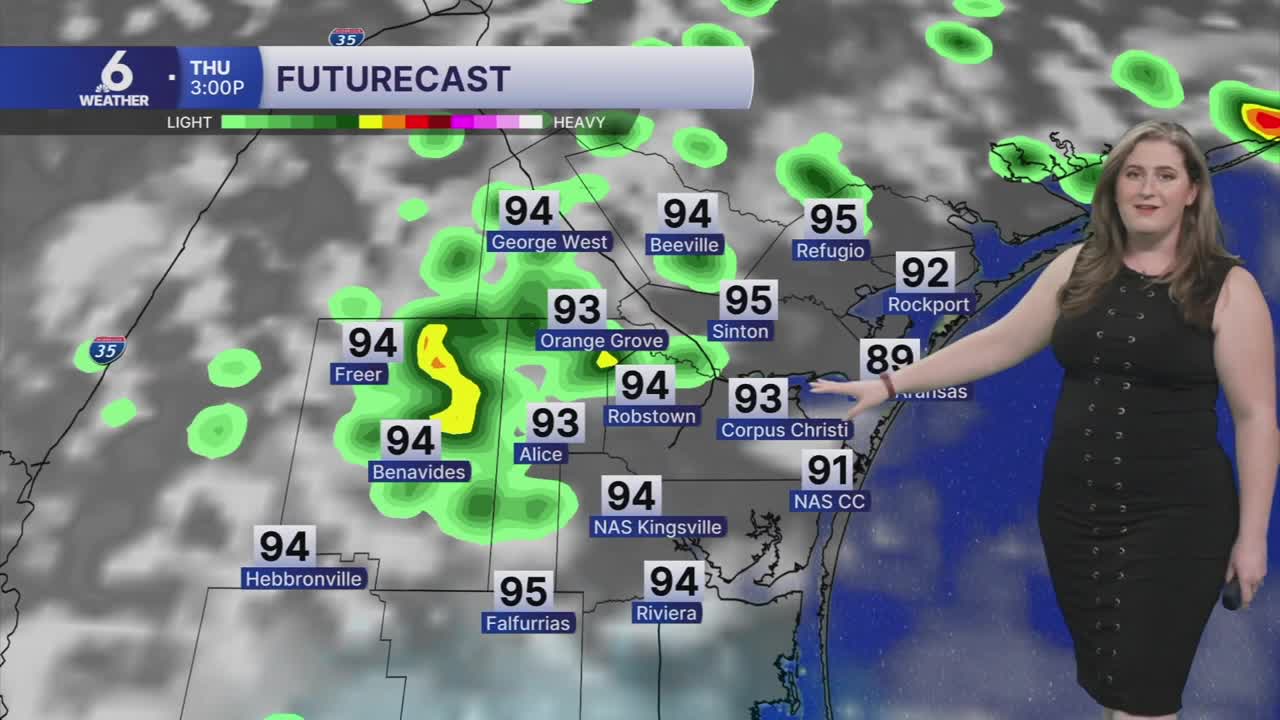
Thursday rain timeline
Thursday could bring a rain to a few neighborhoods. While the activity will be brief and sparse, any showers that do form could provide a 'good sip of rain'. Isolated showers are expected to move in during the morning commute. Then a round of scattered showers will move inland along the afternoon sea breeze. Let's hope these little showers can bring meaningful rain to our neighborhoods! While a few showers are likely to return on Friday, Thursday will be our best chance for measurable rain until next week.
The heat will improve... a little
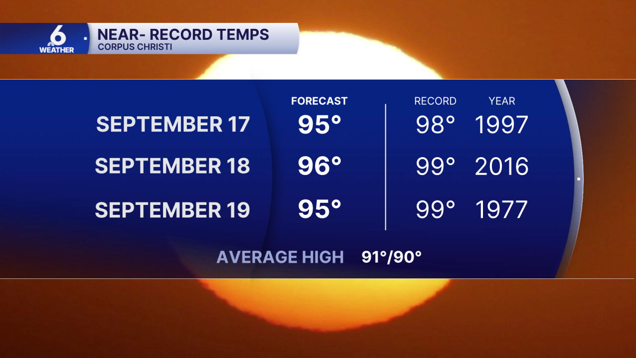
Hotter-than-usual temps continue well into next week. Expect afternoon high temps to top out in the middle 90s, with 'feels like' temps in the low to middle 100s. This heat is still near-record as many of the standing hottest temps are in the upper 90s.
Please practice heat safety! You'll need to take breaks, stay hydrated, and look before you lock.
In The Tropics
Unusually quiet conditions continue across the Atlantic Basin. We're watching one area of interest in the Atlantic, but there is no risk to the Coastal Bend.
