

CORPUS CHRISTI, Tx — Happy Monday!
WHAT YOU NEED TO KNOW
- Windy week ahead
- Humidity rising
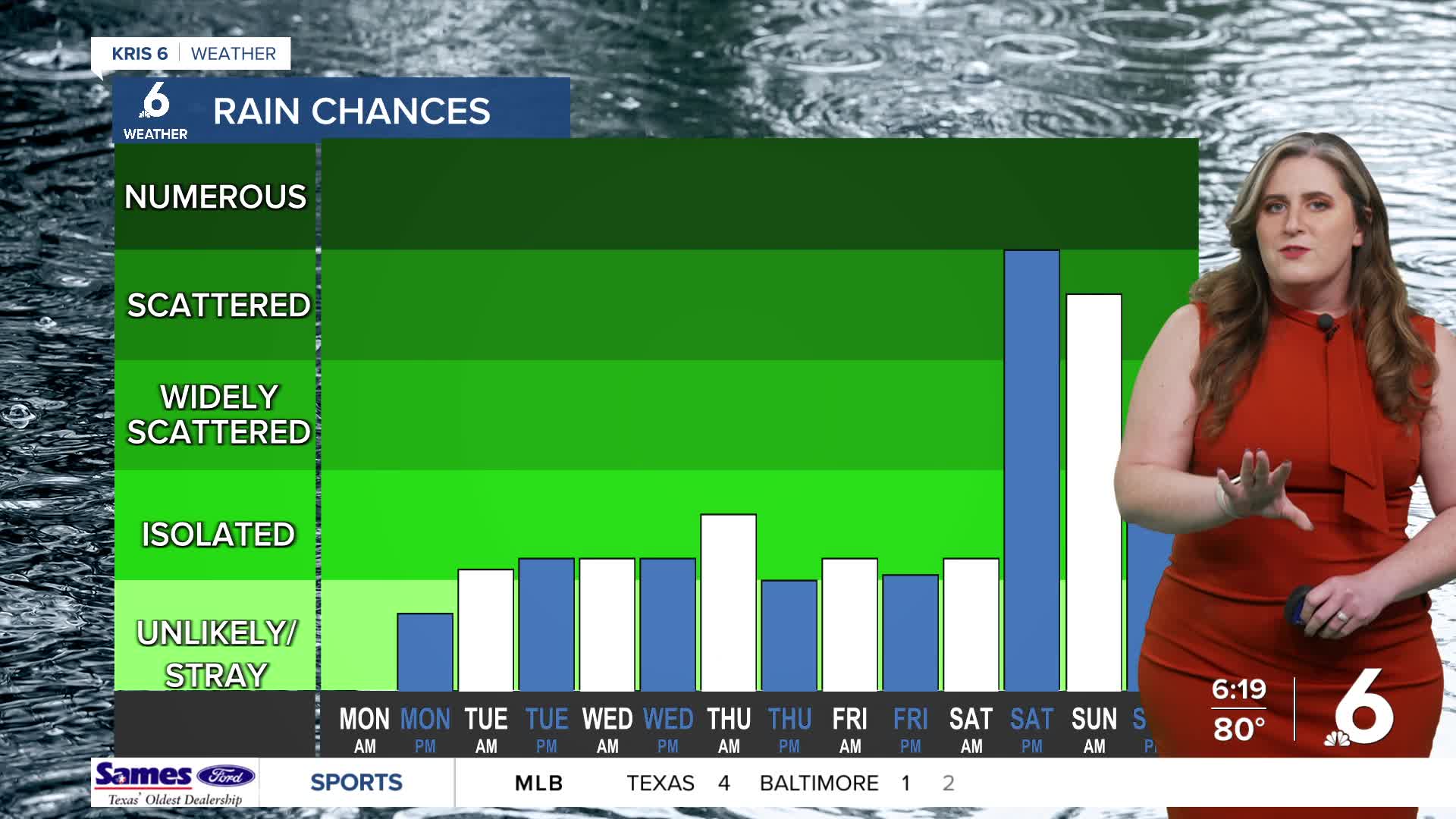
- Daily chance of rain, more likely this weekend
Rain this week
After a short-lived cool down from the weekend, temps are warm again! Monday's high in the mid and upper 80s will return each day this week. Tonight, Temps slowly fall to the upper 60s. A few 'streamer' showers are possible: these are trails of light rain showers over the gulf that trend to trickle into the coastal neighborhoods. I'm not expecting much rainfall on Tuesday nor Wednesday, but don't be surprised if you spot a quick sprinkle! Rain becomes more likely over the week. Wednesday night and into Thursday, isolated showers will be possible as a weak front dips into Central Texas. The front won't get here, but its proximity will make rain likely for the Coastal Bend.
Weekend rain chances
Now, this weekend looks more likely for showers and storms. A stronger cold front will move into the Coastal Bend Saturday evening, bringing scattered thunderstorms across the region. The weekend is still several days away and there are many moving parts in this forecast. As you make plans for the Easter holiday weekend, my best advice is to have a 'rainy day' plan. I wouldn't change your plans this far out, but rather I'd encourage you to make that decision by Wednesday. By midweek, the forecast will offer more clarity!
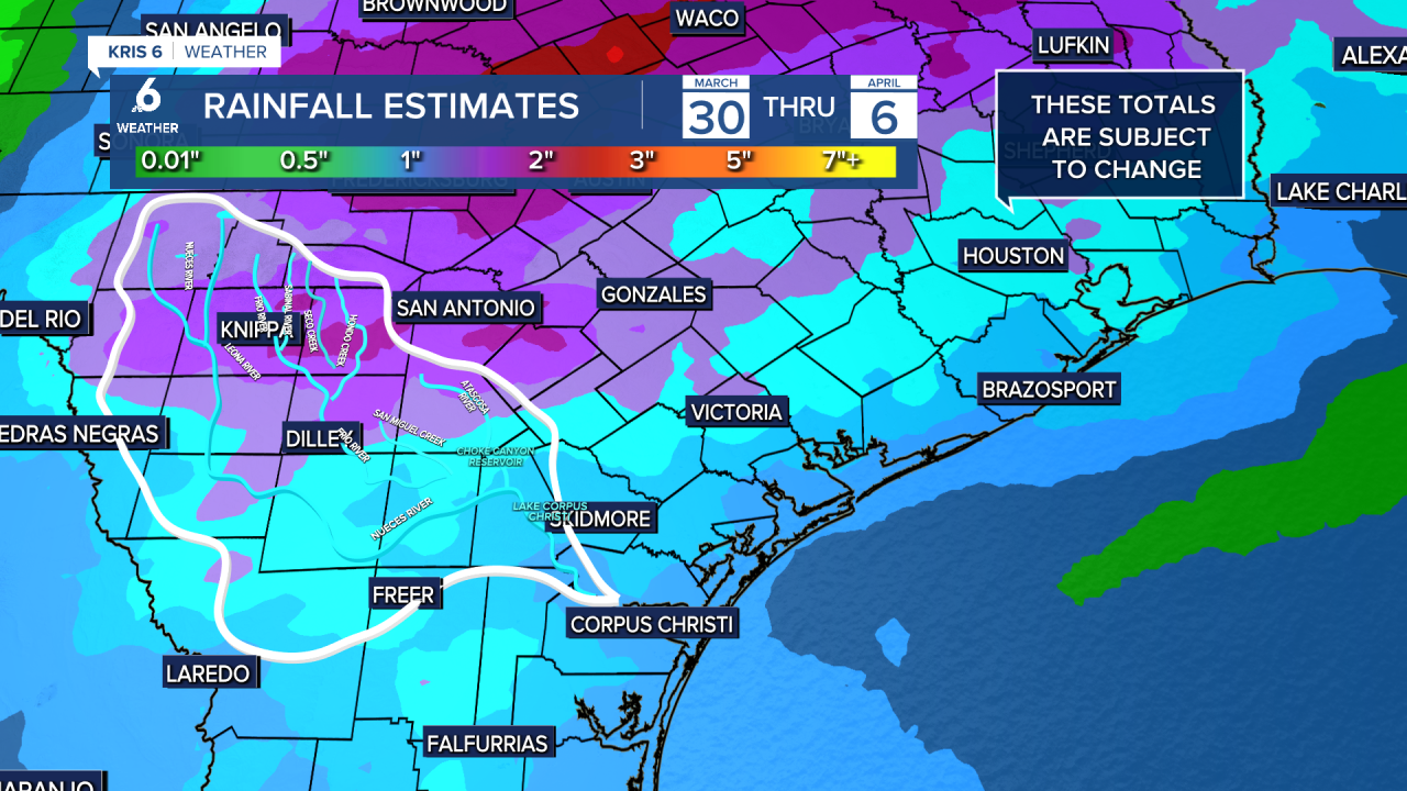
There's a good chance that the rainy days stretch into the following week, so dust off those umbrellas and raincoats! Rainfall estimates are looking more promising with around 1" of total rainfall possible through next Monday, April 6.
CORPUS CHRISTI FORECAST
Monday night: Increasing clouds, overnight showers possible
Temperature: Low 69ºF
Winds: SE 20-30 mph
Tuesday: Sun/cloud mix, breezy, stray showers possible
Temperature: High 85ºF
Winds: SE 20-30 mph, gusts to 35 mph
Tuesday night: Cloudy, warmer, breezy
Temperature: Low 71ºF
Winds: SSE 20-30 mph
Have a great week!
