

CORPUS CHRISTI, Tx — Good evening and Happy Saturday!
WHAT YOU NEED TO KNOW
- Noticeable mugginess in the air through the seven day forecast
- Chance of showers Saturday night into Sunday morning (~30%)
- Chance of thunderstorms that could be strong to severe Sunday evening (~20%)
- Slowly rising daytime highs in the low to mid 80s
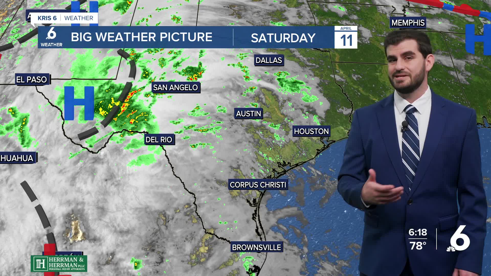
With dew points in the upper 60s and lower 70s we're able to feel the humidity in the air as you step outside. Luckily this could lead to some shower activity as we head through the next ~36 hours. First we'll see the chance for light showers into tonight and tomorrow morning that will be just enough to wet the grass outside if you see one since our coverage is only around ~20%.
Overall tomorrow follows a similar trend to today with the noticeable mugginess and plenty of cloud cover and those light showers we talked about. A breezy and cloudy afternoon, then we head into the evening where things could change. Current models want to kick off some storms just south of the border tomorrow evening, and with the moisture abundant and potential energy on the rise we could see some of these storms on the strong to severe side of things. The NWS Storm Prediction Center has us under a level 1 out of 5 risk in Corpus Christi and most of the Coastal Bend for severe weather with areas towards western Duval county including Freer in a level 2 out of 5 risk. One critical piece of information is this is all dependent on the location of the storms. With only about ~20-30% coverage most of us are likely to stay dry with this system as it passes through, but where we do see the storms things can get noisy pretty quick and the best ingredients for it are to the northwest. The main threats will be the chance of large hail and high winds, with a very low chance of tornadoes but it's always best to stay weather aware no matter what on active weather days.
As we head into Monday and next week the larger system starts to shift to the east and take the "better" rain chances with it. However with moisture still abundant the chance for a light stray shower (~10%) exists almost daily on the seven-day forecast. In terms of temperatures we'll be on the rise slightly from the lower 80s Sunday to the mid and upper 80s as we're closing out the week with some inland neighborhoods bringing the 90s back to town. For winds we're settling into a pattern of breezy afternoon with southeasterly flow around 15-20mph and gusts upwards of 25-30mph pretty much daily, but that's not too far out of the ordinary for us.
All in all, most of us are likely to see enough rain to maybe get the windshield or pavement wet without much in terms of puddles. However with the threat for severe weather tomorrow night we should all remain weather aware to find out the latest on the possibility, current location, and current threats of storms as we go into our Sunday evening.

CORPUS CHRISTI FORECAST
Tonight: Mostly Cloudy with widely scattered showers
Temperature: 71F
Winds: SE 15-20 mph, G 20-25 mph
Tomorrow: Mostly Cloudy, A few morning showers with Evening Isolated Thunderstorms
Temperature: 82F
Winds: SE 15-20 mph, G 20-30 mph
Sunday Night: Mostly Cloudy, Diminishing T-storms and rain chances
Temperature: 72F
Winds: SE 15-20 mph, G 20-25 mph
Monday: Partly Cloudy and Humid
Temperature: 83F
Winds: SE 15-20 mph, G 20-30 mph

I hope you have a great Saturday night and rest of your weekend Coastal Bend!
