



CORPUS CHRISTI, Texas — Happy Monday!
WHAT YOU NEED TO KNOW
- Hot, sunny, and breezy
- Heat alerts likely midweek
- Watching The Tropics
August heat doubles down this week
The high pressure that has been hanging out over the desert southwest is making a comeback! This weather pattern is often referred to as a 'heat dome' because it causes downward movement in the atmosphere. This leads to hot weather and little opportunity for rainfall. Since our predominant wind is from the southeast (onshore), there will still be plenty of moisture and humidity at the ground level. As a result, stifling heat is in the forecast with only the slightest chance of showers along the sea breeze on Friday. This is climatologically our hottest stretch of the year (August 5- 15) with an average high temperature of 96ºF.
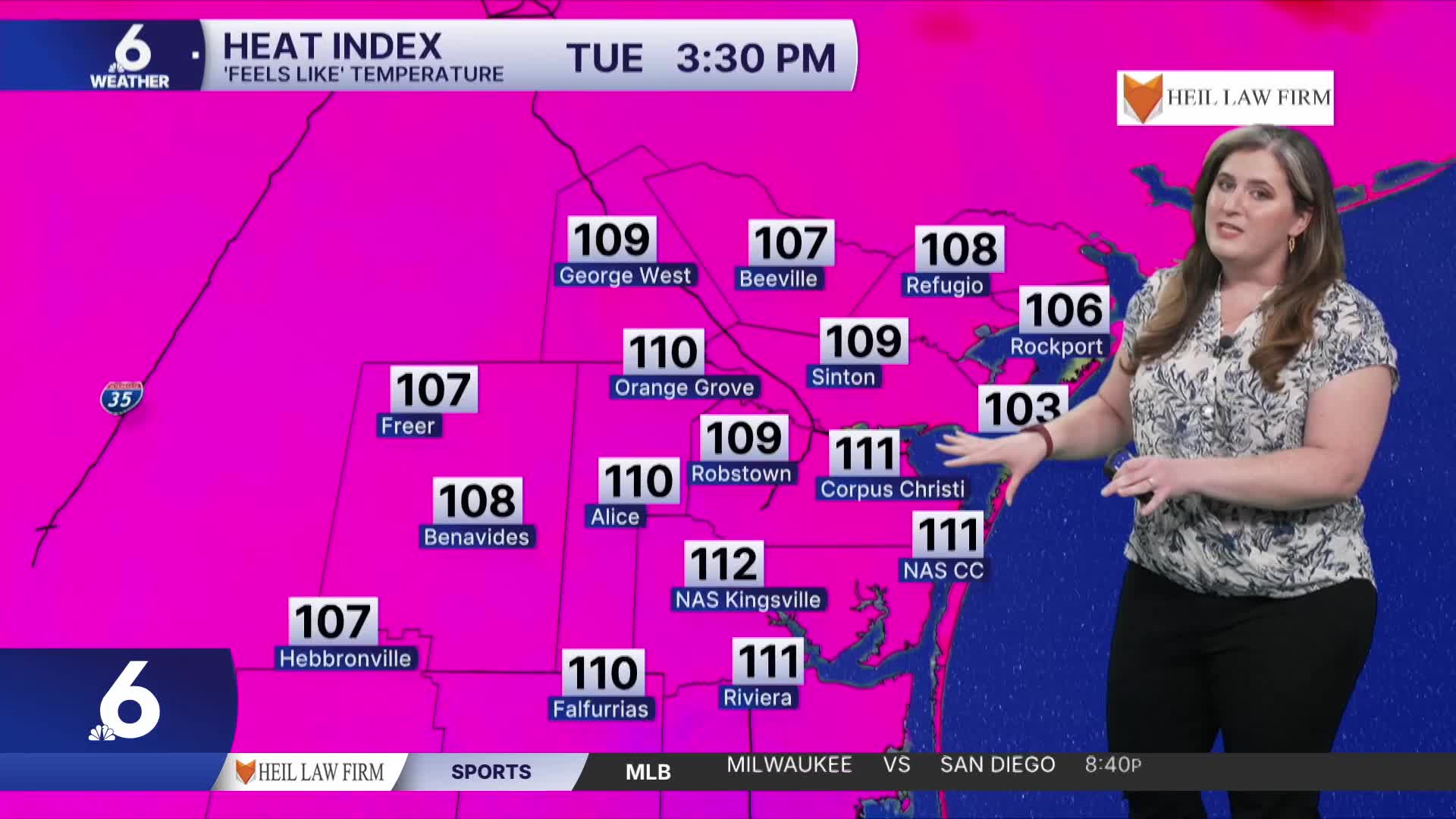
On Tuesday morning, low temperatures begin in the upper 70s and lower 80s, but will feel warmer. As temps begin to rise, plentiful humidity will push 'feels like' temperatures to the 110s by dismissal time. Please be sure to stay cool and hydrated!
In The Tropics
There are a few areas across the Atlantic that we're watching.
It's typical to see an uptick in activity across the open Atlantic as tropical waves leave the western African Coast and emerge over warm water. Each of these areas indicate a probability that 'tropical trouble' forms, those each has obstacles to overcome. The next name on the list of Atlantic Hurricane names is Cristobal (pronounced krees-TOH-bahl). There is not threat to the Coastal Bend at this time.
Have a wonderful week!
