

CORPUS CHRISTI, Tx — Good morning and Happy Friday!
WHAT YOU NEED TO KNOW
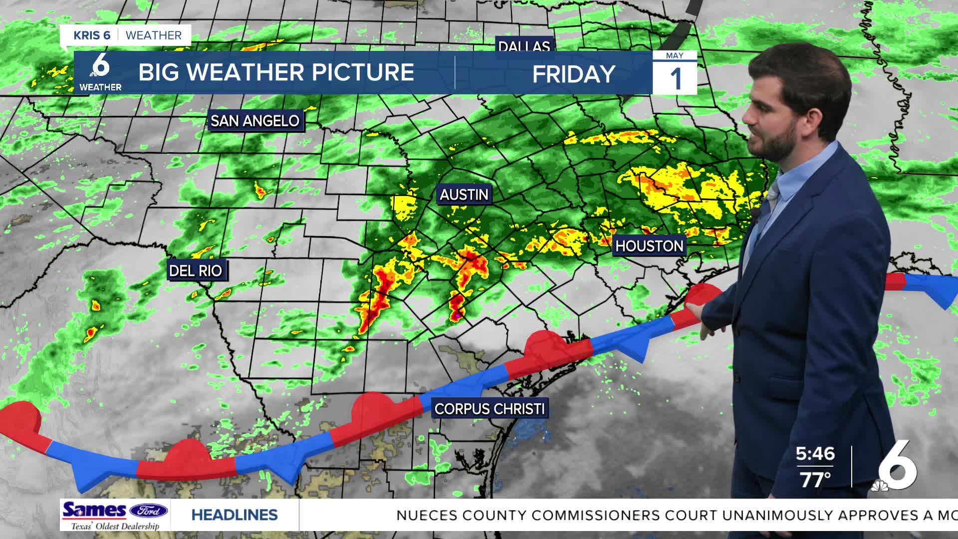
- Marginal Risk of Severe Weather today from Corpus Christi-Orange Grove to the North and East (Level 1/5)
- Scattered Showers for most today, but some could see storms and heavier downpours
- Cold Front this evening brings strong winds from the north
- Great weekend behind the front with more sunshine and 70s for highs!
Severe Weather Chances
From Corpus Christi through Orange Grove to George West and areas north and east we could see some of the storms today get a little stronger out there as we're included in a level 1/5 risk for severe weather from the NWS. The main threats would be hail and high winds as these move through, but for most of us we'll likely be more in the scattered showers area today with a few rumbles of thunder.
Weekend Forecast
Today we'll still be warm through the afternoon until the cold front finally gets a better push this evening through the area. By ~5-7pm we'll see that cold front push through and winds increase behind it pretty quickly out of the northeast leading to a wind advisory and gale warning from this evening through 10am tomorrow. Saturday will be nice with mostly sunny skies and temperatures in the mid and upper 70s with Sunday only coming in around the upper 70s and lower 80s!
Next Week
Going into Monday and Tuesday we'll be back on the warming trend with ~83F and ~89F respectively for daytime highs and overnight lows following a similar trend. We'll see the winds return from the southeast and bring more moisture back to the area and see rain chances increase once again going into the back half of next week!

I hope you have a great Friday and weekend Coastal Bend!
