



CORPUS CHRISTI, Tx — Good morning and Happy Thursday Coastal Bend!
WHAT YOU NEED TO KNOW
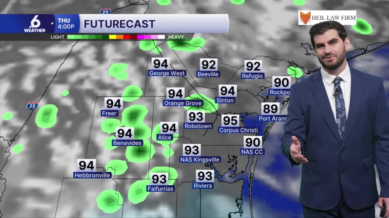
- Scattered showers and thunderstorms for the end of the week (30%)
- Daytime highs in the low to mid 90s as you go inland
- Winds from the east-northeast around 10-20 mph
- Rain chances dry up this weekend, with highs holding in the mid 90s
End of the week rain chances
Starting Thursday we'll begin seeing more scattered showers and even thunderstorms returning to the radar across the Coastal Bend. For the morning it looks like our coastal communities can get in on some of the action before it starts to shift its way inland through the late morning and afternoon hours. This will still be the "popcorn" style activity so not all of us will be rain winners for Thursday's rain, and that remains true into the Friday rain chances as well. Overall we'll see a decent amount of neighborhoods coming in around ~0.1", with the biggest winners getting closer to 0.5-1.0" coming down. Going into the weekend the rain chances look to start drying up, with the exception of a few isolated sea breeze showers.

Disclaimer: Keep in mind this "potential rainfall" graphic isn't set in stone on locations especially, but more gets the point across that we won't all be seeing the rain as we head through our Thursday forecast.
Holding on to the Heat
For the end of the week we're still looking at daytime highs in the low to mid 90s especially where we aren't seeing any of the rain cooled air nearby. As the rain dries up this weekend, we're not looking at too many changes to the temperatures which is good news since it was pretty common this summer to "dry up and warm up." Those mid 90s hold on for daytime highs as we're pushing into the start of next week with plenty of sunshine expected from this weekend through Wednesday on the current seven-day forecast. Overnight lows are also still feeling like summer out there as we bottom out in the upper 70s across the board.

I hope you have a great Thursday Coastal Bend!
