


CORPUS CHRISTI, Texas — Happy Wednesday!
WHAT YOU NEED TO KNOW
- Cold front arrives Thursday
- Storms expected late Wednesday into Thursday
- Some storms could be severe
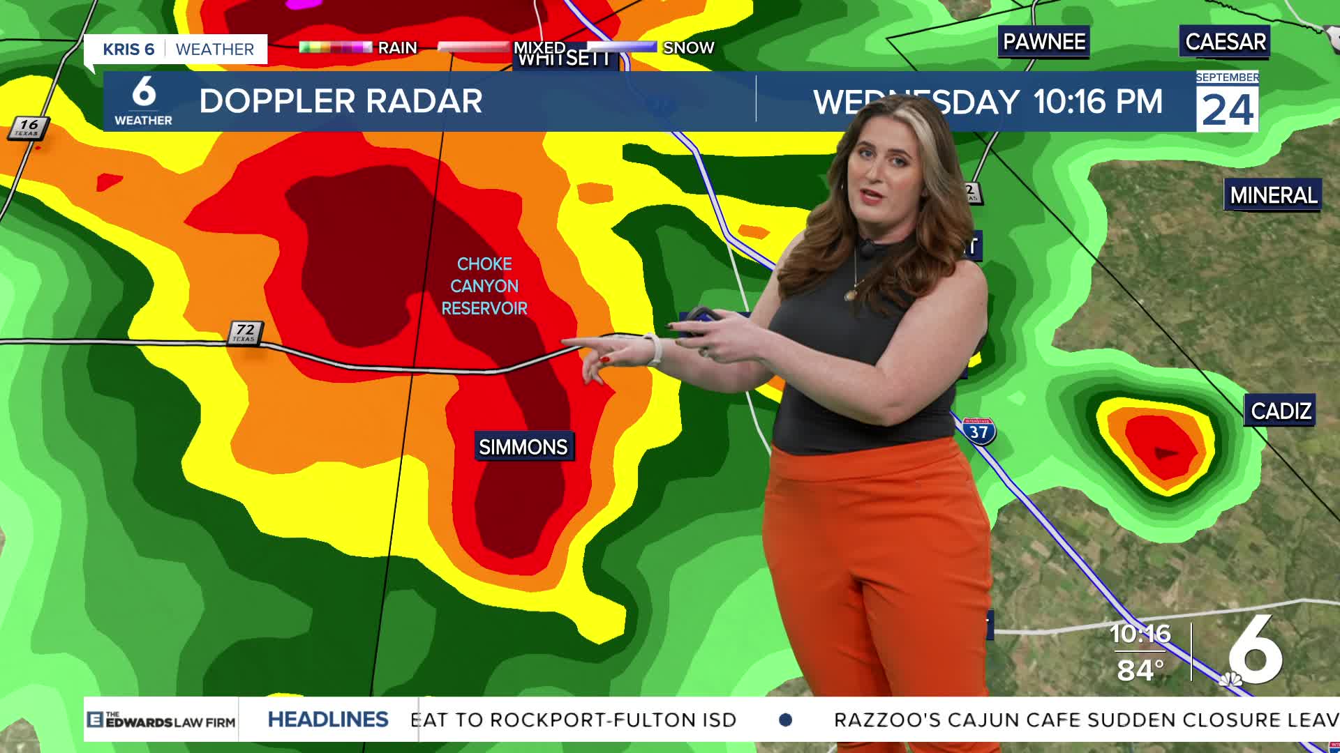
The first cold front of fall is headed our way! The front won't be very strong, but it will move all the way through the Coastal Bend. This is going to bring some much-needed rainfall to South Texas. Storms are expected to become stronger after midnight, ahead of the front. It's a good idea to keep an eye on the forecast and have multiple ways to receive weather alerts in case storms become severe in your neighborhood.
Expect heavy rainfall with thunderstorms, especially Thursday morning. The main threat will be strong winds and localized flooding. Small hail is possible, but less likely. Once the front passes, storms will clear by Thursday midday. A few showers are possible Thursday night, but activity will be sparse and to our south. Conditions will more comfortable! High temperatures will climb to the middle 90s Wednesday before falling to the upper 80s on Thursday afternoon. The cold front will also bring some enjoyable conditions for this weekend, too.
CORPUS CHRISTI FORECAST
Wednesday night: Strong storms expected
Temperature: Low 75ºF
Winds: S/NE 5-10 mph
Thursday: AM t-storms, mostly sunny afternoon
Temperature: High 86ºF
Winds: ENE 15-25 mph
Thursday night: Stray showers, partly cloudy
Temperature: Low 68ºF
Winds: Light and variable
Have a terrific evening!
