

CORPUS CHRISTI, Texas — Happy Sunday!
WHAT YOU NEED TO KNOW
- Moderate to major heat risk
- Stay hydrated, use sunscreen SPF 30+
- Tracking a late-week cold front/rainfall
HEAT RISK
Is that you, summer? Oppressive humidity is back with very warm temperatures. This combo means heat risk will be higher across the Coastal Bend. Afternoon highs rise to the upper 80s and lower 90s across our Coastal Bend neighborhoods, and 'feels like' temps will be even hotter. Please be sure to hydrate! Expect a mix of sun and cloud on Monday and Tuesday— don't forget your sunscreen (SPF 30 or better). Damaging UV rays can still reach you on cloudy days!
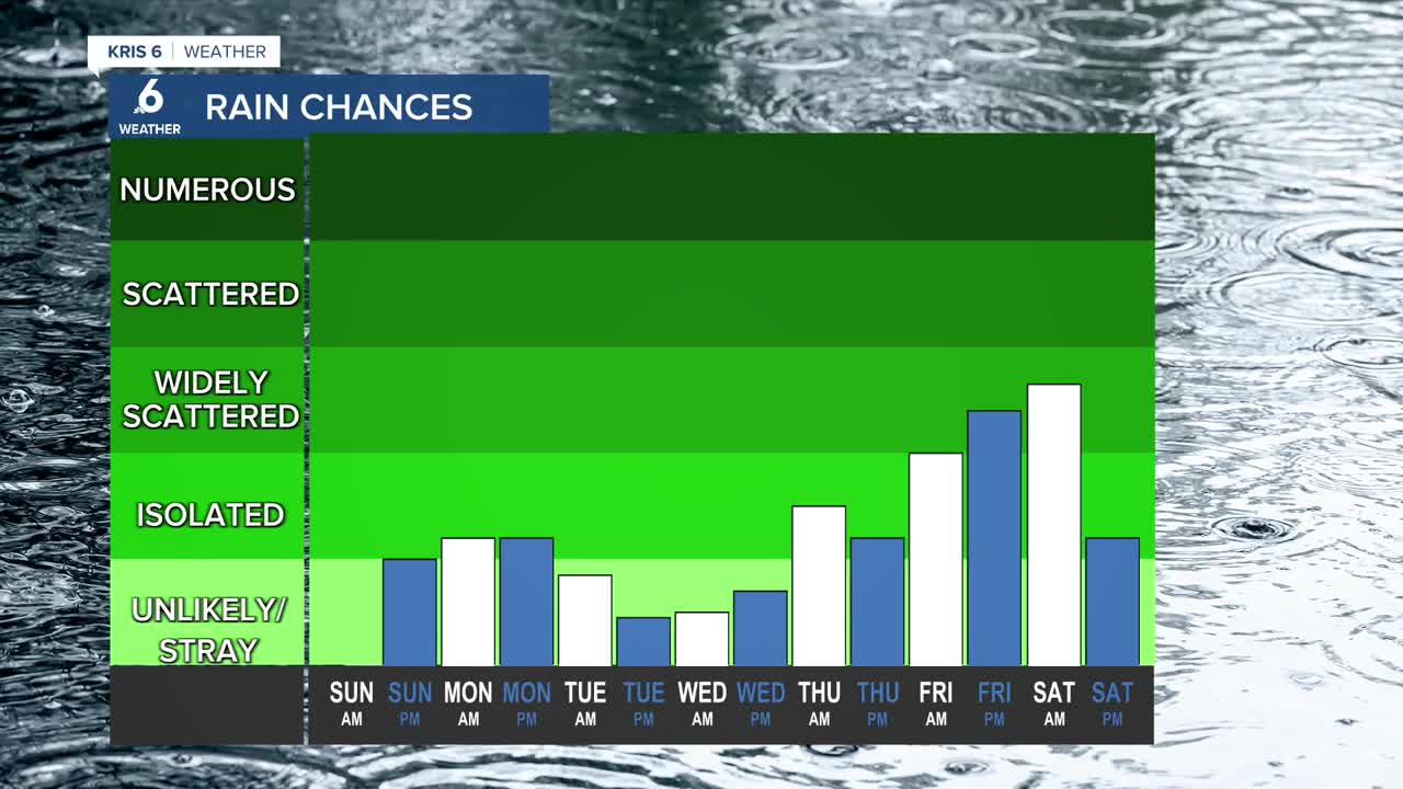
OUR NEXT COLD FRONT
A cold front will be making its way to South Texas later in the week. This could offer decent rain chances as we head into the first few days of May. As of now, it looks like widely scattered showers could begin as early as Thursday evening and last through early Saturday. I'll keep a close eye on this front and the rain expected along with it.
