



CORPUS CHRISTI, Tx — Happy Weekend Coastal Bend!
WHAT YOU NEED TO KNOW
- Severe Weather Risk reduced to Non-Severe threat for most of Coastal Bend
- A few spotty showers with some rumbles of thunder possible
- Cooldown on Monday with highs in the mid 60s
Changes in the forecast
So far on Sunday, we've seen isolated to scattered showers developing across the area ahead of our next cold front working through the region. Sunday's forecast has panned out differently than initially expected, where previously there were multiple signals of strong to severe thunderstorms in the forecast, but those ingredients did not exactly align since today's atmosphere was not as unstable as it was thought to be. A Severe Thunderstorm did develop outside of the Coastal Bend in Matagorda County earlier this afternoon, but that was the only severe-warned storm over land so far. The most intense thunderstorms occurred late last night through today over the Gulf.
Hazardous marine conditions through Monday
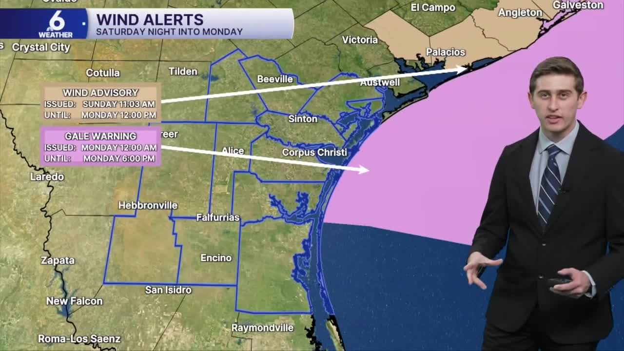
As this front passes through the area today into our Monday, winds will blow of the North and could be quite breezy at times. Sustained winds between 25-30mph are possible tonight. This will lead to hazardous marine conditions for boaters, specifically Gale force gusts and rough seas are possible tonight through Monday evening. A Gale Warning and Small Craft Advisory will last until Monday night at 6PM CST. In Port Aransas, waters have already reached the dunes, making it more difficult to drive on beach roads. Minor coastal erosion or coastal inundation is still a possibility during high tide periods. The next high tide is forecast around 1:11 AM CST Monday in Port Aransas. Tonight, a high risk for life-threatening rip currents are forecast with these choppier waters. With these conditions, I'd avoid going into the waters until later on Monday or Tuesday.
Where's the rain?
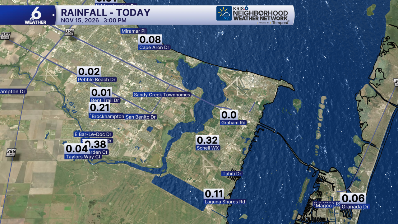
The KRIS 6 Neighborhood Weather Network has picked up on rain totals this afternoon near half an inch in some communities on the Southside of Corpus Christi. This additional rainfall from this weekend could help to put a small "chip" or dent in our drought monitor, but those changes wouldn't be as noticeable as last week where we were able to get rid of the extreme drought conditions in the Coastal Bend.
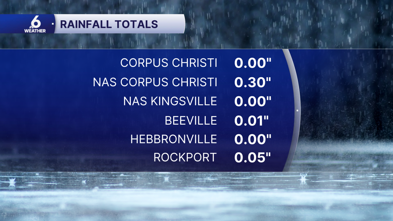
Official Rain Totals as of 2:45 PM
The week ahead
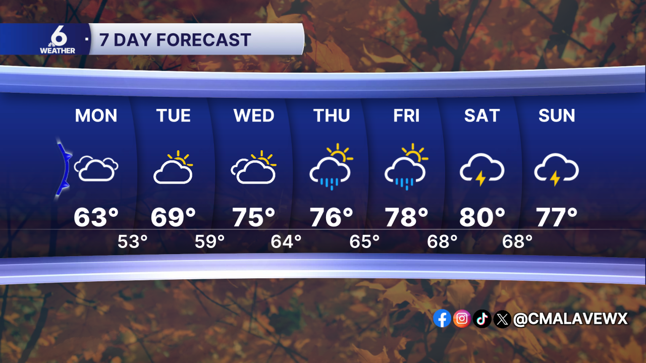
On Monday, most of us will catch a break from the rain and feel the cooldown after our cold front passes by. Monday morning, we will wake up to temps in the mid 50s, but the clouds will only allow our highs to creep into the low to mid 60s. Expect a gradual warming trend throughout the week, alongside increasing moisture and some rain chances for the end of the week. Right now, it's not looking like anything widespread, but the elevated rain chances seem to pick up more starting mainly on Thursday. I'm keeping an eye on a cooldown in the forecast for early next week, but there's still a lot of uncertainty with that so keep checking back in for more details throughout the week.
Have a great rest of your weekend!
