



CORPUS CHRISTI, Tx — CORPUS CHRISTI, Texas - Happy Monday!
WHAT YOU NEED TO KNOW
- Tropical Storm Bertha forms as of the 7PM NHC Advisory
- Intensity pushed back; will continue to monitor this week
- Could aid rain chances in the Coastal Bend late week
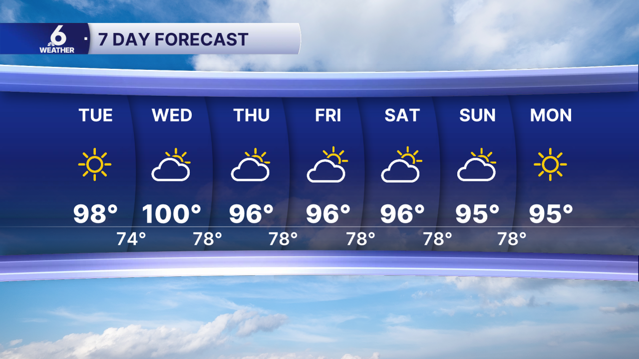
- Temps approaching 100 degrees by Wednesday
High Pressure
A large heat dome is currently in place over the desert southwest. This area of high pressure is leaving us with very few clouds, and little relief from the heat. Today was the hottest day of the year so far in Corpus Christi, we hit 98 degrees over at the airport. Neighborhoods further inland already hit 100 degrees today, but on Wednesday, Corpus Christi could see its first 100 degree day. The high pressure is also a major contributor to the steering flow of where this tropical low ends up, as the clockwise spin of the high pressure direct the track of the storm.
Tropical Activity Brewing in the Gulf
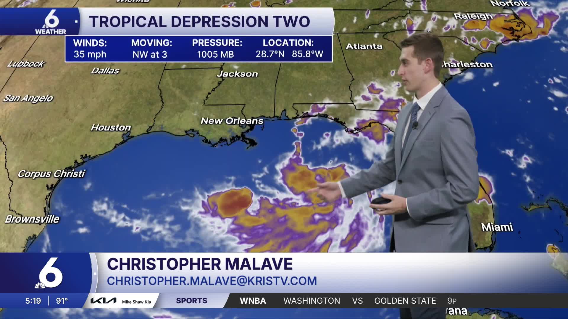
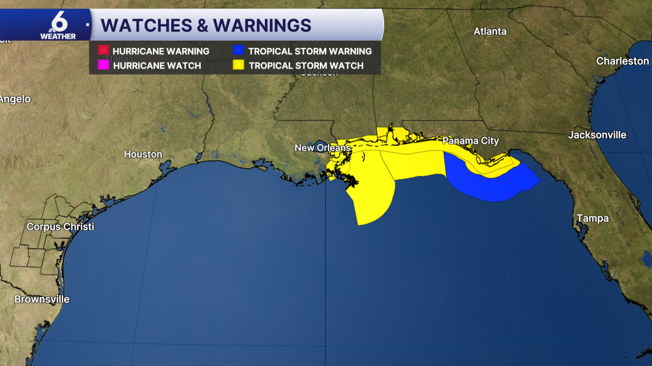
NOAA Hurricane Hunters flew into TD2 and found tropical storm force winds in the low pressure center, prompting the NHC to upgrade TD2 to Tropical Storm Bertha. As of the 7PM CDT Advisory, it has winds of 40mph and a recorded pressure of 1004mb. Currently, its about 110 miles offshore of Panama City Beach, Florida. Tropical Storm Watches and Warnings are currently in effect stretching from Coastal Louisiana to the Florida Panhandle. NHC has also gone ahead and issued Storm Surge Watches from Louisiana to Alabama including New Orleans, Gulfport, Biloxi, and Mobile. While Tropical Storm Bertha is still forecast to gradually strengthen within the next few hours, it is encountering large amounts of wind shear thanks to El Nino and dry air from the Saharan Dust. You can think of these like kryptonite for tropical systems, they both hinder rapid intensification and development.
River Flooding Tuesday & Wednesday
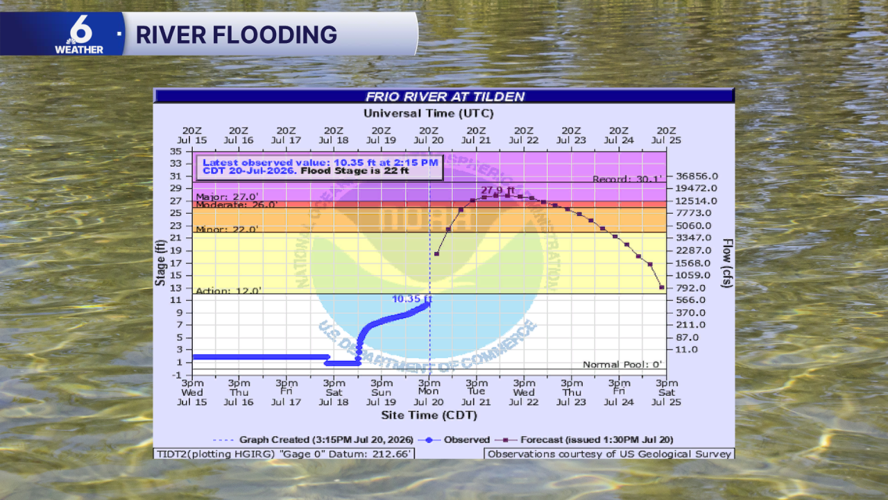
Both the Frio and Nueces Rivers are expected to reach major flood stages by the middle of the week. The Frio River at Tilden reaches major flood stage at 22ft, and is currently forecast to crest around 27.9 feet. At 27 feet, homes and businesses near the Frio River flood, roadways become overtaken by floodwater, and crops are damaged. Along the Nueces River, many roadways flood when the river reaches or exceeds 20 feet. Vulnerable neighbors should plan on evacuating to higher ground. Listen to local emergency managers and officials for any evacuation orders.
Enjoy the rest of your Monday Coastal Bend!
