



CORPUS CHRISTI, Tx — Happy Tuesday Coastal Bend!
WHAT YOU NEED TO KNOW
- Warm and muggy conditions continue through Friday
- Above average temperatures persist in the low to mid 90s
- Windy Wednesday with gusts near 30mph out of the SE
- Coastal Flood Advisory through 1AM Wednesday
- Cooler and drier weekend as cold front arrives Friday into Saturday
Way too hot for October
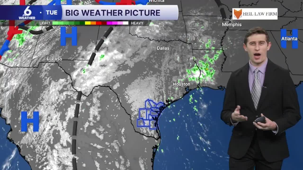
At Corpus Christi International Airport, the record high temperature of 96 degrees was nearly tied today. We ended up at 95 degrees for the daytime high temp on Tuesday, which is notably much hotter than the average high temperature this time of the month, which is 86 degrees. Breezy southeast winds only brought in more oppressive air from the Gulf, making it feel like the triple digits out there. We've only be feeling like mid-to-late summer for a few more days, before a cold front hauls in more cool and dry air into the Coastal Bend.

Hump Day Weather
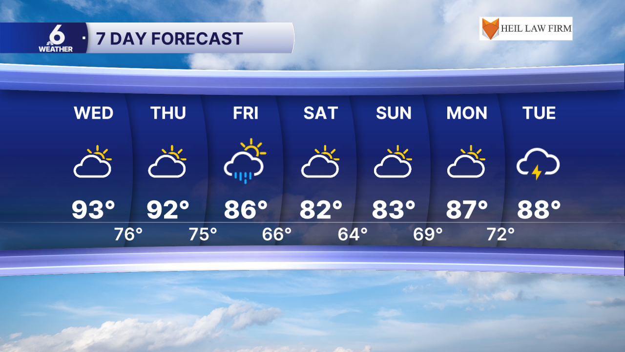
Wednesday brings us some more hot and steamy weather across South Texas, as highs bounce back up into the low to middle 90s. The added humidity will raise up the 'feels-like' temperatures to around 100 degrees area-wide. Gusty winds will blow out of the southeast up to 30mph at times. A few stray showers are possible out towards the Coastal Plains, but coverage does not seem to be all that impressive for our Wednesday (about 20%).
Comfortable Fall-Like Weekend in South Texas
Our local weather pattern shakes up this weekend with the arrival of a cold front on Friday. The exact timing of when this front will arrive hasn't been perfectly nailed yet, but you can expect some more windy conditions this weekend. A Small Craft Advisory could be issued along the coast as these winds could generate more hazardous marine conditions for those with smaller boats. This system won't end up bringing us very much rainfall accumulation, but the front could serve in part as a lifting mechanism to kick up some showers and storms Friday.
Rain isn't necessarily the star of the show for the weekend, rather, the much cooler and dry air we feel after this front passes through will take the spotlight in the forecast. On Saturday, we're expecting to be waking up to lows in the 60s and highs only topping out in the low 80s. The models have come into a little more agreement about how cool we will get here, but this forecast is still subject to change with this frontal passage still being several days out. For the week ahead, temps will climb back up into the upper 80s, as more moisture and rain chances return next Tuesday.
Have a great rest of your Taco Tuesday!
