

CORPUS CHRISTI, Tx — Hey there and Happy Monday Coastal Bend!
WHAT YOU NEED TO KNOW
- Cloudy afternoon in the mid 80s
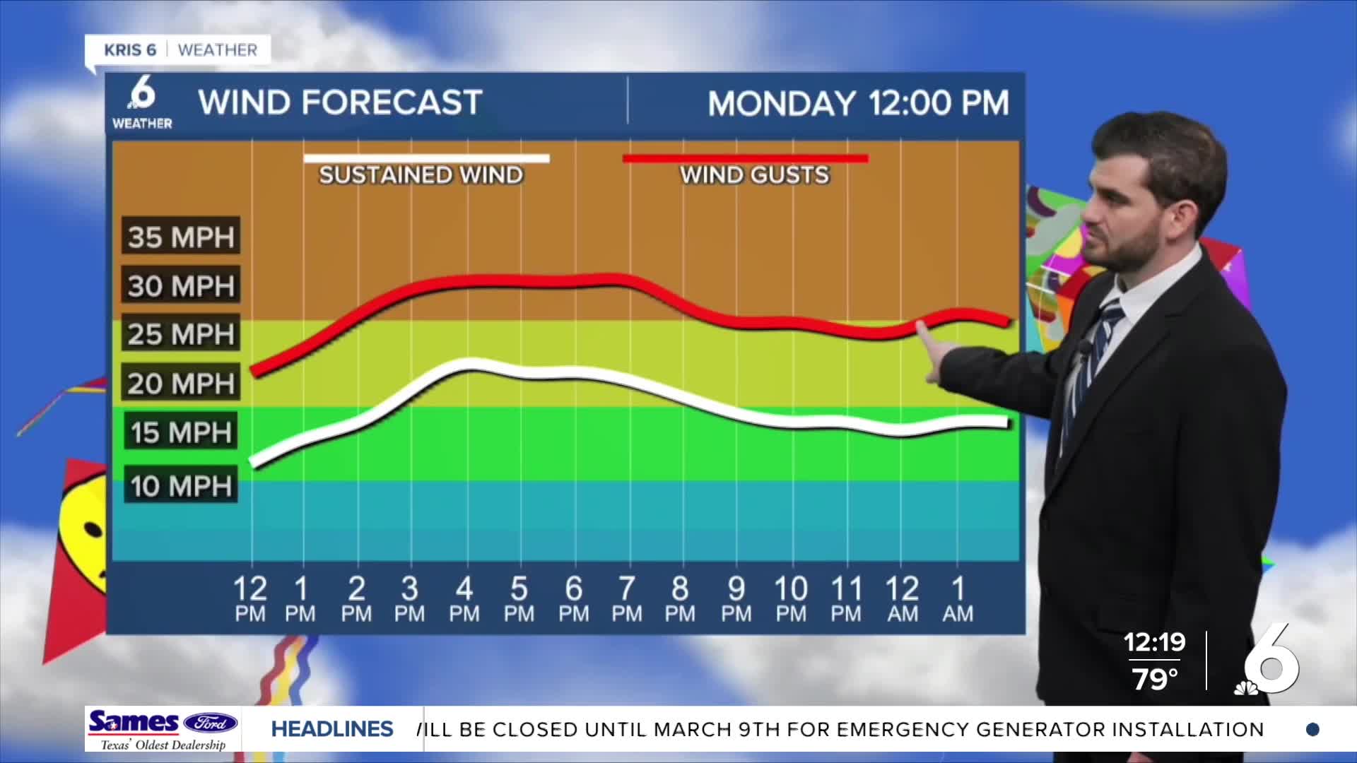
- Breezy SE winds around 20-30mph
- Isolated shower or two tonight for southwestern neighborhoods
- Patchy Fog tomorrow morning where winds are lighter
As we start off the second week of March we're seeing dew points in the 70s and plenty of clouds in the sky. Without much lift we're unfortunately not seeing much rain on the radar, but we could see an isolated shower or two sneak in to some southern and western neighborhoods. Tomorrow is just about a copy and past of today with plenty of cloud cover, and a breezy afternoon in store.

As we head into the middle of the week is where we start to see more changes on the board. By Wednesday we'll have our next cold front approaching the area. In front of the front we could see some scattered showers and even thunderstorms by Wednesday morning for the commute to work, so it's something to keep in mind. By Wednesday afternoon we're expecting the upper 80s and even lower 90s for daytime highs, but luckily the front works in Wednesday night. By Thursday morning we should wake up to the 50s and only see the mid 70s return Thursday afternoon! Following the cold front we'll also clear out dramatically with wall-to-wall sunshine heading into this weekend to close out Spring Break!
CORPUS CHRISTI FORECAST
Today: Mostly Cloudy and Breezy
Temperature: 85F
Winds: SE 15-25 mph, G 25-35 mph
Tonight: Mostly Cloudy, Isolated Showers Southwest
Temperature: 70F
Winds: SE 10-20 mph, G 20-25 mph
Tuesday: Mostly Cloudy and Breezy
Temperature: 85F
Winds: SE 15-25 mph, G 25-30 mph

I hope you have a great Monday afternoon and start to your week!
