

CORPUS CHRISTI, Texas — Happy Tuesday!
WHAT YOU NEED TO KNOW
- Oppressively humid this week
- Heat Risk: Moderate (2 out of 4)
- No meaningful rainfall until Saturday
- Rainfall looking better this weekend
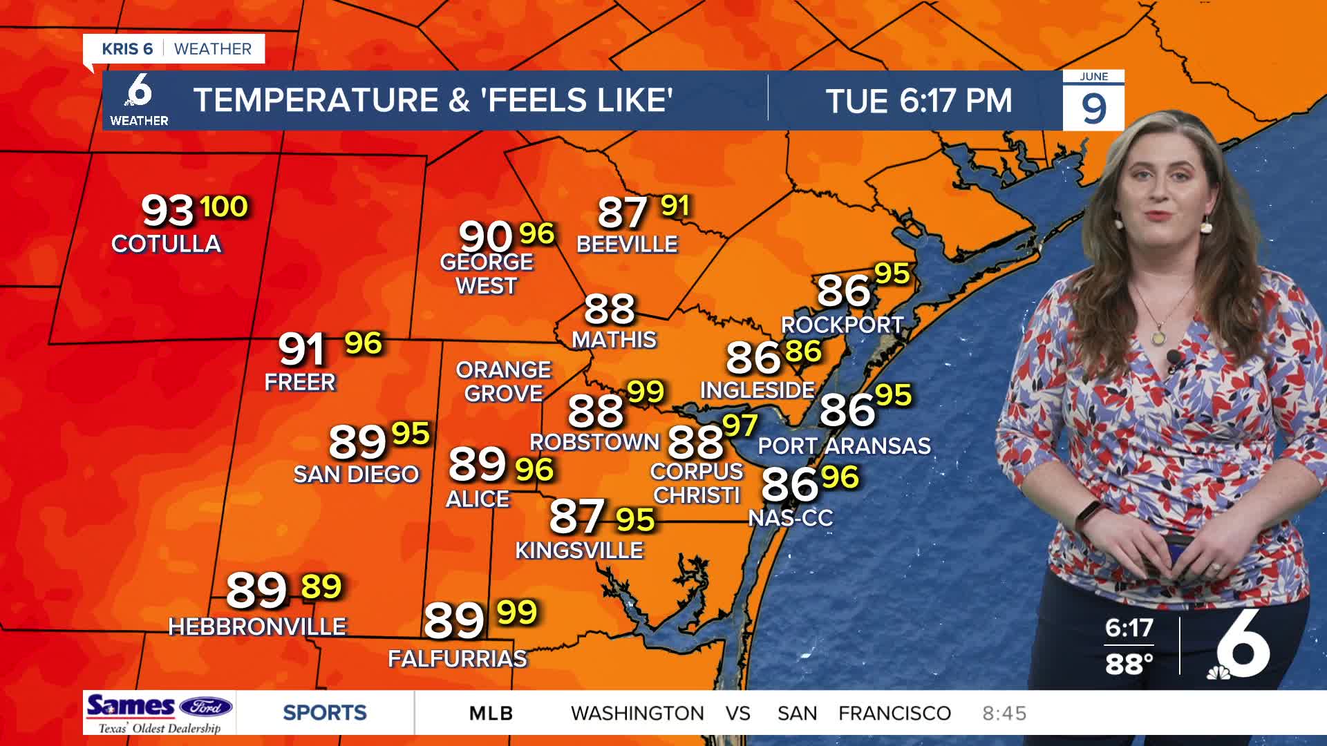
Sweltering heat
'Air-you-can-wear' has each morning feeling like a sauna. Expect morning lows near 80ºF again on Wednesday. By the afternoon, high temperatures in the upper 80s and lower 90s. 'Feels like' temps will stay locked in the triple digits for most of the afternoon. Please be sure to stay hydrated. Check in on kids, pets, and the elderly; these folks are more prone to heat-related illness. Heat Risk will be moderate (2 out of 4).
Stray showers
Again, a few stray showers or 'chispas' are possible on Wednesday. This will be our only format for rain until the weekend. By Saturday morning, a 'wrinkle' of low pressure looks to form along the middle Texas coast. This will trigger showers and thunderstorms. The tropics are active in the Eastern Pacific Basin. While those storms pose ZERO threat to the Coastal Bend, moisture from those storms are likely to be carried our way, just in time for weekend rainfall. This will allow for more generous rainfall on Saturday and into the following week.
