



CORPUS CHRISTI, Tx — Happy Labor Day Weekend Coastal Bend!
WHAT YOU NEED TO KNOW
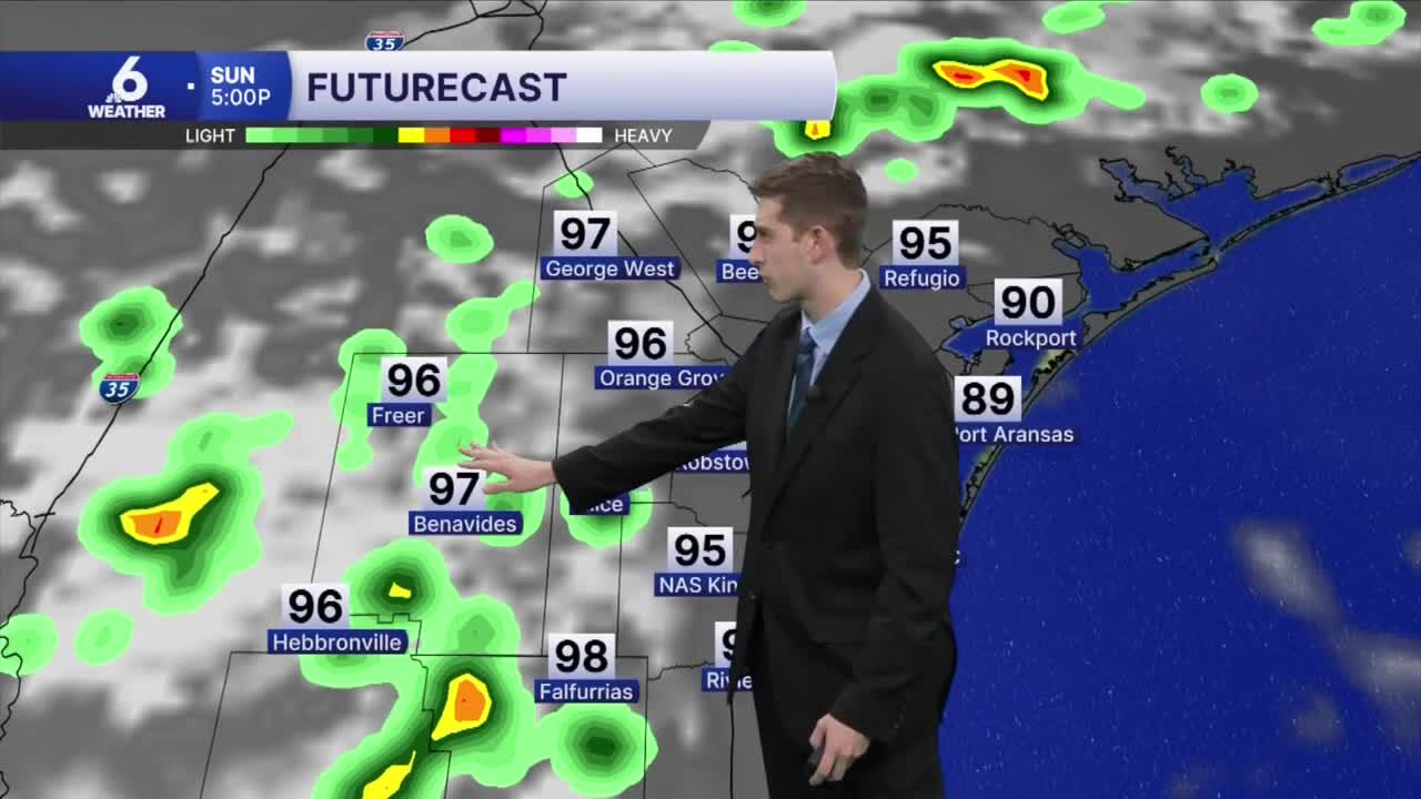
- On and off showers and storms this weekend, but coverage is fairly limited
- 'Feels-like' temps 105-110 degrees
- Better rain chances likely on Wednesday
- High temps in the upper 90s or near 100 for the next few days
Fewer showers on Monday
Late Saturday night, outflow from thunderstorms near the Mexico border kicked up additional showers and thunderstorms in Jim Hogg and Duval counties. Over the past 48 hours, our southwestern counties have seen in excess of 3 inches of rain. On Monday a few stray showers and brief downpours will develop across our area, but the rain will mostly fizzle out by the evening hours. Very low rain chances remain in the forecast for Tuesday, with a similar setup of sea-breeze showers during predominantly the afternoon hours. Come Wednesday, our area could see some extra shower and thunderstorm activity with some additional moisture to fuel storms during the day. For the rest of the week, we will return to minimal rain chances during the day, but mostly hot and muggy weather.
Turning up the heat
With high pressure still controlling our weather pattern from above, we will be staying very hot this week with daytime high temps reaching the upper 90s and near 100 in some spots. 'Feels-like' temps remain between 105-110, and we could be facing more heat advisories this week with this hot and muggy weather pattern on lock. Throughout the week, the ridging pattern over the US will begin to decay, setting up a more "zonal" pattern, where the jet stream will glide from the west to the east across the US. For us, we won't really be catching much of a break from the heat over the next week, but if you get any rain over your home, you can enjoy some short-lived relief and rain-cooled air.
The Peak of Hurricane Season
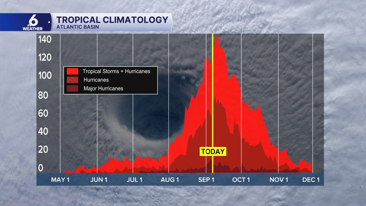
We are approaching the peak of the Atlantic Hurricane Season, which is on September 10th. This is usually the busiest time of the season, where climatologically, the most tropical storms and hurricanes develop. As of September 6th 2026, the Atlantic Basin still has yet to see a hurricane develop this year. We've only had five tropical storms this year, and most of them were fairly weak. With no tropical development over the next 7 days, we have the possibility of setting a new record in the modern satellite era for the latest 'first' hurricane to develop during the season. The current record belongs to Hurricanes Gustav (2002) and Humberto (2013), which both formed on September 11th, just one day after the peak. As El Niño continues to strengthen, storms trying to organize in the main development region so far have struggled to rapidly intensify. We will continue to keep you posted on how this pans out over the coming weeks, but for now, enjoy a labor day weekend free of tropical trouble!
Enjoy the rest of your holiday weekend!
