



CORPUS CHRISTI, Texas —
THE LATEST
The National Hurricane Center continues to track the latest with Isaias. The storm became the first hurricane of the 2026 season early Thursday morning. Despite some strengthening, the storm has battled wind shear. The upper-level southwest wind flow pushed much of the northern fringe of Isaias to the northeast; the result has been a very rainy day across the Florida peninsula.
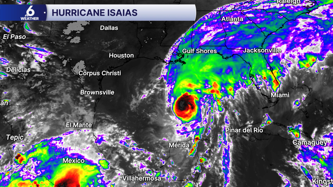
The forecast track hasn't had much adjustment except for the storm's expected movement after landfall. Still, Isaias is expected to weaken as it approaches the Florida panhandle, which means impacts will spread out across a larger swatch of the coast. This is due to a physics concept you might have heard of: conservation of angular momentum! <="The first hurricane of the 2026 Atlantic Hurricane Season is forecast to make landfall on the Florida panhandle.">
The Coastal Bend can expect beautiful (and warm) weather on Thursday and Friday. If the weather calls you to the coast, please keep safety in mind. Conditions won't be as friendly in the water. coastal flooding is already occurring and will be an issue through the weekend. A Small Craft Advisory is also in effect.
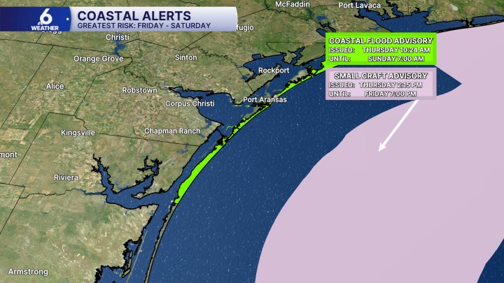 <="Isaias is causing unfriendly conditions along our coastal waters.">
You can check the latest beach conditions anytime, just click here.
__________________________________
Tuesday
The National Hurricane Center sent a reconnaissance aircraft to investigate what was known as "Invest 92L" for development on Tuesday. Around the time the Hurricane Hunters took off to investigate, the NHC identified a closed circulation on satellite imagery, and began issuing advisories on Tropical Depression Nine. TD Nine is forecast to become Tropical Storm Isaias in the next few hours.<="The first hurricane of the 2026 Atlantic Hurricane Season is forecast to form in the Gulf.">
On the current forecast track, the first hurricane of the 2026 Atlantic Hurricane Season will make landfall on the northern Gulf Coast Friday night. The storm will weaken as it moves up towards the Great Lakes. Here along the Texas Coast, I expect minimal impacts along our coast, limited to increased swells, an increasing risk of rip currents, and coastal flooding.
__________________________________
Monday
Remember that weak cold front we were waiting on last week? It hasn't gone far— it's sitting off our coast, across the Gulf. Also nearby, a broad area of upper-level low pressure (called a TUTT) has been meandering in the Bay of Campeche.
The National Hurricane Center will send a reconnaissance aircraft to investigate "Invest 92L" for development on Tuesday. NOAA Hurricane Hunters will fly "Gonzo", a Gulfstream IV aircraft into and around Invest 92L at 41,000 to 45,000 feet.
This low is known as a TUTT, which stands for tropical upper tropospheric trough. These types of low pressure can develop into tropical cyclones with the help of a weak or stagnant cold front. As the "upper tropospheric" part of the term suggests, this type of low pressure is most organized in the upper-levels of the atmosphere. This is precisely what the NOAA Hurricane Hunters flight on Tuesday will investigate. If they find anything interesting, other flights are already mapped out.
TUTTs tend to lack development in the low-levels. When a weakening cold front is in just the right proximity, it can help organize the lower-level of the atmosphere, supporting tropical development; if the front is strong, it can disrupt a TUTT.
The NHC has given a high probability of formation over the next week. In the latest tropical weather discussion on Monday night, NHC forecasters say a tropical depression could form by the middle of the week (this would get a number). If it develops further into a tropical storm, the next name on the list is Isaias. Either way, I expect minimal impacts along the Texas coast: increased swells, risk of rip currents, and coastal flooding. Please be careful if you plan to spend time on the beach! <="Tropical development is expected in the Gulf this week.">