

CORPUS CHRISTI, Texas — Happy Monday!
WHAT YOU NEED TO KNOW
- Rising heat risk
- Slim rain chances Friday night
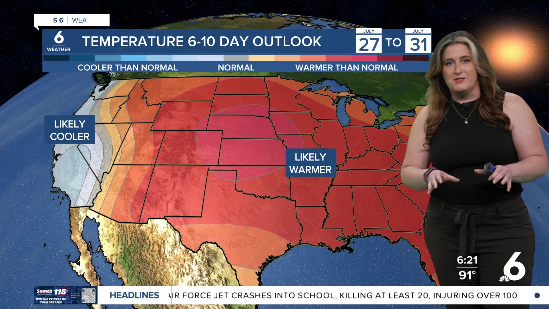
We've gone from hot to hotter over the weekend! Actual air temps will continue to range from near 90ºF along the coast to middle 100s inland through the middle of the week. Humidity will once again 'level the playing field' and keep everyone feeling the heat. Expect 'feels like' temps of 105-110ºF across the entire Coastal Bend. Thursday looks to be the hottest day of the week with many neighborhoods in the upper 90s/middle 100s (except the along the immediate coast).
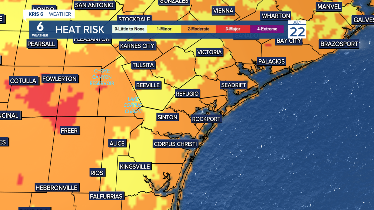
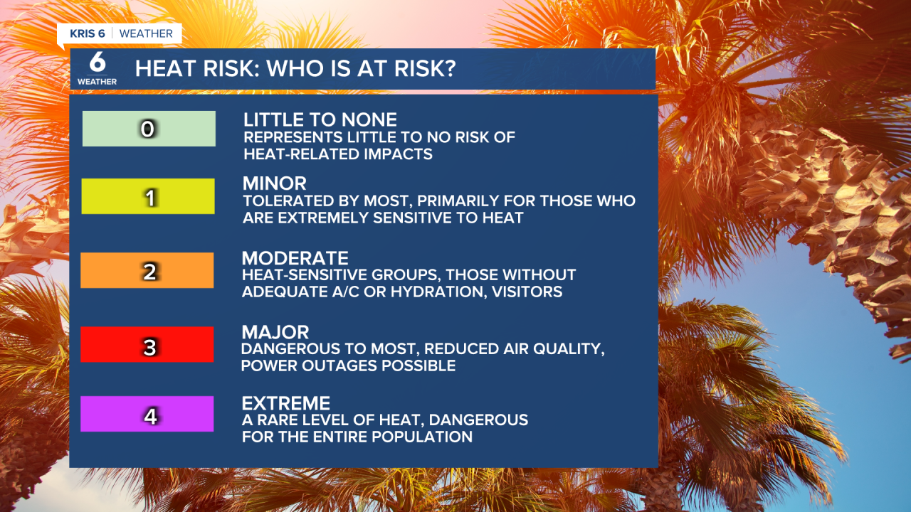
Moderate to major heat risk (level 2 and 3 out of 4) will be in the forecast all week. Please check in on kids, pets, and the elderly. Stay hydrated and be sure to find a cool place to beat the heat.
No significant rainfall is expected over the next few days, but slim rain chances do return by Friday. I'll be tracking a 'wrinkle' of low pressure moving across the Gulf in hopes that it can offer some beneficial rain.
CORPUS CHRISTI FORECAST
Tonight: Partly cloudy, muggy
Temperature: Low 77ºF
Winds: SSE 10-20 mph
Tuesday: Mostly sunny and hot!
Temperature: High 96ºF
Winds: SSE 10-20 mph, gusts to 25 mph
Tuesday night: Clear skies, breezy
Temperature: Low 75ºF
Winds: SE 10-20 mph
Have a great week ahead!
