

CORPUS CHRISTI, Texas — Happy Thursday!
WHAT YOU NEED TO KNOW
- Small Craft Advisory in effect until 10 a.m. Friday
- Coastal Flood Advisory in effect until 7 a.m. Friday
- High Risk of Rip Currents
The pattern is finally changing: both in our forecast and the long-term climate outlook. Let's start with your weekend forecast.
A weak cold front is currently fizzling out over the Coastal Bend. While not a cold front, drier air will return as winds turn north-northeast tonight. While this means relief from the humidity is hours away, our temperatures won't feel like fall. Morning lows drop to our typical upper 60s, but the afternoon highs will remain near 90ºF, which is a little warm for this time of the year. You'll notice less of that 'air you can wear' feeling by Friday morning.
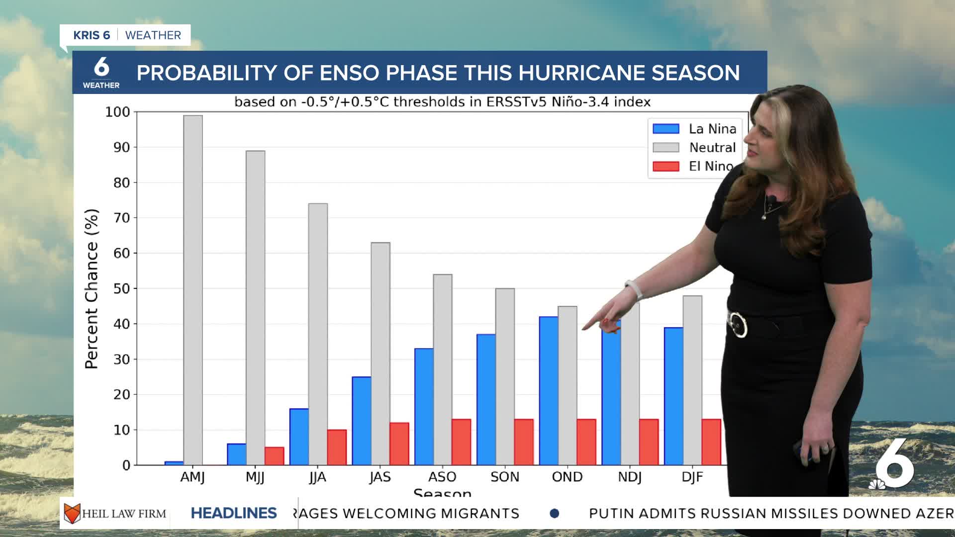
With no meaningful rain in the forecast, the drought outlook adds insult to injury. Thursday's drought monitor showed no change in our watershed, but our lake levels at Choke Canyon, Lake Corpus Christi, and even Lake Texana continue to drop. NOAA has issued a La Niña Advisory — more bad news. During a La Niña phase, the jetstream tends to become fairly 'wavy'. The result is that Texas tends to experience warmer, drier weather. Still, a La Niña winter is also one that can bring drastic temperature changes because of the steep dip of the jetstream (i.e. Arctic cold fronts).
We're heading into what is typically the 'dry season' here in the Coastal Bend, and we've only received about half of our yearly rainfall to date. Keep your fingers crossed for rain!
CORPUS CHRISTI FORECAST
Thursday night: Clear skies, not as muggy
Temperature: Low 70ºF
Winds: ENE 5-10 mph
Fri-YAY: Sunny and pleasant
Temperature: High 91ºF
Winds: NNE 15-25 mph
Friday night: Clear skies
Temperature: Low 66ºF
Winds: ENE 5-15 mph
Have a wonderful evening!
