



CORPUS CHRISTI, Texas — Hope you're having a great weekend Coastal Bend!
WHAT YOU NEED TO KNOW
- Hottest September on record (Sep. 1 - Sep. 12)
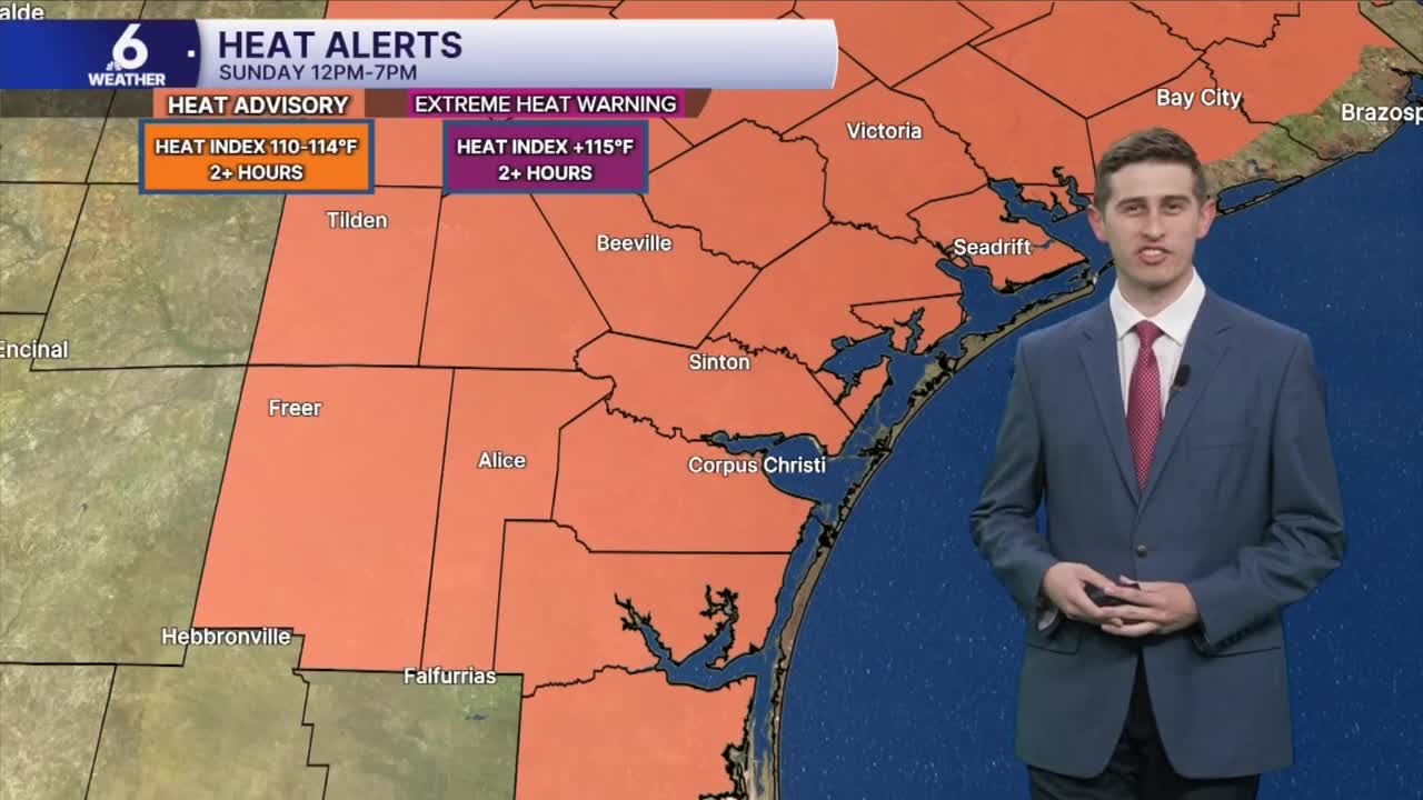
- Major to Extreme heat risk this weekend
- 'Feels-like' temps near 110+ area wide
- Drier air limits rain chances to start the week
Incredibly HOT Weather Pattern
In our big weather picture, a stubburn area of high pressure remains overhead, making our rain chances area wide fairly slim for the first half of the week. A few pop-up showers will still possible along the sea-breeze, but most neighborhoods won't end up with rain. This week, we will be much warmer than average, with temperatures at or approaching 100ºF in many neighborhoods. Normally time of year, we should be seeing high temperatures around 91ºF. In fact, Corpus Christi just set a new record for the hottest average temperature, now being 88.9ºF, so far during the month of September (from the 1st to the 12th), beating out the previous record of 87.2ºF held since 2000. A Heat Advisory remains in effect until 7PM on Sunday, and more will likely be issued over the coming days as heat indices will reach 110ºF-114ºF. With this kind of heat, you absolutely should be practicing heat safety out there. Be sure to look before you lock, take frequent breaks in air-conditioned areas, and drink plenty of water.
The Drought Situation
This week's drought monitor shows the drought is worsening across South Texas. The latest drought monitor update brings extreme (level 3 out of 4) drought back into the Coastal Bend in some spots. This is not surprising since we've seen very little rainfall. Little rain is in the forecast through Tuesday, but a plume of Gulf moisture will help bring more isolated to widely scattered rain chances for the Coastal Bend mostly overnight Wednesday through Thursday.
In The Tropics
We've reached the peak of the Atlantic Hurricane Season and all is quiet across The Tropics! Since there have not been any Hurricanes in the Atlantic Basin so far, we surpassed the previous record for the latest first hurricane to form, that being both Hurricanes Gustav (2002) and Humberto (2013), which developed on September 11th. Our attention now shifts to a 'lemon' in the tropics with low chances of tropical development over the next 7 days. This area highlighted by the NHC is currently an unorganized cluster of showers and thunderstorms in the Central Tropical Atlantic. It could enter a slightly more conducive environment for development later this week, but this won't be any sort of tropical trouble for us in the Coastal Bend as these storms move to the west-northwest. If it does become a named storm, the next name up for grabs is Fay.

Have a great start to the week, Coastal Bend!
