



CORPUS CHRISTI, Tx — Happy Thursday Coastal Bend!
WHAT YOU NEED TO KNOW
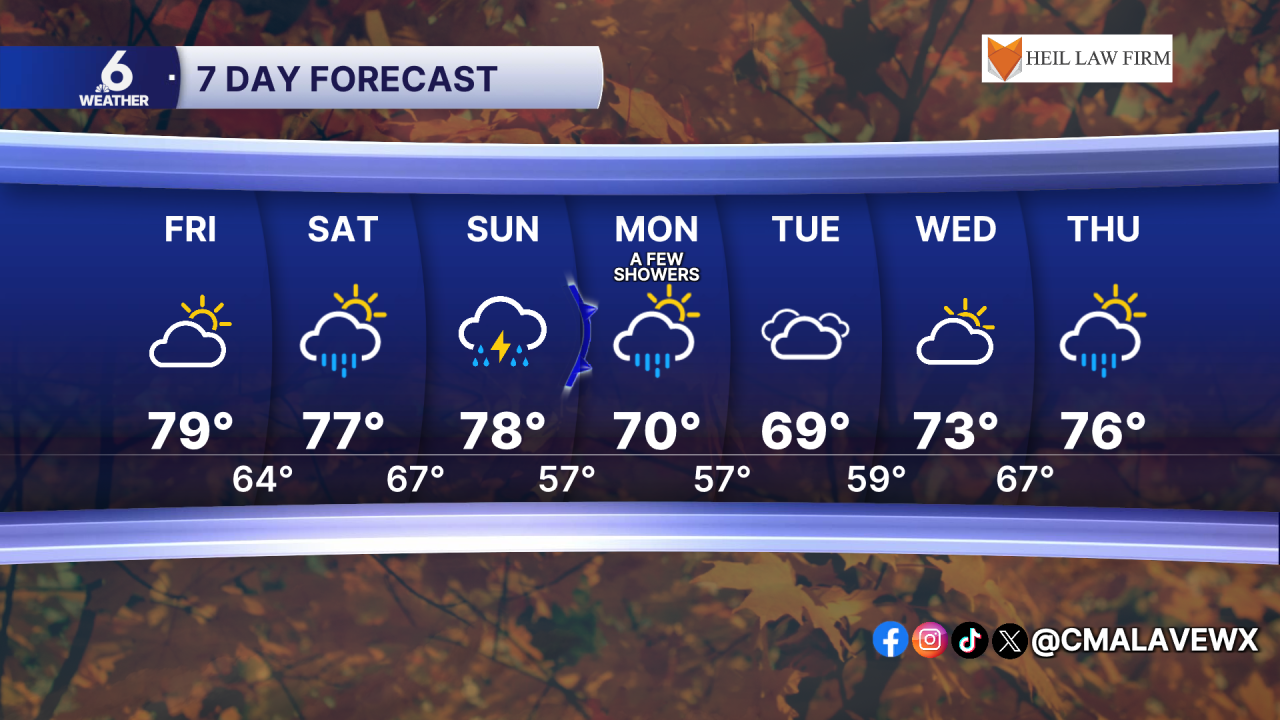
- Cool friday morning with lows in the low to mid 50s
- Highs in the mid to upper 70s, but a few neighborhoods could break 80
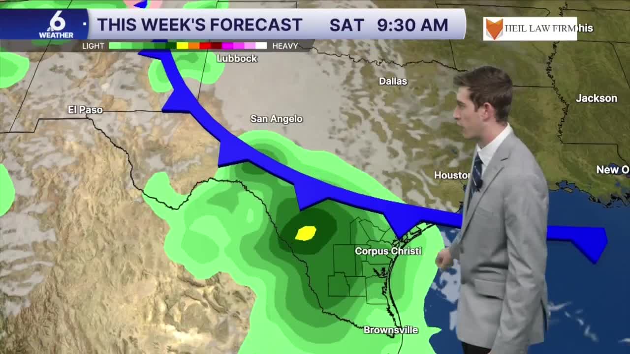
- On and off scattered showers and t-storms starting Saturday morning
- Next cold front exits late Sunday or early Monday, timing still uncertain
Clear skies for Friday
Overnight tonight, you can expect more of the same clear conditions overhead as an area of high pressure remains at the surface. For tonight, temperatures will cool down all the way into the low 50s in our inland neighborhoods, but the closer you are to the water, you will get a taste of upper 50s and low 60s. During the daytime hours, highs will peak mostly in the upper 70s, but a few spots may surpass 80 degrees. A few clouds will return into the mix after sunset, but you can expect perfect weather for high school football playoff games. Winds will shift from out of the north to an east wind around 5 to 10 miles per hour. This will help more moisture to return to the region, and is one of the puzzle pieces to this weekend's forecast.
Isolated to scattered showers and storms this weekend
For this upcoming Saturday and Sunday, multiple weather ingredients are coming together to set up medium rain chances across the region. Onshore flow will bring in more muggy air to our region. To our north, an area of low pressure in upper level weather pattern will provide extra lift to help kickstart those rain chances this weekend. On Sunday, a surface low could develop in North texas, increasing shower and thunderstorm activity to the east of I-35. What is still uncertain about this forecast is regarding the cold front moving in from the northeast. Depending on the positioning of this boundary, this could influence how long the rain might last for Sunday through Monday.
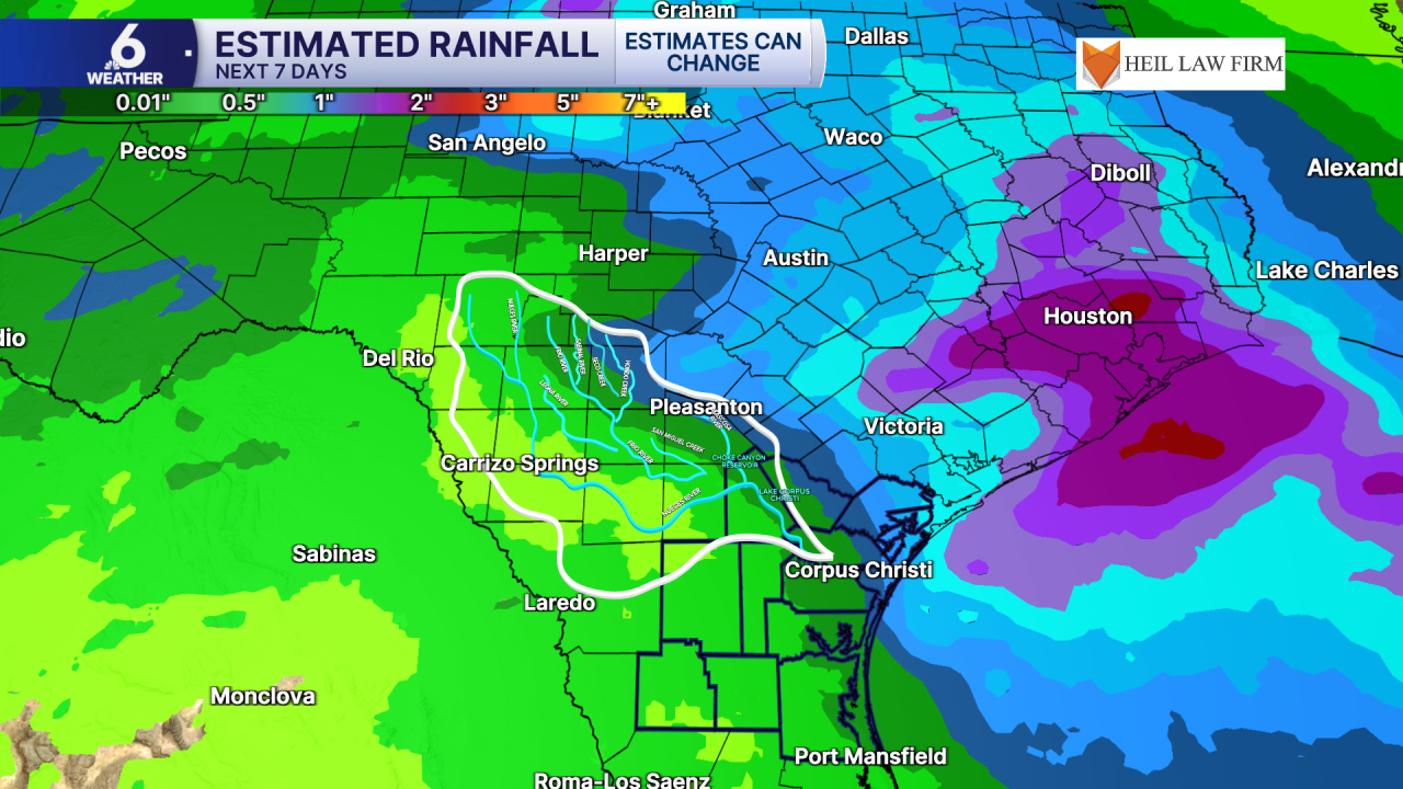
Two rain scenarios
Right now, we're expecting our next cold front to leave the Coastal Bend at some point between Sunday night and Monday morning. If this front were to exit the region by Sunday evening, we would expect less rainfall throughout our Monday. This trend is what the European model is depicting. In that situation, a few showers would linger Monday morning, clearing out by the afternoon. However, if this frontal boundary does not leave until Monday morning, we could be looking at a wetter Monday, with rain chances letting up by Tuesday. This outcome is what the GFS model is leaning towards. Based on the most recent model runs, I'm leaning towards less rain in the forecast for Monday, but that is subject to change.
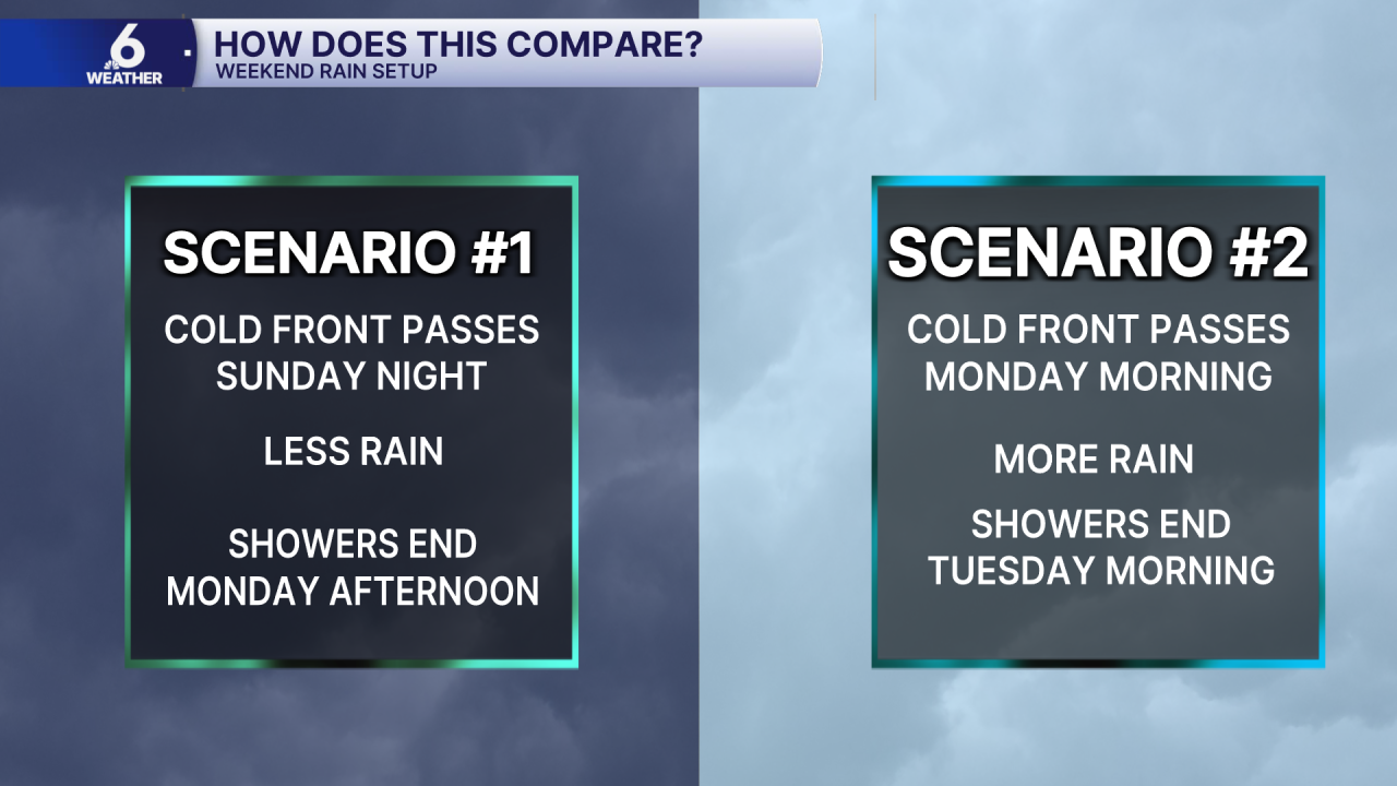
However, there has been model consistency in that we're still expecting only near one half an inch of rain area wide at most, with areas up towards the Victoria Crossroads anticipating roughly one inch of rainfall over the next 7 days. By Friday, we should have a better idea of what the spread of rainfall will look like for this weekend. Once this front finally does pass, dry conditions return with a more noticeable cooldown for Monday and Tuesdays. High temperatures will dip into the upper 60s by Tuesday thanks to this cold front. I will continue to monitor lower rain chances through later next week, with some more moisture coming back into the picture.
Have a great rest of your Thursday!
