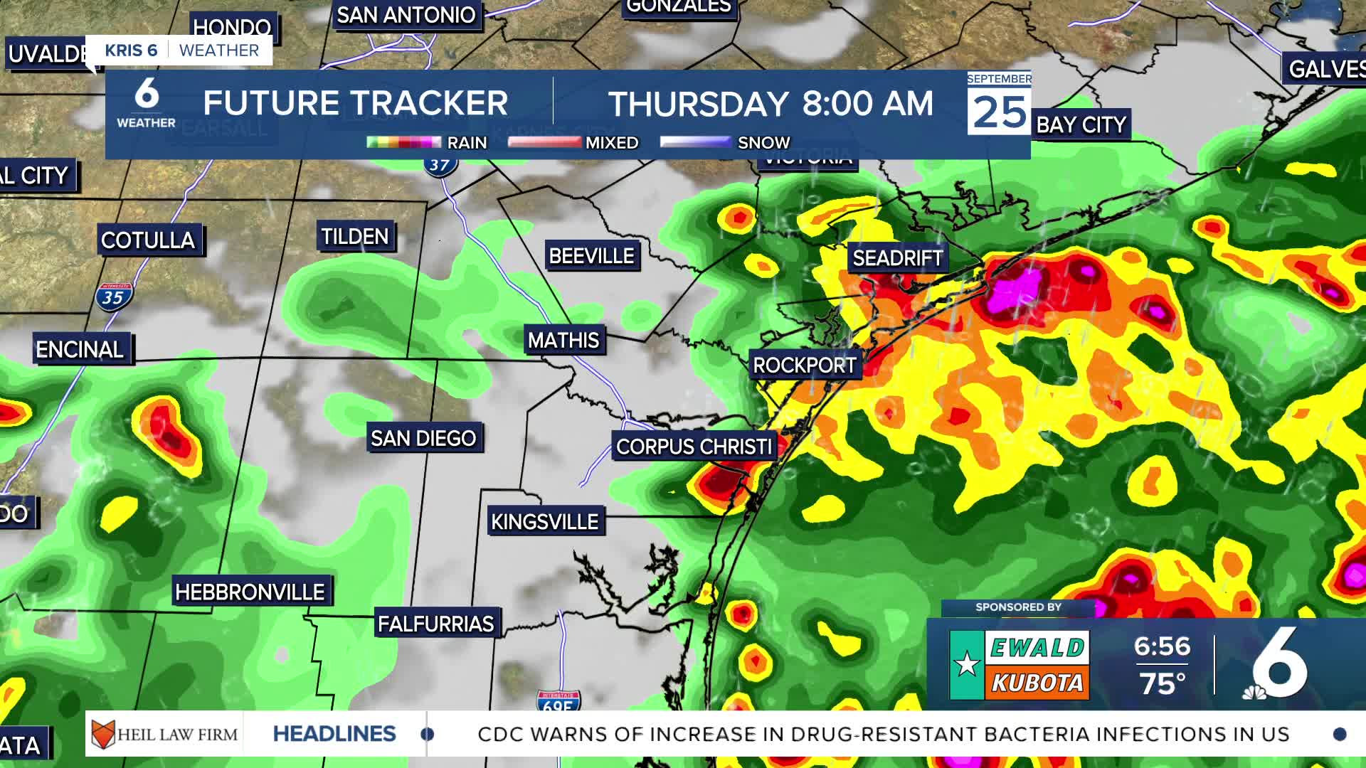


CORPUS CHRISTI, Tx — Good morning, Coastal Bend! The cold front we are all anticipating is arriving this morning, along with showers and thunderstorms that started Wednesday night.
WHAT YOU NEED TO KNOW
Some neighborhoods saw heavier rainfall overnight Wednesday into Thursday morning, along with plenty of lightning and increased wind gusts. This is a weaker cold front moving through our area that will take our high temperatures out of the mid to upper 90s and place them in the mid to upper 80s for Thursday.
With having a lot of dry soil, some neighborhoods could experience localized flooding when heavy rainfall rates appear, leading to flash flood advisories. Rain chances are expected to lessen closer to the noon hour before cooler, drier air moves in and absorbs the leftover moisture from today's storms.
CORPUS CHRISTI FORECAST
Today: Showers and thunderstorms
Temperature: High 89ºF
Winds: N 10 mph
Tonight: Mostly clear skies
Temperature: Low
Winds: ESE 5-10 mph
Friday: Sunny skies, clear and dry
Temperature: High 92ºF
Winds: N 5-10 mph
Have a great Thursday!
