

CORPUS CHRISTI, Tx — Good morning and Happy Friday!
WHAT YOU NEED TO KNOW
- Cloudy and warm today with a few isolated showers
- Cold front arrives tomorrow late morning/early afternoon
- Potential freeze for Sunday morning
- Expected freeze Monday morning and Tuesday morning
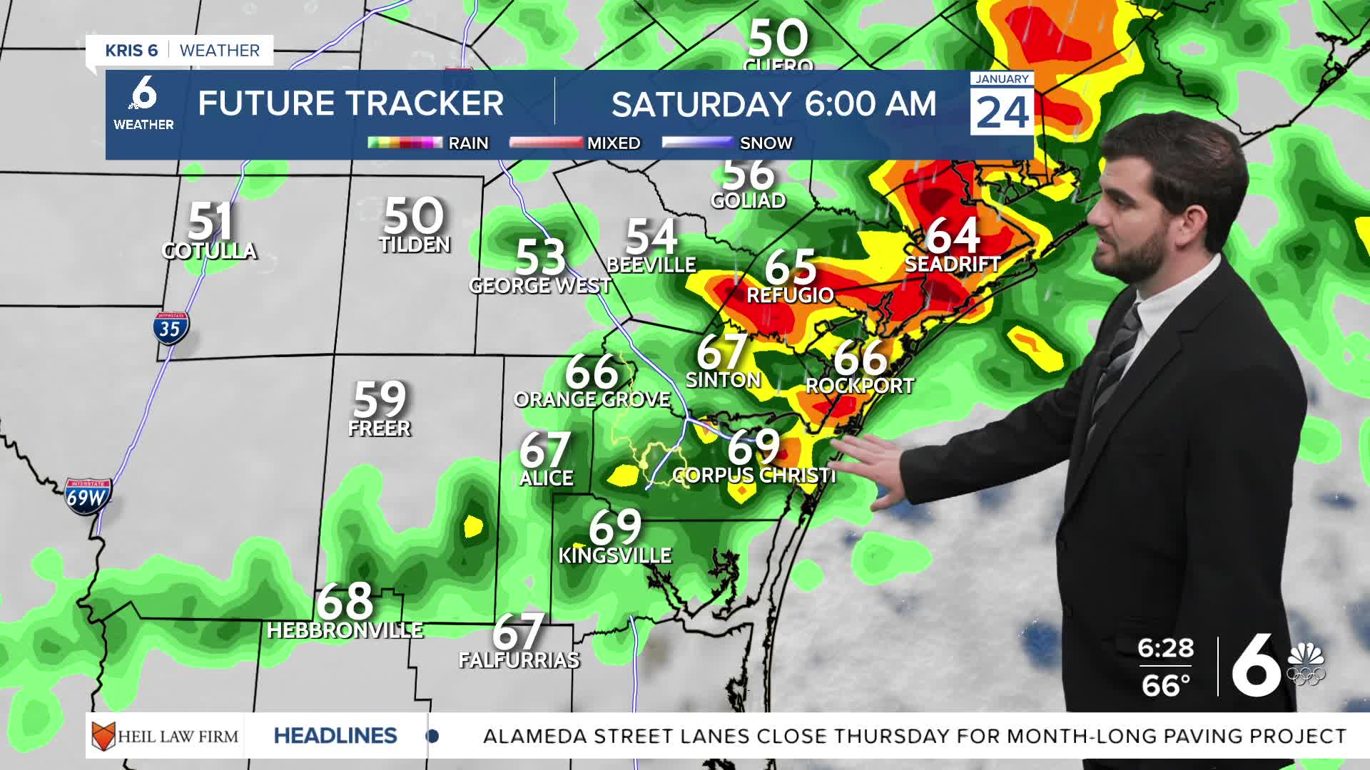
We're starting off a little foggy out there, but thanks to some higher winds we're not quite as bad as yesterday as of the 5am hour. Going into the afternoon we'll hold on to mostly cloudy skies with the chance for some passing isolated showers throughout today. By tomorrow morning we'll see the opportunity for some scattered t-storms and showers throughout the day. Mainly t-storms in the morning pre-cold front and showers after it passes through into the afternoon. As we head into Sunday morning things get tricky. Currently it's looking like northern counties towards Beeville, George West, and Tilden will likely freeze Sunday morning so be prepared to stay off the roadways while they're still icy. Luckily we'll dry up through the day on Sunday, but we will get even colder for Sunday night and Monday night where we'll freeze across most if not all of the Coastal Bend for a decent portion of the night.
CORPUS CHRISTI FORECAST
Today: Foggy AM, Cloudy PM with Isolated Showers
Temperature: 80F
Winds: E-SE 5-15 mph
Tonight: Cloudy, Scattered Showers and T-Storms
Temperature: 65F
Winds: SE 10-20 mph
Saturday: Cloudy with AM T-Storms and PM Showers
Temperature: 70F (In the AM before the front then falling through the day)
Winds: SE 10-20 mph in AM, then N 10-20 mph in the PM

I hope you have a great Friday Coastal Bend and stay warm this weekend!
