

CORPUS CHRISTI, Tx — Good morning and Happy Monday Coastal Bend!
WHAT YOU NEED TO KNOW
- Chilly start to the day today and tomorrow
- Breezy tomorrow afternoon and into Wednesday
- Warm-up on the way with mid 80s by Wednesday
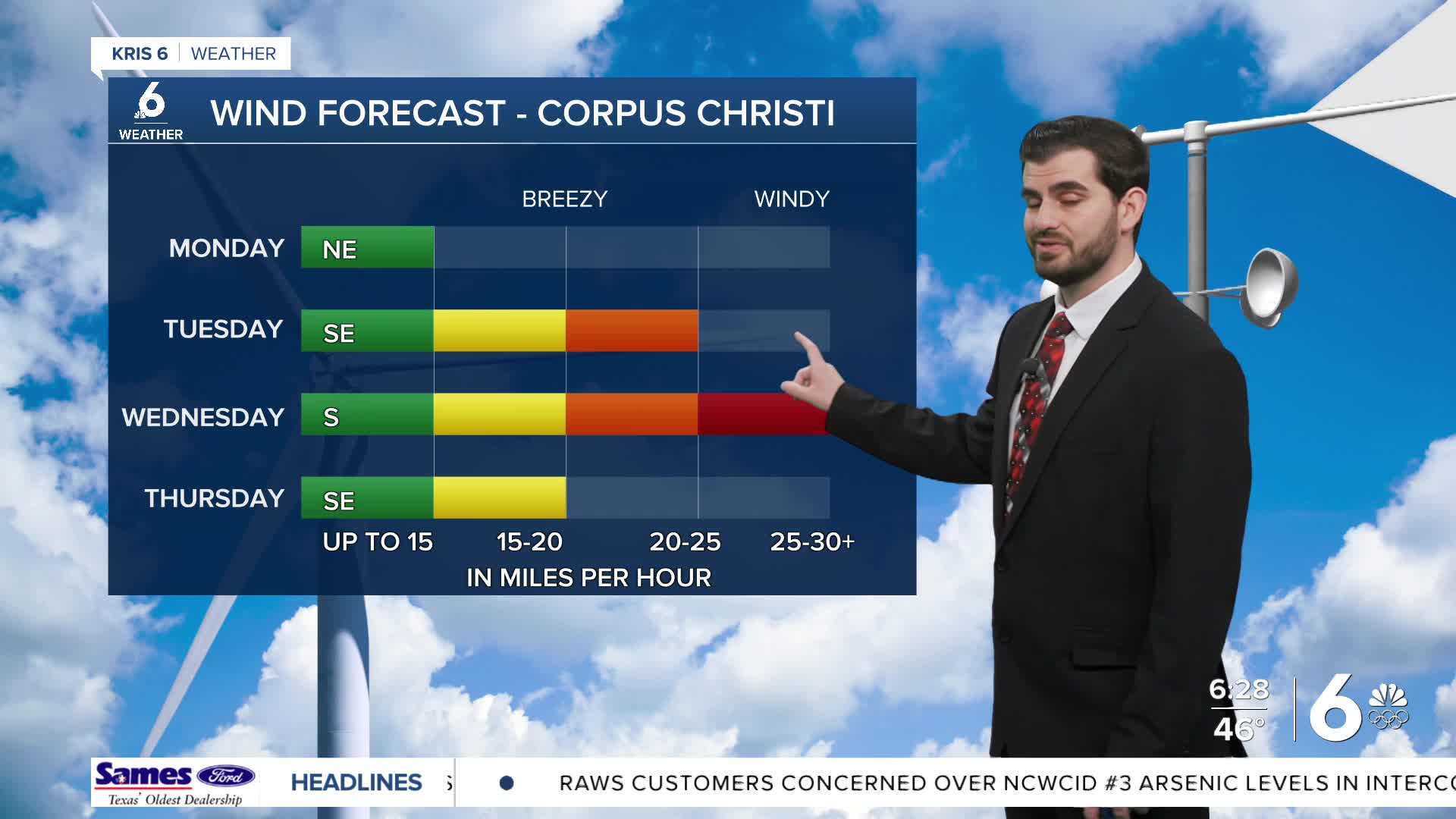
As we kick off the final week of February we're seeing some cooler air starting us in the low and mid 40s for morning lows. As we head into this afternoon we'll warm up with the upper 60s and even ~70F for the daytime high in some areas. By this afternoon we'll see winds shift back out of the southeast indicating the start of our warm-up that's on the way. By tomorrow afternoon we'll see winds pick up gusting to 25-30mph at times and even 30-35mph as we head into Wednesday morning.
In terms of our afternoon highs we'll warm to the mid 70s tomorrow and mid 80s by Wednesday with 90s for some inland neighbors. By Thursday we could even be record breaking in Corpus Christi with our forecast calling 90F and the current record standing at 89F from 2024.
By Thursday evening we're expecting our next cold front to arrive in the region and unfortunately it looks like another dry run for the Coastal Bend. However, it does bring us back down in temps from close to 90F to the 80F mark as we end the week and February going into Saturday.
CORPUS CHRISTI FORECAST
Today: Mostly Sunny and Cool
Temperature: 68F
Winds: AM NE 5-15 mph, PM SE 5-15 mph
Tonight: Mostly Clear
Temperature: 47F
Winds: SE 5-15 mph
Tuesday: Mostly Sunny and Breezy
Temperature: 76F
Winds: SE 15-20 mph, G 20-30mph

I hope you have a great Monday and start to the week!
