

CORPUS CHRISTI, Tx — Good morning and Happy Tuesday Coastal Bend!
WHAT YOU NEED TO KNOW
- Last chilly start in the 40s
- Sunny, breezy afternoon in the 70s for highs
- Elevated fire danger today and tomorrow
- Potentially record breaking heat by Thursday
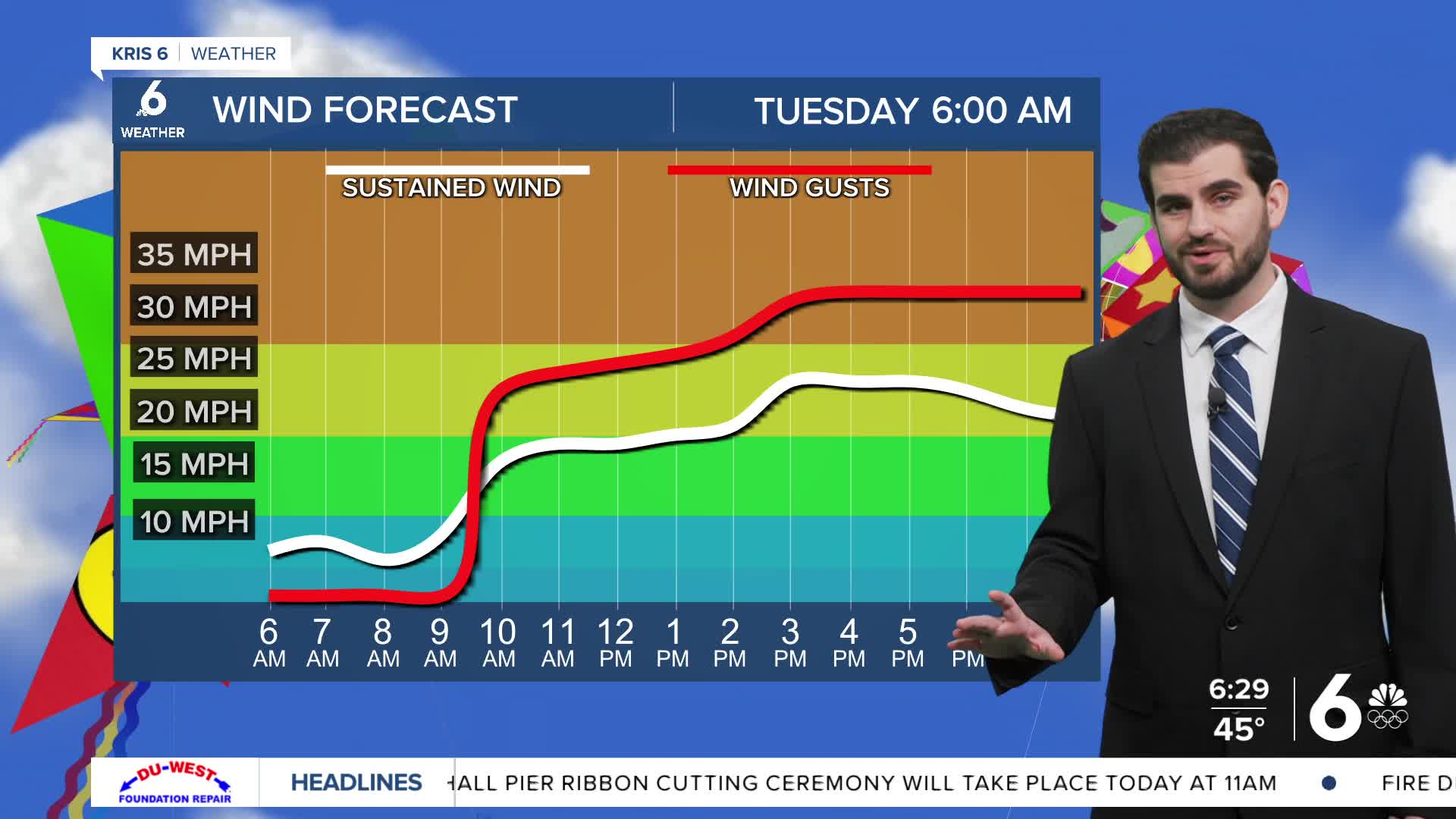
We're starting off chilly once again in the 40s for most neighbors with a few upper 30s sneaking their way in also. By this afternoon we'll approach the upper 70s and even lower 80s for daytime highs with a breezy wind. Right now we're expecting winds to pick up later this morning and get towards 25-30mph with peak gusts this afternoon.
For the next two days we'll stay on the warm-up with the 80s and a few 90s tomorrow and more 90s around nearly all of the area as we head into Thursday! Keep in mind this could be record breaking with our current record at 89F from 2024.
By Thursday night our next cold front should arrive and drop our daytime highs back into the lower 80s for the remainder of the seven day forecast taking us into the start of March on Sunday and Monday! Overnight lows don't dip too much settling out in the lower 60s with rain chances looking minimal unfortunately.
CORPUS CHRISTI FORECAST
Today: Mostly Sunny and Breezy Afternoon
Temperature: 77F
Winds: SE 15-25 mph, G 25-35 mph
Tonight: Mostly Clear
Temperature: 60F
Winds: SE 10-20 mph, G 20-25 mph
Wednesday: Mostly Sunny and Breezy Afternoon
Temperature: 88F
Winds: SE 15-25 mph, G 25-35 mph
I hope you have a great Tuesday Coastal Bend!
