



CORPUS CHRISTI, Texas — Hope you're having a great weekend Coastal Bend!
WHAT YOU NEED TO KNOW
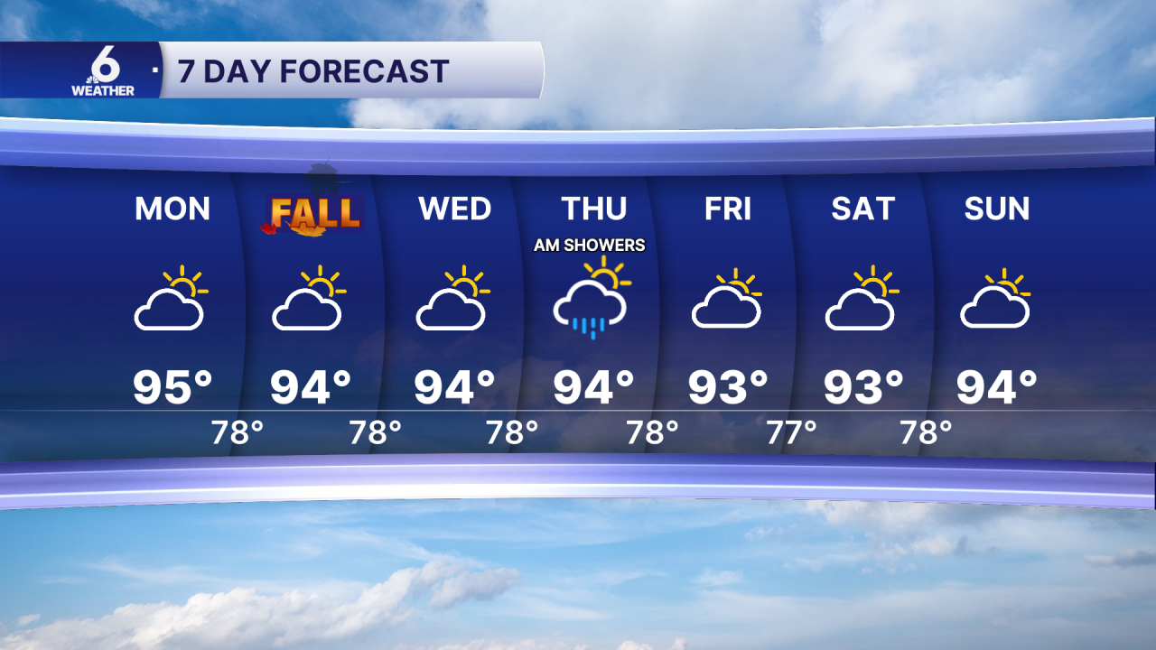
- Highs in the middle 90s
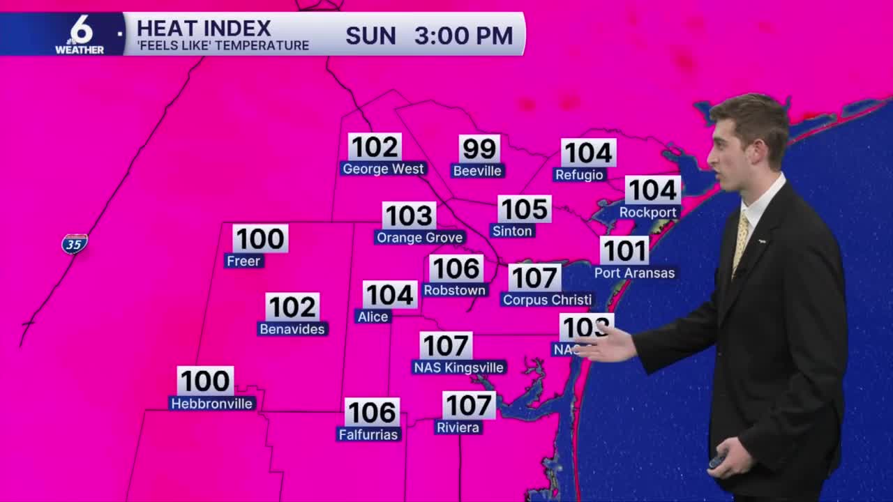
- 'Feels-like' temps in the middle 100s
- Stray to isolated sea-breeze showers this week
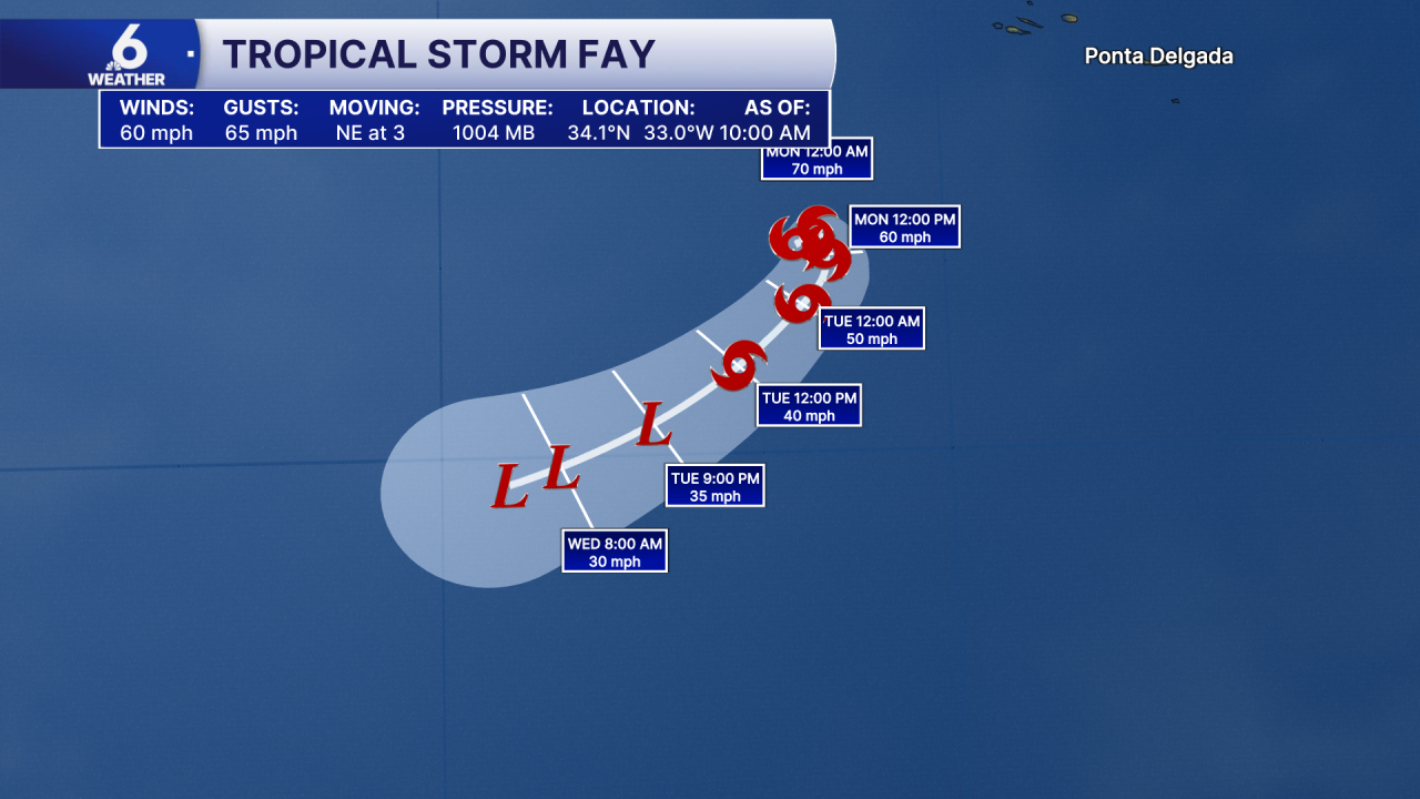
- Tropcial Storm Fay could become first Hurricane of the season
The beginning of fall starts warmer than usual
This week, temps will top off in the middle 90s across the area, with a few inland neighborhoods experiencing temps closer to the upper 90s. We will still be a few degrees warmer than normal as we head into the first few days of fall. Winds out of the ESE are ushering in plenty of moisture, making us feel muggier than what the thermometer says. Heat index values will peak in the low to middle 100s area wide. Moderate to major heat risk remains in the forecast so please practice heat safety! You'll need to take breaks, stay hydrated, and look before you lock.
Sea-breeze rain chances this week
So far on Sunday, we've seen a few sea-breeze showers near the coast during the late morning and early afternoon hours, but most neighborhoods remain dry. Later this week,
In The Tropics
Early Sunday Morning, the National Hurricane Center had found that Tropical Depression Six had strengthened to Tropical Storm status, giving it the name Fay. As of the 10:00 AM CST Advisory, Fay has winds of about 60 miles per hour and is continuing to gradually strengthen. The forecast has Fay potentially strengthening to a Hurricane later on Sunday before weakening on Monday. This is big news for the Atlantic because this would be the latest first hurricane to form in the modern satellite era (the past 60 years). Thankfully, this will not impact the US, and it will likely remain a rain and wind storm for the fish!
7 Day Forecast
Enjoy the rest of your weekend!
