

CORPUS CHRISTI, Tx — Good morning and Happy Tuesday!
WHAT YOU NEED TO KNOW
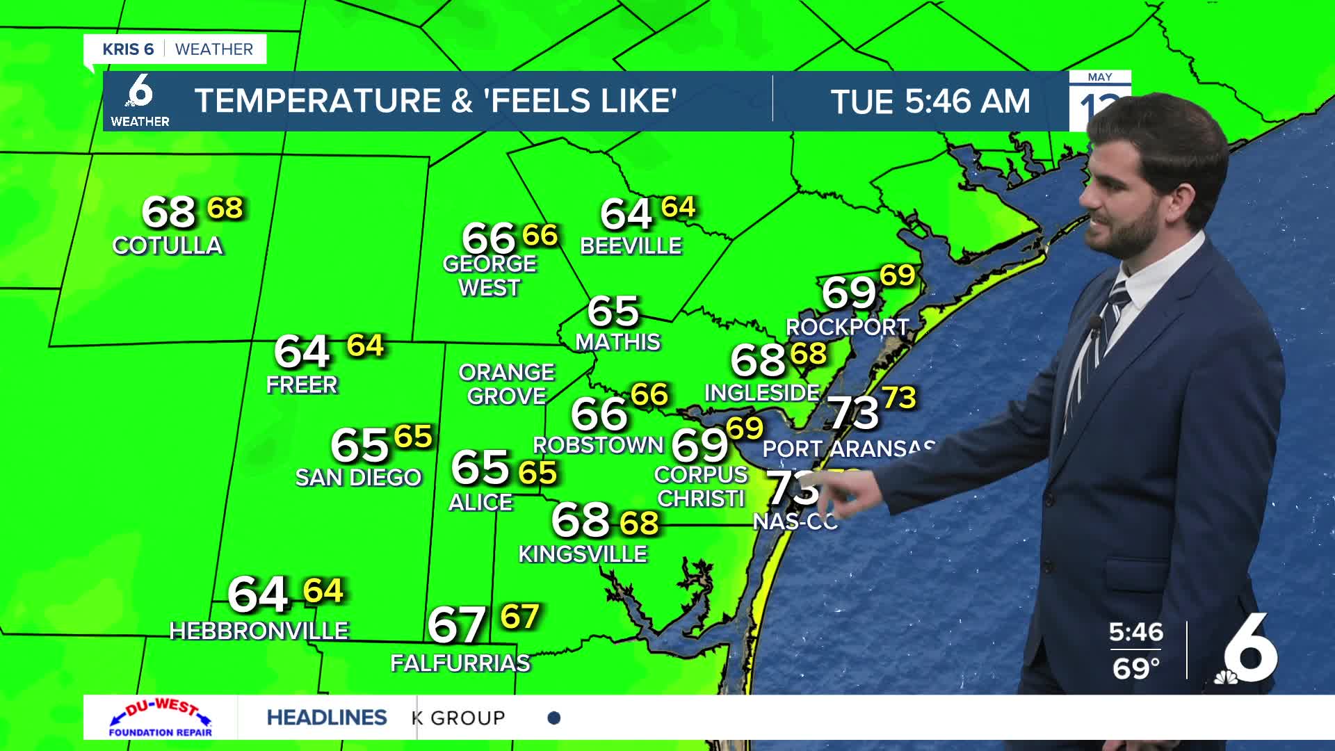
- Cool start to Tuesday in the upper 60s and lower 70s
- Warmer afternoon in the upper 80s under partly cloudy skies
- Warmer overnight temps later this week with rising humidity
- Rain chances reappear at the end of the seven day forecast for next Monday
Warming Up
Going into this evening we'll see winds shift back from the southeast meaning onshore flow from the gulf and rising humidity as we heat into the back half of the work week. Overnight lows rise from the upper 60s to the upper 70s as we head into the weekend thanks to this. Daytime highs follow a similar trend but not as drastically, going from the mid 80s yesterday to the upper 80s and maybe ~90F by the weekend here in Corpus Christi. Inland locations are expected to rise to the low to mid 90s for areas like Jim Wells and Duval counties.
Long Range Rain Chances
Going into the weekend and next week the latest long range guidance has the upper level ridge that's keeping us dry and warm weakening and shifting east. This will allow for more showers, cloud cover, and slightly cooler temperatures if it follows through towards next week. Current estimates are betting on next Tuesday as our rainiest day with chances lasting for a few days. However, keep in mind this is at least 7 days out and needs some major refinement on that part of the forecast with timing, totals, and intensity. So make sure to check back in on the forecast changes and enjoy the warmer weather this week if you're a Summer lover!

I hope you have a great Tuesday Coastal Bend!
