



CORPUS CHRISTI, Texas — Happy Weekend, Coastal Bend!
WHAT YOU NEED TO KNOW
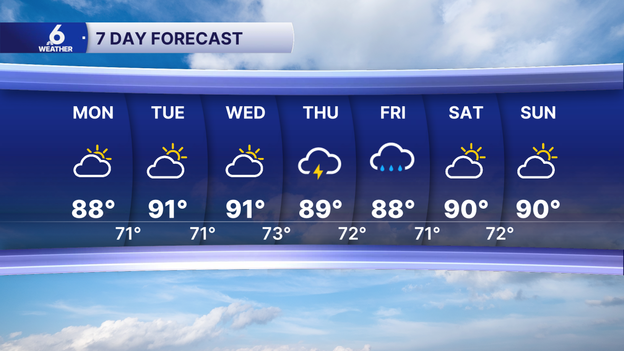
- After Sunday, temps should stay in the upper 80s and low 90s.
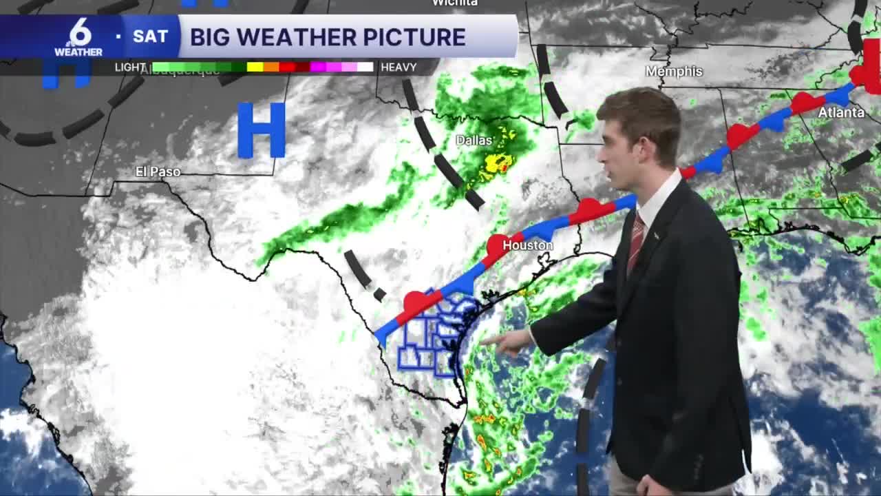
- Low pressure in the Gulf brings in showers to southern and eastern Coastal Bend neighborhoods.
- Watching an area in the Southwestern Gulf for tropical development
- Increasing tropical moisture brings the rain chances back into the forecast mid-week
Diminishing shower activity
The month of October has been fairly wet across South Texas! This change of pace is very much appreciated since we are still under mostly extreme to exceptional drought conditions in the Coastal Bend. With all of this beneficial rain, I'm expecting to see a 'dent' in our drought monitor come next Thursday. There hasn't been very much sun on this Sunday, as an overrunning pattern has been setting up more low level clouds and some drizzle around Corpus Christi. This is caused by warm, less dense air gliding up and over a slope of cool, dry, and more dense air on the 'cold' side of a cold front. Our frontal boundary has passed through the Coastal Bend and now resides offshore, which has allowed for this pattern to dominate our forecast on Sunday. For the rest of your weekend, I'm still tracking some more bands of rain being ushered in from the area of low pressure in the Gulf, but I don't think the showers will be as numerous or heavy at times compared to Saturday. Some neighborhoods may still end up with a 'sip' of rain from these intermittent showers and brief thunderstorms, but as we start the new work week, shower activity will continue to decrease across South Texas.
A break in the rain... for now
By next Tuesday, drier conditions will settle into place. As implied by the name 'cool-front' we are now starting to get a taste of drier and comparatively cooler air than what we had been experiencing before this front passed by. This week, it won't feel cold here in the Coastal Bend, but it will feel more like typical early October weather here with upper 80s and low 90s in the forecast! We're still keeping an eye on increasing rain chances later this week, as some more rich moisture could help to give us some additional rain beginning Wednesday.
Tracking the Tropics
We're watching an area of interest in the Southwestern Gulf for tropical development highlighted by the National Hurricane Center. As of the latest advisory, it has a medium (40%) chance of organizing into something tropical in the next week. NHC says this could become a tropical depression later this week. Slight movement to the north is expected, but model guidance is incredibly uncertain of where this could go from there. If anything, this will likely mean more rain for some of the Gulf coast, whether it has a name or not. Like any tropical system, we will continue to take it one day at a time and keep you up to date with the latest from the tropics.
7 Day Forecast
Enjoy the rest of your weekend!
