

A change in the weather pattern this week will bring much needed rain to the Coastal Bend starting Wednesday with best rain chances Thursday and Friday.
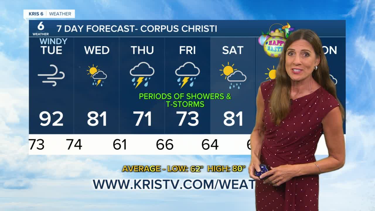
Tuesday will be windy, humid and a hot day in our inland areas, reaching near 100 with Corpus Christi touching 90 and the coast in the low to mid 80s. South to southeast winds will increase to 20-25 mph, gusting to 35 mph.
Winds will stay out of the south Tuesday night, keeping temperatures in the 70s for lows. A cold front is forecast to move through late Wednesday morning, triggering scattered showers Wednesday morning through early afternoon. Rainfall amounts look low with the front, mainly under a third of an inch.
Northeast winds will usher in cooler air late Wednesday with drier air in the afternoon. As the front stalls and moves back toward the coast, moisture will increase Wednesday night into Thursday with rain showers becoming more numerous. Temperatures will stay in the 70s Thursday and Friday due to clouds and periods of rain.
Upper level waves moving through south Texas along with a trough of low pressure at the surface and higher water vapor in the atmosphere will keep rain chances going through Friday with the potential of heavy rain at times. Overall rain totals are expected to come in at 1-2" inland and up to 3 inches along the coast from Corpus Christi northward.
Showers will decrease Friday night through Saturday morning and we'll be drier for the weekend with temperatures reaching near 80 Saturday and lower 80s for Easter.
Easter Sunday looks warm and dry with partly sunny skies.