

CORPUS CHRISTI, Texas — Happy Tuesday!
WHAT YOU NEED TO KNOW
- Heatwave continues
- Wed.: New hottest day of 2025?
A heatwave is a prolonged period of warmer-than-normal temperatures. While temperatures may not be much hotter than normal, they are challenging records in more ways than one. As afternoon highs remain a few degrees above average, fluctuating humidity will make for both 'dry heat' and 'humid heat' this week; Wednesday is going to be the inflection point of this change in humidity. This will probably make tomorrow the hottest day of the week AND of the year. Yes, we just reached the hottest day of 2025 in Corpus Christi last week and the forecast is already threatening to set the bar higher.
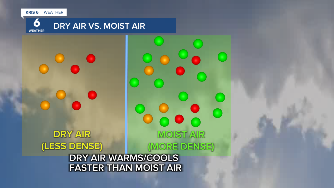
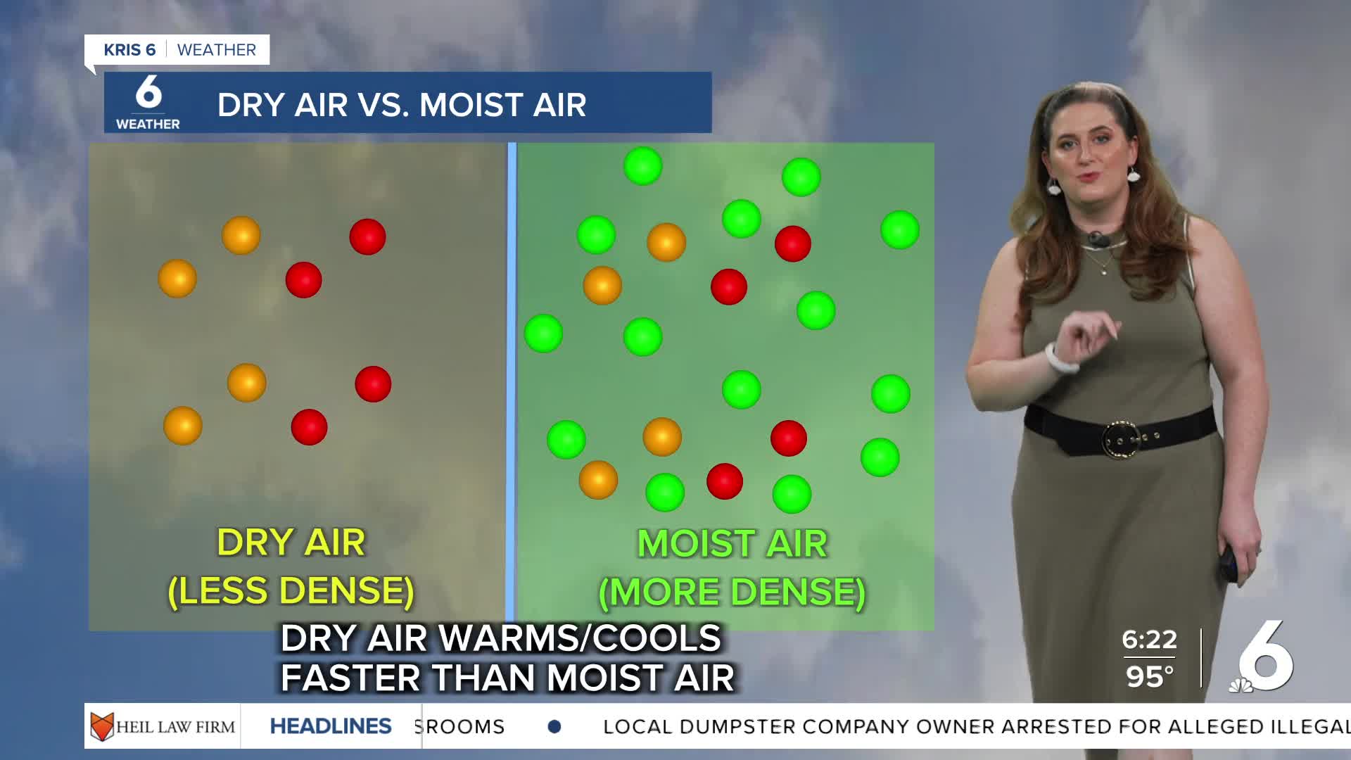
Moist air is denser than dry air so it takes more energy to heat/cool. This is why there's a bigger range between the morning and afternoon temps on dry days. Still, the afternoon will be hot! Please practice heat safety! Heat can be dangerous, even if heat alerts are not issued. Prolonged periods of hot weather can be especially threatening for kids, pets, and the elderly. Stay cool!
Once again, Wednesday morning will be off to a refreshing start with cool temps and patchy dense fog. This round of fog will likely dissipate more quickly with a light breeze and rising temps. Most neighborhoods will experience a 'feels like' temperature range from 105-109ºF. This will be more pronounced as we move into the second half of the week because humidity is on the rise. With high pressure over the Coastal Bend, don't bet on rain chances. Rain chances look pretty slim for the Coastal Bend, though there may be some in the forecast for the Victoria Crossroads.
CORPUS CHRISTI FORECAST
Tonight: Patchy fog overnight
Temperature: Low 73ºF
Winds: S 5 mph
Wednesday: Sunny and hotter
Temperature: High 100ºF
Winds: ESE 5-15 mph
Wednesday Night: A few clouds, muggy
Temperature: Low 77ºF
Winds: S 5-10 mph
Have a terrific evening!
