

CORPUS CHRISTI, Tx — Happy Wednesday!
WHAT YOU NEED TO KNOW
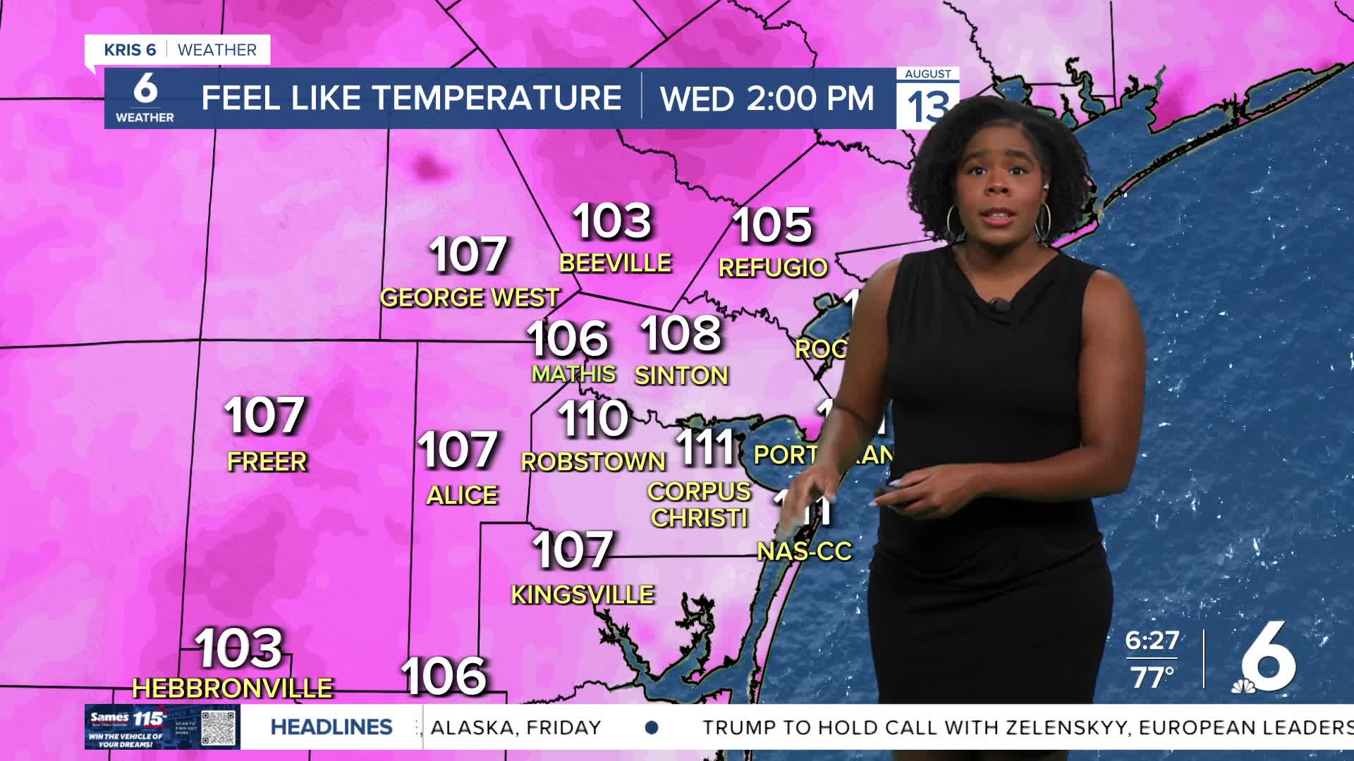
- Feels like temps around 110º
- Major to extreme heat risk
- Afternoon sea breeze showers
Near-record and dangerous heat is in the forecast for today. Across the area, we'll see afternoon high temperatures in the upper 90s or even possibly in the triple digits. Feels like temps will be well into the 100s around 110°. This puts us very close to the criteria to see heat alerts potentially becoming necessary. Remember, we need to hold a heat index value of 110º or more for at least two hours for a heat advisory to be issued. Regardless, this heat needs to be taken seriously, and heat safety should be put into practice.
Stray afternoon and early evening showers are possible with the help of the sea breeze. Rain chances look to be more promising Friday and Saturday as tropical moisture arrives from a new area of interest in the Northwestern Caribbean Sea. It has 20% of development, and regardless of development, impacts locally include heavy rain and increased rip currents. We'll continue to watch this space.
Also, we're still monitoring Tropical Storm Erin as it tracks westward, away from the West Coast of Africa. It is our 5th named storm of the 2025 Hurricane season, and it is forecast to become the first hurricane of the season. There are no threats to the Coastal Bend. It is too early to determine the precise track of the system or its impacts at this time.
CORPUS CHRISTI FORECAST
Today: Sunny with passing afternoon showers
Temperature: High 99ºF
Winds: SE 10-20 mph
Tonight: Mostly clear skies
Temperature: Low 79ºF
Winds: SSE 5-15 mph
Thursday: Hot and mostly sunny
Temperature: High 99ºF
Winds: SE 10-20 mph
Have a great day and stay cool!
