

CORPUS CHRISTI, Texas — Happy Tuesday!
WHAT YOU NEED TO KNOW
- No significant rainfall in the forecast
- Increasing heat risk with temps on the rise
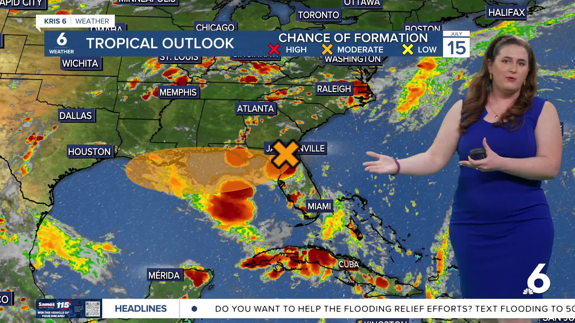
- Tracking Invest 93L
Summer heat has been relatively tame by South Texas standards, but temperatures are looking a bit hotter over the next few days.

Temperatures will likely cause more red days on this calendar with afternoon highs reaching the mid- to upper 90s well into the weekend. Be sure to stay cool! Aside from a few very brief showers along the sea breeze (near the HWY 281 and HWY77/I-69 corridors), no significant rainfall is expected over the next few days. A few light batches of Saharan dust will help to keep the forecast fairly dry.
In the tropics, I'm still tracking an area of interest now known as "Invest 93L". High pressure "upstairs" in the upper-levels of the atmosphere will steer this group of disorganized thunderstorms somewhere along the northern Gulf Coast over the next week. This system is not a direct threat to the Coastal Bend. Still, whenever something is brewing in the Gulf, it tends to shake up the seas. I'll be tracking the Tropics closely this week and our rip current risk for the weekend.
CORPUS CHRISTI FORECAST
Tonight: Partly cloudy
Temperature: Low 78ºF
Winds: SE 10-20 mph, gusts to 25 mph
Wednesday: Sunny, a bit hazy, and muggy
Temperature: High 95ºF
Winds: SSE 15-25 mph, gusts to 30 mph
Wednesday Night: Mostly clear
Temperature: Low 74ºF
Winds: SSE 10-20 mph, gusts to 25 mph
Have a terrific evening!
